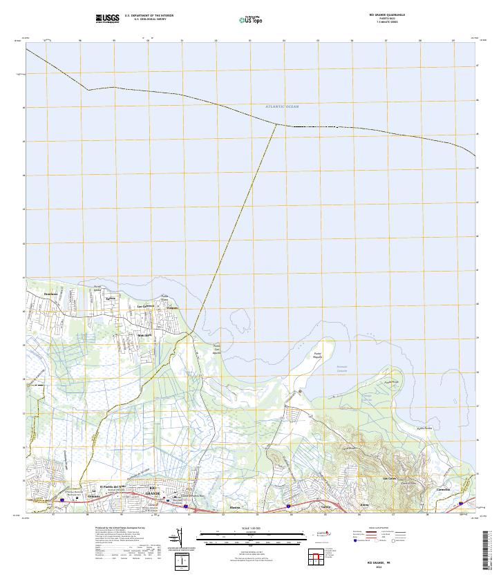
2024 Map of Rio Grande
USGS Topo · Published 2024About this map
Río Grande serves as the inland anchor of this coastal landscape, where the Río Espíritu Santo flows toward the Atlantic Ocean. The topography shifts from the low-lying wetlands of Ciénaga La Picúa and the mangrove-lined Ensenada Comezón to the rising elevations of Cerro Bravo and Cerro El Faro. This area is characterized by a mix of traditional municipal centers and modern development, with civic landmarks like the Tribunal de Primera Instancia de Río Grande and the National University College - Río Grande appearing alongside established residential sectors. Coastal features like Punta Miquillo and Punta Percha define the shoreline, while smaller settlements such as Mini Mini, Vieques, and Honduras provide a detailed look at the local geography between the river and the sea.
Find a feature on this map
47 named features on this map. Tap any name to fly to it.
Don’t see what you’re looking for? This feature index may not catch every label — zoom into the map to look around manually.
Map Details
Editions of this 2024 Rio Grande Map
This is the sole edition of this map. No revisions or reprints were ever made.
Other maps of this area

1940 · Carolina
USGS Topo · 1:30,000

1941 · Rio Grande
USGS Topo · 1:30,000

1941 · Carolina
USGS Topo · 1:30,000

1945 · El Yunque
USGS Topo · 1:30,000

1946 · El Yunque
USGS Topo · 1:30,000

1946 · Gurabo
USGS Topo · 1:30,000

1946 · Fajardo
USGS Topo · 1:30,000

1947 · Carolina
USGS Topo · 1:30,000

1947 · El Yunque NE
USGS Topo · 1:10,000

1947 · Gurabo NE
USGS Topo · 1:10,000