1947 Map of Gurabo NE
USGS Topo · Published 1947About this map
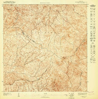
The Caribbean National Forest dominates the southern landscape of this 1940s topographic survey, where steep terrain rises toward peaks like Cerro Gordo and Cerro Peñon. In the lower elevations and valleys, the settlement pattern reveals small communities such as Cambute, La Marina, and Campo Rico connected by winding roads and tracks. The Escuela Segunda Unidad de Carruzos serves as a central social landmark for the rural population living near the border between the Municipio de Carolina and Municipio de Canovanas. Water management is evident along the Río Canóvanas, which includes a Toma de Agua (water intake), illustrating how the natural hydrological network was utilized for local needs during this era of post-war development in Puerto Rico.
Find a feature on this map
13 named features on this map. Tap any name to fly to it.
Don’t see what you’re looking for? This feature index may not catch every label — zoom into the map to look around manually.
Map Details
Editions of this 1947 Gurabo NE Map
This is the sole edition of this map. No revisions or reprints were ever made.
Other maps of this area

1940 · Carolina
USGS Topo · 1:30,000

1941 · Rio Grande
USGS Topo · 1:30,000

1941 · Carolina
USGS Topo · 1:30,000

1945 · El Yunque
USGS Topo · 1:30,000

1946 · El Yunque
USGS Topo · 1:30,000

1946 · Gurabo
USGS Topo · 1:30,000

1947 · Carolina
USGS Topo · 1:30,000
1947 · El Yunque SO
USGS Topo · 1:10,000
1947 · Gurabo SE
USGS Topo · 1:10,000

1947 · Rio Grande
USGS Topo · 1:30,000
Featured Places
- La Marina, Canóvanas
- Mansiones del Tesoro, Canóvanas
- Cambalache, Canóvanas
- Estancias de Campo Rico, Canóvanas
- Sector Los Canales, Carolina