
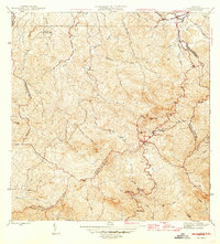
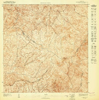
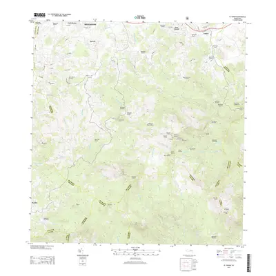
1946 Map of El Yunque
USGS Topo · Published 1946About this map
The Sierra de Luquillo dominates this 1946 landscape, defined by the extensive reach of the Luquillo National Forest across the mountains of northeastern Puerto Rico. The survey captures the transition from the coastal plains at Mameyes (Palmer) to the high peaks of El Yunque 1065 and Mte Britton 941. Settlement patterns here follow the water, with small communities like Jimenez and El Verde situated along the many rivers, including the Rio Espiritu Santo and Rio Grande, that drain the watershed.
Find a feature on this map
59 named features on this map. Tap any name to fly to it.
Don’t see what you’re looking for? This feature index may not catch every label — zoom into the map to look around manually.
Map Details
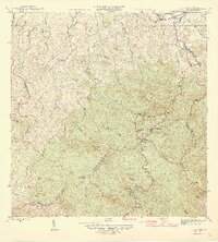
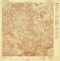
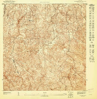
Editions of this 1946 El Yunque Map
3 editions found
Historical Maps of Hacienda Jordán Through Time
20 maps found

1941 Rio Grande
Río Grande Municipio, PR

1945 El Yunque
Río Grande Municipio, PR
1946 El Yunque
Río Grande Municipio, PR
1947 El Yunque NE
Río Grande Municipio, PR
1947 El Yunque NO
Río Grande Municipio, PR
1947 El Yunque SO
Río Grande Municipio, PR
1947 Rio Grande
Río Grande Municipio, PR

1949 Rio Grande SO
Río Grande Municipio, PR

1950 Rio Grande SE
Río Grande Municipio, PR

1952 El Yunque
Río Grande Municipio, PR

1956 Rio Grande
Río Grande Municipio, PR

1958 El Yunque
Río Grande Municipio, PR
1963 Rio Grande
Río Grande Municipio, PR
1967 El Yunque
Río Grande Municipio, PR
2013 El Yunque
Río Grande Municipio, PR
2013 Rio Grande
Río Grande Municipio, PR
2018 El Yunque
Río Grande Municipio, PR
2018 Rio Grande
Río Grande Municipio, PR

2024 El Yunque
Río Grande Municipio, PR

2024 Rio Grande
Río Grande Municipio, PR
Featured Locations
- Palma Sola, Canóvanas
- Hacienda Jordán, Río Grande
- Colinas Tres T, Río Grande
- Comunidad La Vega, Río Grande
- Sector Rosado, Las Piedras