1900s (20th Century) Maps of Sector La Ceiba, Mayagüez
Explore 5 historic maps of Sector La Ceiba from the 1900s (20th Century). These maps offer a rare glimpse into what life looked like during the 1900s — showing old roads, neighborhoods, homes, and landmarks that have changed or disappeared over time.
Whether you're researching your family's past, planning a metal detecting trip, or studying how Sector La Ceiba's landscape evolved across the 1900s, these high-resolution maps are a powerful tool for exploring the history of this region.
- Focus on a specific era: All maps on this page are from the 1900s, giving you a focused view of this time period.
- See what’s changed: Compare century-old streets, trails, and buildings to today's modern landscape using overlays and satellite layers.
- Research with precision: Use these maps for genealogy, historical research, land use analysis, or educational projects.
- View, download, or print: Maps are fully viewable online in high resolution, and can be downloaded or printed for your own records.
Start exploring Sector La Ceiba's history through authentic maps from the 1900s. This is your window into the past.
Sector La Ceiba, Mayagüez maps
(5)- 1941 Map of Rosario, 1952 Print
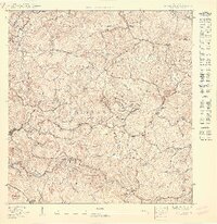
 1941 Rosario1952 Print · USGSWestern Puerto Rico's mountain interior comes alive in this mid-century survey of the Rosario region. Researchers can trace ancestral lands through numerous named estates like Hacienda Juanita and Hacienda Esperanza, or locate early community centers such as Limon and Iglesia de San Jose.2 unique versions available
 - 1942 Map of Rosario
 1942 Rosario1942 Print · USGSWestern Puerto Rico is captured here in the era before widespread urbanization, showing the mountainous agricultural estates and early rail infrastructure. Genealogists can trace family holdings at Hacienda Esperanza or locate landmarks like the Hospital de Tuberculosis and American R. R.3 unique versions available
 - 1950 Map of Rosario NO
 1950 Rosario NO1950 Print · USGSMayagüez in the mid-century reveals a rural landscape of coffee estates and narrow river valleys before modern development. Genealogists can trace family connections through named landmarks like Hacienda Constanza, Hacienda Cipriano, and the Iglesia Santa Teresita.
 - 1955 Map of Rosario, 1958 Print
 1955 Rosario1958 Print · USGSMid-century San Germán and Maricao are shown here during a time when the highland economy still revolved around traditional haciendas. Genealogists and historians can locate family estates like Hacienda Juanita and community centers such as Rosario or the Iglesia de San Jose.
 - 1964 Map of Rosario, 1968 Print
 1964 Rosario1968 Print · USGSThe hill country of western Puerto Rico in the mid-sixties reveals a landscape of historic haciendas and emerging institutions. Genealogists and historians can locate family estates like Hacienda Retiro and community landmarks such as Capilla de Santa Ana or Escuela Mariano Abril.2 unique versions available
End of results
Showing maps 1-5 of 5
Top cities near Sector La Ceiba
- Mayagüez historical maps
- Hormigueros historical maps
- Aguadilla historical maps
- San Germán historical maps
- Sabana Grande historical maps
- San Sebastián historical maps
See more
Frequently asked questions
- What are the different types of historical maps available for Sector La Ceiba?
- What is the oldest map of Sector La Ceiba?
- Where can I purchase historical maps of Sector La Ceiba for my home or office?
- Where can I download high-res historical maps of Sector La Ceiba?
- Are there historical topographic maps available for Sector La Ceiba?
- Is there historical aerial imagery available for Sector La Ceiba?
- Where are historical maps of Sector La Ceiba sourced from?