Old Maps of Aguirre, Salinas for Genealogy
Trace your family roots with 25 historic maps of Aguirre. These high-res maps reveal old neighborhoods, homesites, landmarks, and streets — helping you uncover where your ancestors lived and how the area evolved over time.
- Explore historic neighborhoods: Identify where your relatives may have lived in the 1800s or 1900s.
- Compare maps over time: Trace the changes in streets, buildings, and landmarks for multi-generational research.
- Perfect for genealogy & ancestry research: Used by family historians and researchers to map out lineage and migration.
These maps are an incredible resource for exploring your personal connection to Aguirre's past.
Aguirre, Salinas maps
(25)- 1945 Map of Central Aguirre
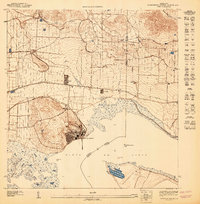
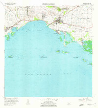
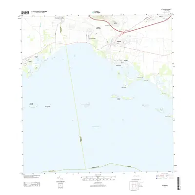
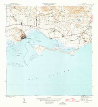 1945 Central Aguirre1945 Print · USGSThe southern coast of Puerto Rico was dominated by sugar production and coastal trade at the end of World War II. Researchers can trace the industrial infrastructure of Central Aguirre, the rail connections to Puerto Jobos, and old estates like Hacienda Mercedes.3 unique versions available
 - 1945 Map of Salinas
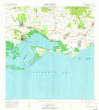
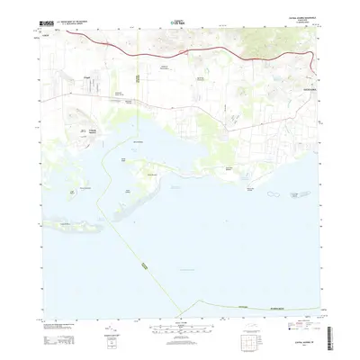
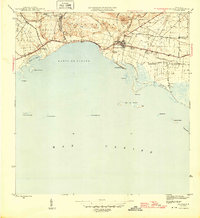 1945 Salinas1945 Print · USGSThe southern coast of Puerto Rico comes alive in this mid-century survey of the sugar-driven economy and maritime geography. Genealogists and historians can trace the legacy of local estates like Hacienda Margarita and the industrial hub at Central Caribe.2 unique versions available
 - 1946 Map of Cayey
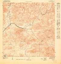
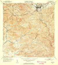
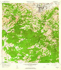
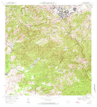
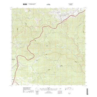
 1946 Cayey1946 Print · USGSThe central mountains of Puerto Rico are captured here in the mid-1940s, centered on the growing town of Cayey. Local historians can trace agricultural roots at Hacienda Clavell and Hacienda Julia, or locate early religious landmarks like the Capilla de Santa Maria.2 unique versions available
 - 1947 Map of Cayey SO
 1947 Cayey SO1947 Print · USGSSouthern Puerto Rico was defined by traditional estates and military land use in the mid-1940s. Genealogists and historians can trace the foundations of local life at Hacienda Clavell, the settlement at La Plena, and the Capilla de Santa Marta.
 - 1947 Map of Salinas NE
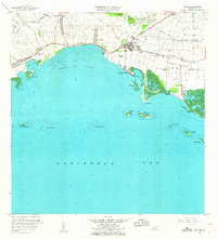
 1947 Salinas NE1947 Print · USGSCoastal Puerto Rico's sugar-driven economy is on full display in the 1940s as rail lines and irrigation canals crisscross the plains. Genealogists can locate specific estates like Hacienda Teresa and Colonia Esperanza near the town of Salinas.
 - 1947 Map of Central Aquirre SO
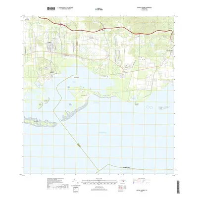
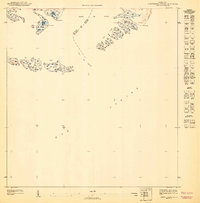 1947 Central Aquirre SO1947 Print · USGSThe southern coast of Puerto Rico is revealed in the mid-1940s as a complex network of bays and cays. Coastal historians can trace the municipal boundary between Salinas and Guayama through the Boca del Infierno and the many islets of the Cayos de Barca.
 - 1947 Map of Central Aquirre NO
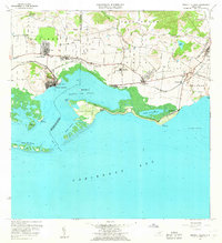
 1947 Central Aquirre NO1947 Print · USGSThe sugar-producing coast of southern Puerto Rico comes to life in the 1940s as the industry reached its peak. Researchers can trace the industrial layout of Central Aguirre, the worker housing at Coquí, and the vital irrigation of the Canal de Patillas.
 - 1952 Map of Salinas, 1953 Print
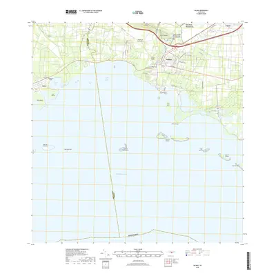
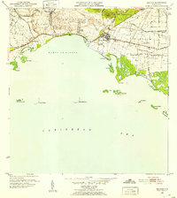 1952 Salinas1953 Print · USGSThe southern coast of Puerto Rico is captured here in the early 1950s, a landscape defined by sugar haciendas and the Caribbean shoreline. Genealogists and historians can locate family-named estates like Hacienda Pales and trace the sugar economy at Central Caribe.2 unique versions available
 - 1952 Map of Central Aguirre, 1953 Print
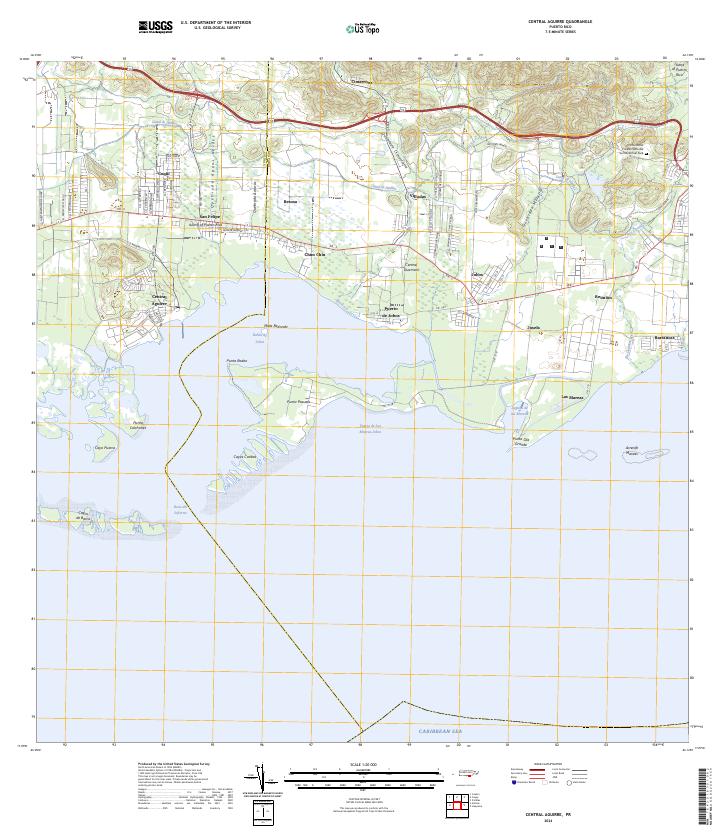
 1952 Central Aguirre1953 Print · USGSThe sugar-producing coastal plains of southern Puerto Rico are captured here in the early fifties, showcasing the vital infrastructure of the era. Genealogists and historians can trace the plantation economy through estate labels like Hacienda Mercedes, the port at Puerto Jobos, and the worker communities of Central Aguirre.2 unique versions available
 - 1953 Map of Cayey
 1953 Cayey1953 Print · USGSThe mountain town of Cayey and its surrounding barrios are documented here in the early 1950s during a period of transition and growth. Researchers can trace land ownership and community centers through labels for Hacienda Clavell, Poblado Carmen, and the Iglesia Sagrado Corazon.2 unique versions available
 - 1960 Map of Salinas, 1962 Print
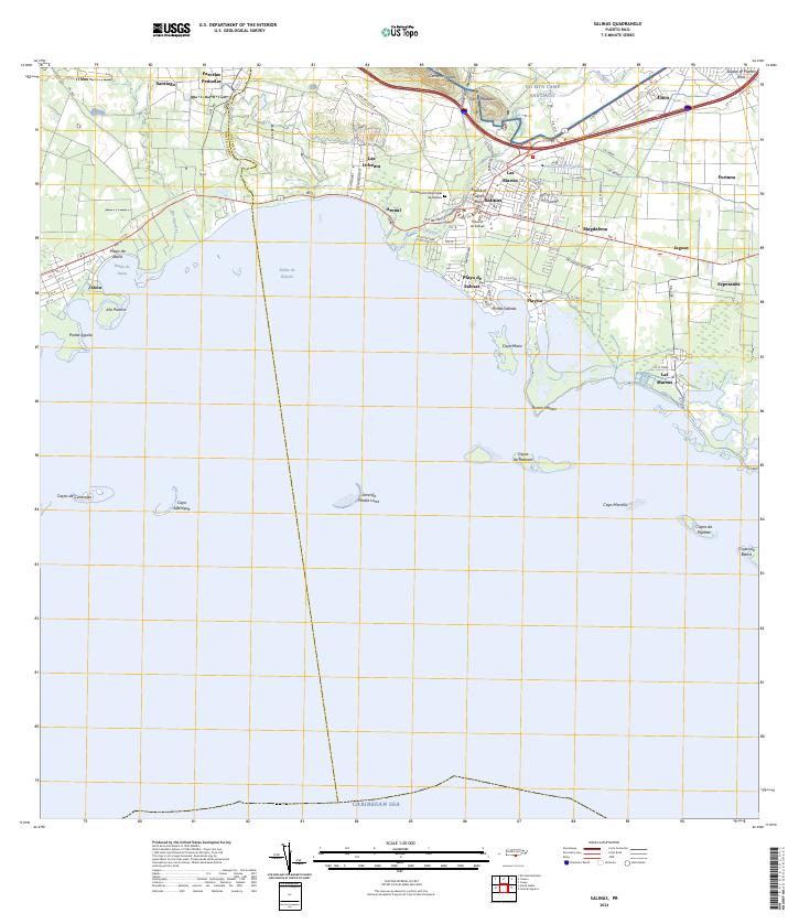
 1960 Salinas1962 Print · USGSThe southern coast of Puerto Rico is captured here in the early sixties, showing the agricultural and maritime life of the region. Researchers can trace land holdings like Hacienda Teresa or locate the mid-century Aeropuerto de Salinas.2 unique versions available
 - 1960 Map of Central Aguirre, 1962 Print
 1960 Central Aguirre1962 Print · USGSThe sugar-producing coast of southern Puerto Rico comes alive in this mid-century survey of the Central Aguirre region. Genealogists can trace family roots through settlements like Coquí and San Felipe or locate local landmarks like the Colegio del Perpetuo Socorro and Central Guamaní.2 unique versions available
 - 1960 Map of Cayey, 1962 Print
 1960 Cayey1962 Print · USGSCayey was transitioning from an agrarian mountain outpost to a regional hub during the early sixties. Genealogists can trace family footprints across several named estates, including Hacienda Julia and Hacienda Clavell, and locate old landmarks like the Capilla de Santa Marta.
 - 1970 Map of Salinas, 1972 Print
 1970 Salinas1972 Print · USGSThe southern coast of Puerto Rico is captured here in the early seventies, detailing the transition from mountain foothills to the Caribbean. Trace historic family estates like Hacienda Carmen or explore coastal features like Mar Negro and the Aeropuerto de Salinas.4 unique versions available
 - 1970 Map of Central Aguirre, 1972 Print
 1970 Central Aguirre1972 Print · USGSThe southern coast of Puerto Rico comes alive in this 1970s survey of the sugar-producing heartland. Genealogists and historians can trace company town life at Central Aguirre and Coquí, or explore the maritime landscape of Bahía de Jobos and Las Mareas.3 unique versions available
 - 1972 Map of Cayey, 1974 Print
 1972 Cayey1974 Print · USGSThe mountain town of Cayey and the surrounding Cordillera Central peaks are captured here in the early seventies. Genealogists and historians can trace family estates like Hacienda Clavell and Hacienda Julia, or locate civic landmarks like the Casilla del Gobernador.2 unique versions available
 - 2013 Map of Cayey, 2013 Print
 2013 Cayey2013 Print · USGSCovers Aguirre, including Cayey, Sector Los Paganes, and other nearby areas
 - 2013 Map of Salinas, 2013 Print
 2013 Salinas2013 Print · USGSCovers Aguirre, including Salinas, Urb. Brisas del Everlymar, and other nearby areas
 - 2013 Map of Central Aguirre, 2013 Print
 2013 Central Aguirre2013 Print · USGSCovers Aguirre, including Las Mareas, Cimarrona, and other nearby areas
 - 2018 Map of Central Aguirre, 2018 Print
 2018 Central Aguirre2018 Print · USGSCovers Aguirre, including Las Mareas, Cimarrona, and other nearby areas
 - 2018 Map of Salinas, 2018 Print
 2018 Salinas2018 Print · USGSCovers Aguirre, including Salinas, Urb. Brisas del Everlymar, and other nearby areas
 - 2018 Map of Cayey, 2018 Print
 2018 Cayey2018 Print · USGSCovers Aguirre, including Cayey, Sector Los Paganes, and other nearby areas
 - 2024 Map of Central Aguirre, 2024 Print
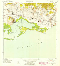
 2024 Central Aguirre2024 Print · USGSThe southern coast of Puerto Rico is mapped here in the modern era, showing the transition from mangrove lagoons to industrial centers. Genealogists can trace family names and local landmarks in Central Aguirre, Puerto de Jobos, and Coquí.
 - 2024 Map of Salinas, 2024 Print
 2024 Salinas2024 Print · USGSThe southern coast of Puerto Rico is mapped here in the early twenty-first century, showing the developed corridor between the mountains and the sea. Researchers can locate the Cementerio Municipal de Salinas, the military training grounds of NG MTA Camp Santiago, and coastal villages like Las Mareas.
 - 2024 Map of Cayey, 2024 Print
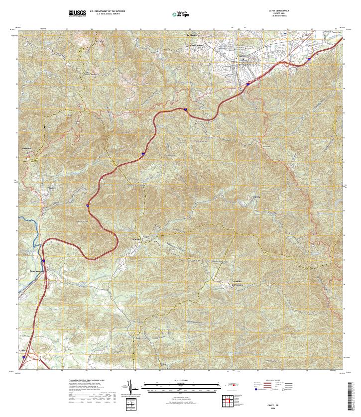 2024 Cayey2024 Print · USGSThe mountain city of Cayey and its surrounding peaks are captured in this contemporary survey of Puerto Rico's central highlands. Local researchers can trace the limits of NG MTA Camp Santiago, locate the Antiguo Cementerio Municipal de Cayey, and explore rural barrios like Pueblito del Carmen.
End of results
Showing maps 1-25 of 25
Frequently asked questions
- What are the different types of historical maps available for Aguirre?
- What is the oldest map of Aguirre?
- Where can I purchase historical maps of Aguirre for my home or office?
- Where can I download high-res historical maps of Aguirre?
- Are there historical topographic maps available for Aguirre?
- Is there historical aerial imagery available for Aguirre?
- Where are historical maps of Aguirre sourced from?