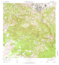
1972 Map of Cayey
USGS Topo · Published 1974About this map
Cayey sits at the northern edge of this landscape, serving as a hub where the Colegio Cayey-UPR and Escuela Rexford G Tugwell mark the town's mid-century educational growth. The terrain is defined by the Cordillera Central and the Sierra de Cayey, which create a complex network of ridges and deep valleys. Historic land use is evident in several named estates such as Hacienda Clavell, Hacienda Húcar, and Hacienda Julia, representing the agricultural heritage of the region.
Find a feature on this map
71 named features on this map. Tap any name to fly to it.
Don’t see what you’re looking for? This feature index may not catch every label — zoom into the map to look around manually.
Map Details
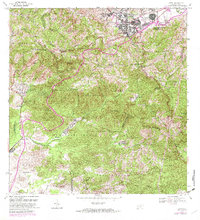
Editions of this 1972 Cayey Map
2 editions found
Other maps of this area

1945 · Central Aguirre
USGS Topo · 1:30,000

1945 · Salinas
USGS Topo · 1:30,000

1946 · Patillas
USGS Topo · 1:30,000

1946 · Coamo
USGS Topo · 1:30,000

1946 · Barranquitas
USGS Topo · 1:30,000

1946 · Cayey
USGS Topo · 1:30,000

1946 · Comerio
USGS Topo · 1:30,000

1946 · Guayama
USGS Topo · 1:30,000

1946 · Caguas
USGS Topo · 1:30,000

1947 · Cayey NO
USGS Topo · 1:10,000
Featured Places
- Cayey
- Alturas de Cantera, Cayey
- Sector Rústico Rivera, Cayey
- Sector La Sierra, Aibonito
- Sector Ramón Malavé, Cayey