
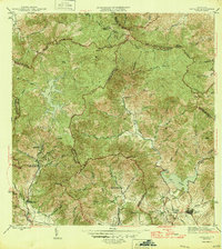
1946 Map of Patillas
USGS Topo · Published 1946About this map
The Sierra de Cayey dominates this mid-1940s landscape, where steep topography and water resources defined early industrial development in southeastern Puerto Rico. The town of Patillas sits at the foot of these mountains, serving as a gateway to the intricate network of river valleys formed by the Rio Patillas and the Rio Grande de Patillas. High in the interior, the Planta Hidroelectrica de Carite No 1 and its sister facility, Planta Hidroelectrica de Carite No 2, highlight the era's reliance on hydroelectric power drawn from the mountain reservoirs of Lago Carite. Local life is anchored by the Hacienda Felicita and educational landmarks like the Escuela Segunda Unidad de Yaurel. The map also captures several mountain peaks such as Cerro La Santa and Cerro Lucero, alongside established settlements like Campamento Guavate and Campamento Real.
Find a feature on this map
51 named features on this map. Tap any name to fly to it.
Don’t see what you’re looking for? This feature index may not catch every label — zoom into the map to look around manually.
Map Details
Editions of this 1946 Patillas Map
2 editions found
Other maps of this area

1945 · Punta Tuna
USGS Topo · 1:30,000

1945 · Central Aguirre
USGS Topo · 1:30,000

1946 · Cayey
USGS Topo · 1:30,000

1946 · Comerio
USGS Topo · 1:30,000

1946 · Juncos
USGS Topo · 1:30,000

1946 · Yabucoa
USGS Topo · 1:30,000

1946 · Guayama
USGS Topo · 1:30,000

1946 · Caguas
USGS Topo · 1:30,000

1947 · Yabucoa SO
USGS Topo · 1:10,000

1947 · Patillas SO
USGS Topo · 1:10,000
Featured Places
- Patillas
- Sector Los Meléndez, Cayey
- Villa Kike, San Lorenzo
- Villa Real, Patillas
- Sector Conejo Blanco, Patillas