1960s Maps of Caín Alto, San Germán
Explore 4 historic maps of Caín Alto from the 1960s. These maps offer a rare glimpse into what life looked like during the 1960s — showing old roads, neighborhoods, homes, and landmarks that have changed or disappeared over time.
Whether you're researching your family's past, planning a metal detecting trip, or studying how Caín Alto's landscape evolved across the 1960s, these high-resolution maps are a powerful tool for exploring the history of this region.
- Focus on a specific era: All maps on this page are from the 1960s, giving you a focused view of this time period.
- See what’s changed: Compare century-old streets, trails, and buildings to today's modern landscape using overlays and satellite layers.
- Research with precision: Use these maps for genealogy, historical research, land use analysis, or educational projects.
- View, download, or print: Maps are fully viewable online in high resolution, and can be downloaded or printed for your own records.
Start exploring Caín Alto's history through authentic maps from the 1960s. This is your window into the past.
Caín Alto, San Germán maps
(4)- 1960 Map of Maricao, 1961 Print
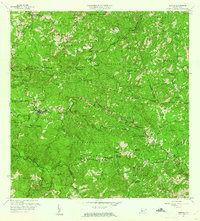 1960 Maricao1961 Print · USGSThe mountains of western Puerto Rico are captured here in the early sixties, showing the agricultural heritage of Maricao. Genealogists can trace family lands across Hacienda Lealtad, Hacienda Santa Rita, and Pueblo Nuevo.3 unique versions available
 - 1964 Map of Rosario, 1968 Print
 1964 Rosario1968 Print · USGSThe hill country of western Puerto Rico in the mid-sixties reveals a landscape of historic haciendas and emerging institutions. Genealogists and historians can locate family estates like Hacienda Retiro and community landmarks such as Capilla de Santa Ana or Escuela Mariano Abril.2 unique versions available
 - 1966 Map of San German, 1969 Print
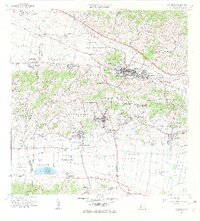 1966 San German1969 Print · USGSSan Germán and the surrounding Lajas Valley are captured here in the mid-sixties, showing a landscape defined by historic haciendas and rising urban centers. Genealogists and historians can trace family estates like Hacienda Resolución or locate local landmarks including the Cementerio de San Germán and Lajas Arriba.4 unique versions available
 - 1966 Map of Sabana Grande, 1969 Print
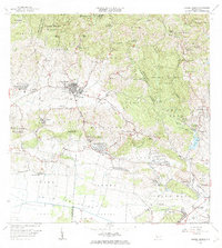 1966 Sabana Grande1969 Print · USGSSabana Grande and the surrounding southwestern highlands are captured here during a period of significant rural development in the mid-sixties. Researchers can trace the Antigua Via del Ferrocarril and locate landmarks like the Capilla del Pozo de la Virgen and Aeropuerto Santa Rita.3 unique versions available
End of results
Showing maps 1-4 of 4
Frequently asked questions
- What are the different types of historical maps available for Caín Alto?
- What is the oldest map of Caín Alto?
- Where can I purchase historical maps of Caín Alto for my home or office?
- Where can I download high-res historical maps of Caín Alto?
- Are there historical topographic maps available for Caín Alto?
- Is there historical aerial imagery available for Caín Alto?
- Where are historical maps of Caín Alto sourced from?