1950s Maps of Toa Alta
Explore 9 historic maps of Toa Alta from the 1950s. These maps offer a rare glimpse into what life looked like during the 1950s — showing old roads, neighborhoods, homes, and landmarks that have changed or disappeared over time.
Whether you're researching your family's past, planning a metal detecting trip, or studying how Toa Alta's landscape evolved across the 1950s, these high-resolution maps are a powerful tool for exploring the history of this region.
- Focus on a specific era: All maps on this page are from the 1950s, giving you a focused view of this time period.
- See what’s changed: Compare century-old streets, trails, and buildings to today's modern landscape using overlays and satellite layers.
- Research with precision: Use these maps for genealogy, historical research, land use analysis, or educational projects.
- View, download, or print: Maps are fully viewable online in high resolution, and can be downloaded or printed for your own records.
Start exploring Toa Alta's history through authentic maps from the 1950s. This is your window into the past.
Toa Alta maps
(9)- 1950 Map of Bayamon SO
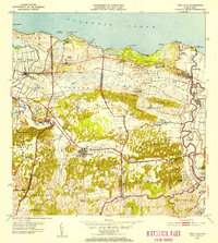
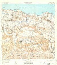
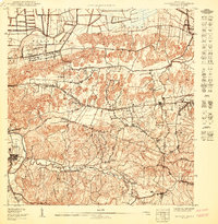 1950 Bayamon SO1950 Print · USGSCoastal plains meet the limestone hills south of San Juan at mid-century, before modern urbanization transformed the landscape. Trace the boundaries of the Reservacion Naval and locate family homesteads near Toa Alta, Sabana Seca, and the Iglesia Evangelica.
 - 1950 Map of Vega Alta SE
 1950 Vega Alta SE1950 Print · USGSNorthern Puerto Rico's interior hills and river valleys are captured here at mid-century as rural life centered on established barrios and churches. Genealogists can trace family connections near Toa Alta or locate landmarks like Iglesia del Cristo and Punta Cubano.
 - 1952 Map of Naranjito, 1953 Print
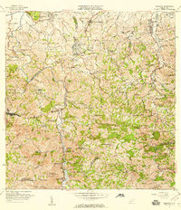
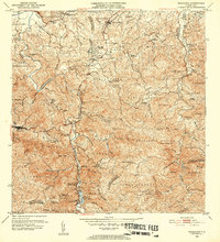 1952 Naranjito1953 Print · USGSNaranjito and the central highlands are captured here in the early fifties, showing a landscape of traditional agricultural colonias and developing barrios. Genealogists can locate specific family landmarks and local institutions like Iglesia de Minillas, Escuela Don Manolo, and the Represa de Comerio.2 unique versions available
 - 1953 Map of Corozal
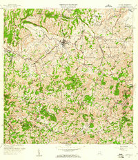
 1953 Corozal1953 Print · USGSCentral Puerto Rico's interior is captured here in the early fifties as the town of Corozal expanded its infrastructure. Genealogists and historians can locate specific landmarks like the Acueducto de Corozal, Iglesia La Milagrosa, and numerous localized school units.2 unique versions available
 - 1953 Map of Vega Alta, 1954 Print
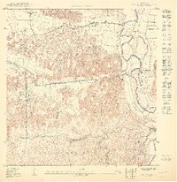
 1953 Vega Alta1954 Print · USGSCoastal and interior Puerto Rico are mapped in detail during the early 1950s, showing the sugar industry and rural life. Researchers can locate family homesteads near Central San Vicente, Poblado Higuillar, and schools like Escuela Dr Livingston.2 unique versions available
 - 1957 Map of Naranjito, 1959 Print
 1957 Naranjito1959 Print · USGSNaranjito and the central highlands of Puerto Rico appear in detail during the late 1950s, showing a landscape defined by sharp ridges and deep river valleys. Researchers can trace rural life through landmarks like Iglesia de la Monserrate and the Represa de San Juan reservoir.
 - 1957 Map of Bayamon, 1959 Print
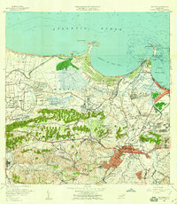 1957 Bayamon1959 Print · USGSBayamón and its coastal surroundings are captured here in the late fifties, showing the area as industrial centers and new suburbs began to reshape the landscape. Researchers can trace family roots in Pueblo Viejo or locate landmarks like Central Juanita and Isla de Cabras.
 - 1957 Map of Corozal, 1960 Print
 1957 Corozal1960 Print · USGSThe interior highlands of Puerto Rico are captured here during a period of significant rural development. Genealogists can locate family-named barrios like Ortiz and Medina, or trace local history at the Iglesia La Milagrosa and Escuela Ramón Pabón.2 unique versions available
 - 1958 Map of Vega Alta, 1960 Print
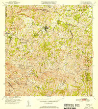
 1958 Vega Alta1960 Print · USGSThe northern coast of Puerto Rico in the late fifties reveals a landscape of sugar mills and rising infrastructure. Genealogists and historians can trace family roots through old barrios like Higuillar, the Central San Vicente mill, and the Escuela Almirante Norte.2 unique versions available
End of results
Showing maps 1-9 of 9
Frequently asked questions
- What are the different types of historical maps available for Toa Alta?
- What is the oldest map of Toa Alta?
- Where can I purchase historical maps of Toa Alta for my home or office?
- Where can I download high-res historical maps of Toa Alta?
- Are there historical topographic maps available for Toa Alta?
- Is there historical aerial imagery available for Toa Alta?
- Where are historical maps of Toa Alta sourced from?