Old Maps of Yellow Cliff, Saint Croix District for Genealogy
Trace your family roots with 3 historic maps of Yellow Cliff. These high-res maps reveal old neighborhoods, homesites, landmarks, and streets — helping you uncover where your ancestors lived and how the area evolved over time.
- Explore historic neighborhoods: Identify where your relatives may have lived in the 1800s or 1900s.
- Compare maps over time: Trace the changes in streets, buildings, and landmarks for multi-generational research.
- Perfect for genealogy & ancestry research: Used by family historians and researchers to map out lineage and migration.
These maps are an incredible resource for exploring your personal connection to Yellow Cliff's past.
Yellow Cliff, Saint Croix District maps
(3)- 1958 Map of East Point, 1959 Print
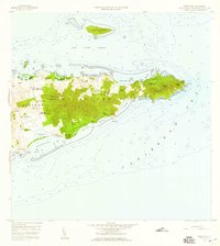 1958 East Point1959 Print · USGSThe eastern reaches of Saint Croix are captured in the late fifties, showing a landscape of traditional estates and rugged coastal topography. Genealogists can trace family landholdings and small settlements like All for the Better, Sallys Fancy, and Madame Carty.5 unique versions available
 - 2013 Map of Grass Point, 2013 Print
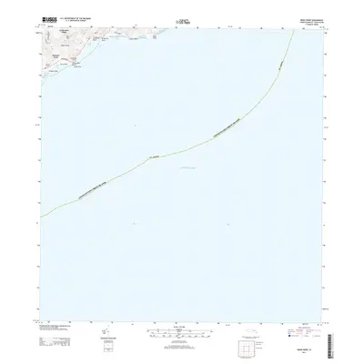 2013 Grass Point2013 Print · USGSCovers Yellow Cliff, including South Slob, Hope and Cartlon Hill, and other nearby areas
 - 2024 Map of Grass Point, 2024 Print
 2024 Grass Point2024 Print · USGSThe southeastern coast of Saint Croix is documented here as it stands today, showing the intersection of coastal topography and contemporary residency. Trace local landmarks like Catharinas Hope and the shoreline at Grapetree Bay or Grassy Point Beach.
End of results
Showing maps 1-3 of 3
Frequently asked questions
- What are the different types of historical maps available for Yellow Cliff?
- What is the oldest map of Yellow Cliff?
- Where can I purchase historical maps of Yellow Cliff for my home or office?
- Where can I download high-res historical maps of Yellow Cliff?
- Are there historical topographic maps available for Yellow Cliff?
- Is there historical aerial imagery available for Yellow Cliff?
- Where are historical maps of Yellow Cliff sourced from?