2000s (21st Century) Maps of East Mill, Alabama
Explore 6 historic maps of East Mill from the 2000s (21st Century). These maps offer a rare glimpse into what life looked like during the 2000s — showing old roads, neighborhoods, homes, and landmarks that have changed or disappeared over time.
Whether you're researching your family's past, planning a metal detecting trip, or studying how East Mill's landscape evolved across the 2000s, these high-resolution maps are a powerful tool for exploring the history of this region.
- Focus on a specific era: All maps on this page are from the 2000s, giving you a focused view of this time period.
- See what’s changed: Compare century-old streets, trails, and buildings to today's modern landscape using overlays and satellite layers.
- Research with precision: Use these maps for genealogy, historical research, land use analysis, or educational projects.
- View, download, or print: Maps are fully viewable online in high resolution, and can be downloaded or printed for your own records.
Start exploring East Mill's history through authentic maps from the 2000s. This is your window into the past.
East Mill, AL maps
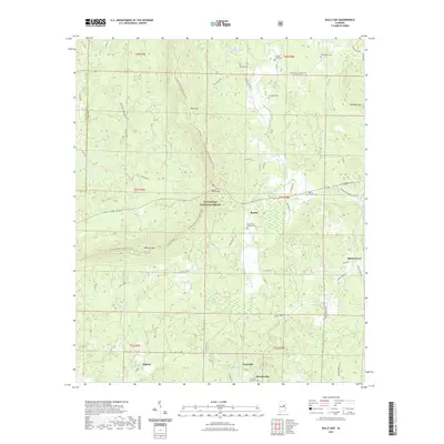
(6)- 2001 Map of Bulls Gap, 2004 Print
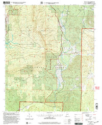 2001 Bulls Gap2004 Print · USGSClay County as it appeared at the start of the century is defined by its deep forest roads and mountain ridges. Trace family history at Bethlehem Ch or explore the early 2000s landscape of Brownsville and Rocky Mount.
 - 2011 Map of Bulls Gap, 2011 Print
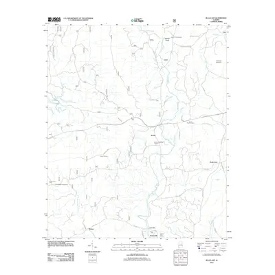 2011 Bulls Gap2011 Print · USGSCovers East Mill, including Roselle, Midway, and other nearby areas
 - 2014 Map of Bulls Gap, 2014 Print
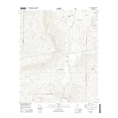 2014 Bulls Gap2014 Print · USGSCovers East Mill, including Roselle, Midway, and other nearby areas
 - 2018 Map of Bulls Gap, 2018 Print
 2018 Bulls Gap2018 Print · USGSCovers East Mill, including Roselle, Midway, and other nearby areas
 - 2021 Map of Bulls Gap, 2021 Print
 2021 Bulls Gap2021 Print · USGSCovers East Mill, including Roselle, Midway, and other nearby areas
 - 2024 Map of Bulls Gap, 2024 Print
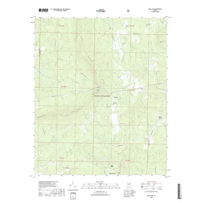
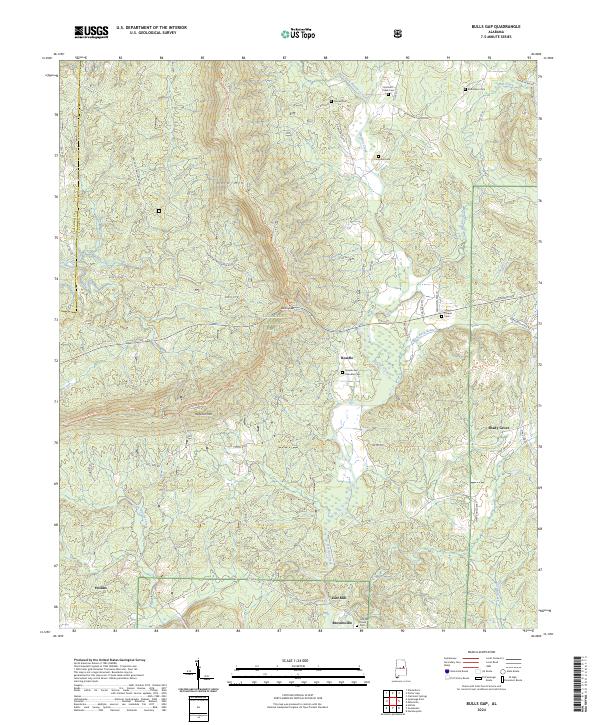 2024 Bulls Gap2024 Print · USGSThe Talladega National Forest ridgelines and the winding Hatchet Creek valley define this Alabama landscape in the mid-2020s. Genealogists can locate family landmarks like the Rozelle and Chandler Cem, Marvin Chapel, and the settlement of Brownsville.
End of results
Showing maps 1-6 of 6
Top cities near East Mill
- Alexander City historical maps
- Sylacauga historical maps
- Ashland historical maps
- Stewartville historical maps
- Goodwater historical maps
- Mignon historical maps
See more
Frequently asked questions
- What are the different types of historical maps available for East Mill?
- What is the oldest map of East Mill?
- Where can I purchase historical maps of East Mill for my home or office?
- Where can I download high-res historical maps of East Mill?
- Are there historical topographic maps available for East Mill?
- Is there historical aerial imagery available for East Mill?
- Where are historical maps of East Mill sourced from?