2000s (21st Century) Maps of Glades, Alabama
Explore 6 historic maps of Glades from the 2000s (21st Century). These maps offer a rare glimpse into what life looked like during the 2000s — showing old roads, neighborhoods, homes, and landmarks that have changed or disappeared over time.
Whether you're researching your family's past, planning a metal detecting trip, or studying how Glades's landscape evolved across the 2000s, these high-resolution maps are a powerful tool for exploring the history of this region.
- Focus on a specific era: All maps on this page are from the 2000s, giving you a focused view of this time period.
- See what’s changed: Compare century-old streets, trails, and buildings to today's modern landscape using overlays and satellite layers.
- Research with precision: Use these maps for genealogy, historical research, land use analysis, or educational projects.
- View, download, or print: Maps are fully viewable online in high resolution, and can be downloaded or printed for your own records.
Start exploring Glades's history through authentic maps from the 2000s. This is your window into the past.
Glades, AL maps
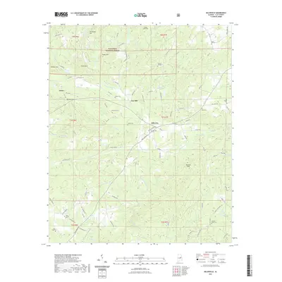
(6)- 2001 Map of Millerville, 2004 Print
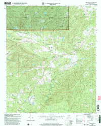 2001 Millerville2004 Print · USGSClay County at the dawn of the millennium shows a landscape deeply tied to the Talladega National Forest and its high ridges. Researchers can trace rural community life through numerous landmarks like Carr Mill, the Bibb Co High Sch, and Mt Tabor Ch.
 - 2011 Map of Millerville, 2011 Print
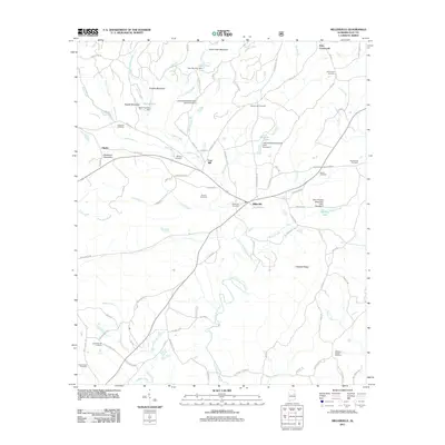 2011 Millerville2011 Print · USGSCovers Glades, including Millerville, Carr Mill, and other nearby areas
 - 2014 Map of Millerville, 2014 Print
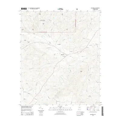 2014 Millerville2014 Print · USGSCovers Glades, including Millerville, Carr Mill, and other nearby areas
 - 2018 Map of Millerville, 2018 Print
 2018 Millerville2018 Print · USGSCovers Glades, including Millerville, Carr Mill, and other nearby areas
 - 2021 Map of Millerville, 2021 Print
 2021 Millerville2021 Print · USGSCovers Glades, including Millerville, Carr Mill, and other nearby areas
 - 2024 Map of Millerville, 2024 Print
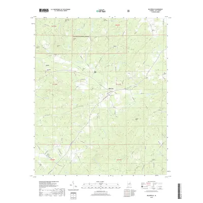
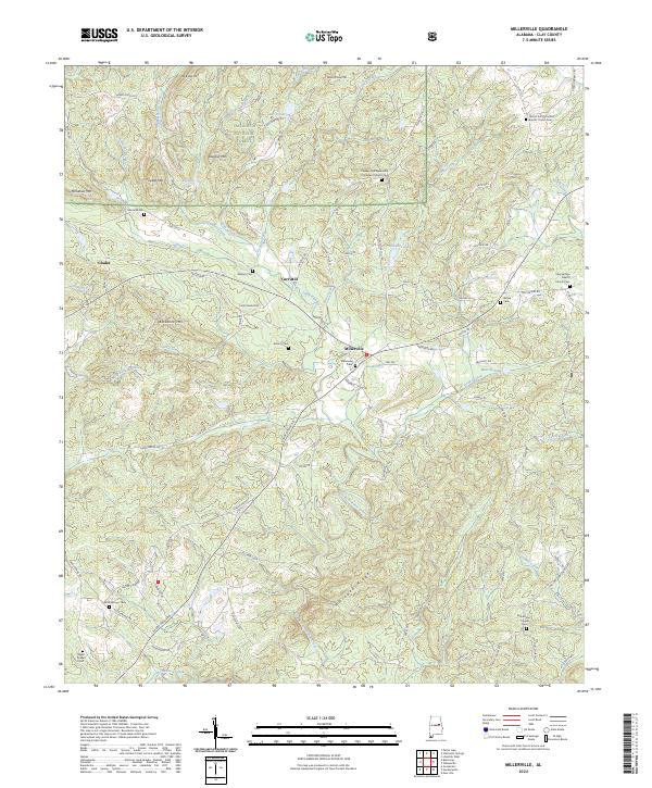 2024 Millerville2024 Print · USGSClay County's rural character remains centered on Millerville in this modern topographical study of east-central Alabama. Researchers can trace family history through numerous landmarks like Mount Zion Primitive Baptist Church and Antioch Cem.
End of results
Showing maps 1-6 of 6
Top cities near Glades
- Talladega historical maps
- Alexander City historical maps
- Sylacauga historical maps
- Lineville historical maps
- Ashland historical maps
- Goodwater historical maps
See more
Frequently asked questions
- What are the different types of historical maps available for Glades?
- What is the oldest map of Glades?
- Where can I purchase historical maps of Glades for my home or office?
- Where can I download high-res historical maps of Glades?
- Are there historical topographic maps available for Glades?
- Is there historical aerial imagery available for Glades?
- Where are historical maps of Glades sourced from?