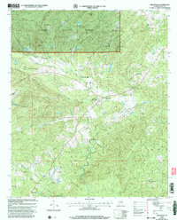
2001 Map of Millerville
USGS Topo · Published 2004About this map
Talladega National Forest encompasses the northern reaches of this Clay County landscape, where the ridges of McGehee Mtn, Triplett Mtn, and Dugout Mtn overlook the drainage basins of Mill Creek and Hillabee Creek. This rural section of Alabama preserves a network of traditional community centers, notably at Millerville and the smaller settlement of Carr Mill. The presence of Grain Elevators at Carr Mill indicates the agricultural foundations of the local economy, while the Bibb Co High Sch serves as a central landmark for the area.
Find a feature on this map
33 named features on this map. Tap any name to fly to it.
Don’t see what you’re looking for? This feature index may not catch every label — zoom into the map to look around manually.
Map Details
Editions of this 2001 Millerville Map
This is the sole edition of this map. No revisions or reprints were ever made.
Other maps of this area

1890 · Talladega
USGS Topo · 1:125,000

1891 · Ashland
USGS Topo · 1:125,000

1892 · Talladega
USGS Topo · 1:125,000

1943 · Talladega
USGS Topo · 1:62,500

1944 · Goodwater
USGS Topo · 1:62,500

1946 · Talladega
USGS Topo · 1:62,500

1947 · Goodwater
USGS Topo · 1:62,500

1953 · Birmingham
USGS Topo · 1:250,000

1953 · Atlanta
USGS Topo · 1:250,000

1956 · Birmingham
USGS Topo · 1:250,000