1956 Map of Birmingham
USGS Topo · Published 1956About this map
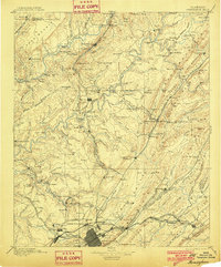
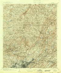
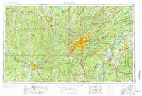
Birmingham serves as the industrial and logistical heart of Central Alabama in this mid-1950s Army Map Service compilation. The urban corridor stretches southwest through Fairfield, Homewood, and Bessemer, following the mineral-rich geology of Red Mountain and Shades Mountain. The landscape is defined by the sharp ridges of the Appalachian Mountains and a dense network of major rail lines, including the Southern, Alabama Great Southern, and Louisville and Nashville railroads, which linked the region's mines and furnaces to broader markets.
Find a feature on this map
137 named features on this map. Tap any name to fly to it.
Don’t see what you’re looking for? This feature index may not catch every label — zoom into the map to look around manually.
Map Details
Editions of this 1956 Birmingham Map
This is the sole edition of this map. No revisions or reprints were ever made.
Historical Maps of Birmingham Through Time
7 maps found