1900s (20th Century) Maps of Elba, Alabama
Explore 6 historic maps of Elba from the 1900s (20th Century). These maps offer a rare glimpse into what life looked like during the 1900s — showing old roads, neighborhoods, homes, and landmarks that have changed or disappeared over time.
Whether you're researching your family's past, planning a metal detecting trip, or studying how Elba's landscape evolved across the 1900s, these high-resolution maps are a powerful tool for exploring the history of this region.
- Focus on a specific era: All maps on this page are from the 1900s, giving you a focused view of this time period.
- See what’s changed: Compare century-old streets, trails, and buildings to today's modern landscape using overlays and satellite layers.
- Research with precision: Use these maps for genealogy, historical research, land use analysis, or educational projects.
- View, download, or print: Maps are fully viewable online in high resolution, and can be downloaded or printed for your own records.
Start exploring Elba's history through authentic maps from the 1900s. This is your window into the past.
Elba, AL maps
(6)- 1953 Map of Andalusia, 1965 Print
 1953 Andalusia1965 Print · USGSSouth Alabama in the mid-twentieth century remains a land of pine forests and river-fed settlements. You can trace the vital rail corridors of the Louisville & Nashville and locate regional centers such as Andalusia, Brewton, and Monroeville.3 unique versions available
 - 1957 Map of Andalusia
 1957 Andalusia1957 Print · USGSSouthern Alabama in the mid-1950s was a landscape defined by timbered stretches and the rhythmic flow of the Alabama River. Researchers can trace the legacy of the rail era through the Central of Georgia tracks and the storied river bluffs at Choctaw Bluff.
 - 1968 Map of Danleys Crossroads, 1970 Print
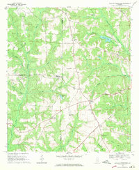 1968 Danleys Crossroads1970 Print · USGSSoutheast Alabama in the late sixties reveals a landscape of tight-knit farming communities at the junction of Coffee, Crenshaw, and Covington Counties. Researchers can trace family history through local landmarks like Mt Olive Ch, Danleys Crossroads, and Friendship.2 unique versions available
 - 1968 Map of Ino, 1970 Print
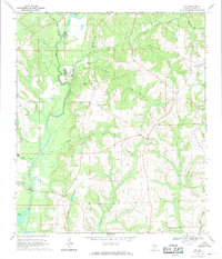 1968 Ino1970 Print · USGSCoffee County life in the late 1960s centered on the Pea River and its rural settlements. Researchers can trace family roots through sites like Ino, Mt Gilead Ch, and Phillips Cem, or locate infrastructure like the Elba Dam.2 unique versions available
 - 1968 Map of Elba, 1971 Print
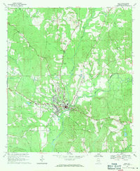 1968 Elba1971 Print · USGSElba and the surrounding Coffee County countryside are captured here in the late sixties as the city expanded along the Pea River. Genealogists and local historians can locate family landmarks like Evergreen Cemetery, Shiloh Cem, and Wise Mill Ch.2 unique versions available
 - 1986 Map of Andalusia
 1986 Andalusia1986 Print · USGSCovington County and the Wiregrass region are shown here in the mid-1980s, centered on the growing hubs of Andalusia and Opp. Genealogists and local historians can trace legacy sites like the Old Pioneer Cem, Straughn Sch, and the rail lines of the Louisville and Nashville RR.2 unique versions available
End of results
Showing maps 1-6 of 6
Top cities near Elba
- Enterprise historical maps
- Opp historical maps
- New Brockton historical maps
- Brantley historical maps
- Kinston historical maps
- Horn Hill historical maps
See more
Frequently asked questions
- What are the different types of historical maps available for Elba?
- What is the oldest map of Elba?
- Where can I purchase historical maps of Elba for my home or office?
- Where can I download high-res historical maps of Elba?
- Are there historical topographic maps available for Elba?
- Is there historical aerial imagery available for Elba?
- Where are historical maps of Elba sourced from?