Old Maps of Battelle, Alabama for Genealogy
Trace your family roots with 17 historic maps of Battelle. These high-res maps reveal old neighborhoods, homesites, landmarks, and streets — helping you uncover where your ancestors lived and how the area evolved over time.
- Explore historic neighborhoods: Identify where your relatives may have lived in the 1800s or 1900s.
- Compare maps over time: Trace the changes in streets, buildings, and landmarks for multi-generational research.
- Perfect for genealogy & ancestry research: Used by family historians and researchers to map out lineage and migration.
These maps are an incredible resource for exploring your personal connection to Battelle's past.
Battelle, AL maps
(17)- 1886 Map of Stevenson
 1886 Stevenson1886 Print · USGSNortheast Alabama at the peak of the railroad era shows a landscape tied to the river and the rails. Genealogists can trace family landmarks like Coffey's Store or locate river crossings such as Caperton Ferry and Snodgrass Ferry.
 - 1892 Map of Stevenson
 1892 Stevenson1892 Print · USGSNortheast Alabama and the Tennessee border in the 1890s reveal a landscape of mountain coves and vital river crossings. Genealogists and historians can trace rail junctions at Stevenson, river landings like Coffey's Ferry, and landmarks like Nickajack Cave.
 - 1895 Map of Stevenson
 1895 Stevenson1895 Print · USGSThe Tennessee River valley and surrounding plateaus were a hub of rail and river commerce at the close of the century. Genealogists can trace family crossings at Island Creek Ferry or locate old communities like Bellefonte, Stevenson, and Valley Head.6 unique versions available
 - 1936 Map of Sulphur Springs
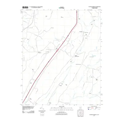
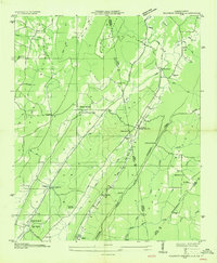 1936 Sulphur Springs1936 Print · USGSLookout Mountain and the Alabama-Georgia borderlands are captured here in the mid-1930s. Researchers can trace families near Sulphur Springs or find landmarks like Amos Mill, Battelle, and the Lookout Chapel Sch.
 - 1946 Map of Sulphur Springs, 1956 Print
 1946 Sulphur Springs1956 Print · USGSThe Alabama and Georgia state line meets along the spine of the mountains in this mid-century survey of the Little River Valley. Researchers can trace the path of the Southern Railroad through old stops like Sulphur Springs Station and find family landmarks like Pannell Cem and Amos Mill.3 unique versions available
 - 1947 Map of Sulphur Springs
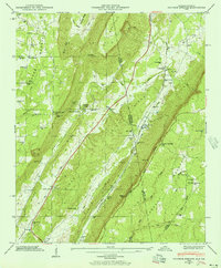
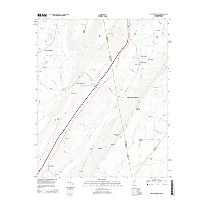
 1947 Sulphur Springs1947 Print · USGSThe Alabama and Georgia state line divides this high-plateau landscape just after the war, showing a network of ridge-top settlements and valley rail stops. Researchers can locate family landmarks like Gann Crossroad, Amos Mill, and churches including Harmony Grove Ch and State Line Ch.2 unique versions available
 - 1955 Map of Rome
 1955 Rome1955 Print · USGSThe tri-state borderlands of Georgia, Alabama, and Tennessee appear in the mid-fifties as a landscape of ridge-and-valley industry and river navigation. Genealogists can trace family footprints near Chattanooga, the iron works of Gadsden, and textile towns like Trion or Summerville.
 - 1958 Map of Rome, 1966 Print
 1958 Rome1966 Print · USGSNorthwest Georgia and neighboring Tennessee and Alabama are captured here in the late fifties, showcasing a landscape of high ridges and river valleys. Researchers can trace historic rail lines like the Seaboard Air Line RR and explore the bounds of Cloudland Canyon State Park or Fort Oglethorpe.3 unique versions available
 - 1961 Map of Rome
 1961 Rome1961 Print · USGSNorthwest Georgia and neighboring Tennessee and Alabama are shown here at a moment of significant mid-century growth. Researchers can trace the rail networks of the Central of Georgia or locate landmarks within Chickamauga and Chattanooga Nat Military Park.
 - 1963 Map of Rome
 1963 Rome1963 Print · USGSThe tri-state corner of Georgia, Alabama, and Tennessee is captured here during a period of massive reservoir expansion and post-war growth. Genealogists and historians can trace the rail corridors of the Southern Ry or locate landmarks like Fort Oglethorpe and Cloudland Canyon State Park.
 - 1981 Map of Chickamauga, 1982 Print
 1981 Chickamauga1982 Print · USGSThe tri-state border region of Georgia, Alabama, and Tennessee comes into focus during the early eighties, defined by the towering ridges of the Appalachians. Historians can trace the preserved grounds of Chickamauga and Chattanooga National Military Park and old rail stops like Rising Fawn or Sulphur Springs.2 unique versions available
 - 1982 Map of Sulphur Springs, 1983 Print
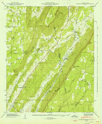
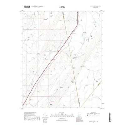
 1982 Sulphur Springs1983 Print · USGSThe Alabama and Georgia borderlands in the early eighties were defined by the steep ridges of Lookout Mountain and the Great Southern Railroad. Genealogists can trace family roots at Bible Cem or Pannell Cem and locate old community hubs like Gann Crossroad and Sulphur Springs.
 - 2011 Map of Sulphur Springs, 2011 Print
 2011 Sulphur Springs2011 Print · USGSCovers Battelle, including Rogers, Sulphur Springs, and other nearby areas2 unique versions available
 - 2014 Map of Sulphur Springs, 2014 Print
 2014 Sulphur Springs2014 Print · USGSCovers Battelle, including Rogers, Sulphur Springs, and other nearby areas
 - 2018 Map of Sulphur Springs, 2018 Print
 2018 Sulphur Springs2018 Print · USGSCovers Battelle, including Rogers, Sulphur Springs, and other nearby areas
 - 2020 Map of Sulphur Springs, 2020 Print
 2020 Sulphur Springs2020 Print · USGSCovers Battelle, including Rogers, Sulphur Springs, and other nearby areas
 - 2024 Map of Sulphur Springs, 2024 Print
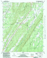
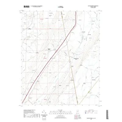
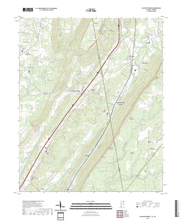 2024 Sulphur Springs2024 Print · USGSDeKalb County and the borderlands of Georgia appear here in contemporary detail, showing the deep valleys and plateaus that define this region. Genealogists can trace numerous family sites such as Finlayson Family Cem, Miller Cem, and Beene Cem across the mountain ridges.
End of results
Showing maps 1-17 of 17
Top cities near Battelle
- Fort Payne historical maps
- Rainsville historical maps
- Summerville historical maps
- Henagar historical maps
- Trenton historical maps
- Stevenson historical maps
See more
Frequently asked questions
- What are the different types of historical maps available for Battelle?
- What is the oldest map of Battelle?
- Where can I purchase historical maps of Battelle for my home or office?
- Where can I download high-res historical maps of Battelle?
- Are there historical topographic maps available for Battelle?
- Is there historical aerial imagery available for Battelle?
- Where are historical maps of Battelle sourced from?