1980s Maps of Black, Alabama
Explore 4 historic maps of Black from the 1980s. These maps offer a rare glimpse into what life looked like during the 1980s — showing old roads, neighborhoods, homes, and landmarks that have changed or disappeared over time.
Whether you're researching your family's past, planning a metal detecting trip, or studying how Black's landscape evolved across the 1980s, these high-resolution maps are a powerful tool for exploring the history of this region.
- Focus on a specific era: All maps on this page are from the 1980s, giving you a focused view of this time period.
- See what’s changed: Compare century-old streets, trails, and buildings to today's modern landscape using overlays and satellite layers.
- Research with precision: Use these maps for genealogy, historical research, land use analysis, or educational projects.
- View, download, or print: Maps are fully viewable online in high resolution, and can be downloaded or printed for your own records.
Start exploring Black's history through authentic maps from the 1980s. This is your window into the past.
Black, AL maps
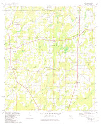
(4)- 1981 Map of Dothan, 1982 Print
 1981 Dothan1982 Print · USGSSoutheast Alabama and the tri-state border region are shown here in the early 1980s as the area thrived on military and rail connectivity. Researchers can trace historic transit lines like the Hartford and Slocomb railroad or locate family roots in Ozark, Headland, and Geneva.
 - 1982 Map of Esto, 1983 Print
 1982 Esto1983 Print · USGSThe Florida-Alabama state line and the Holmes County border intersect here in the early eighties, anchoring a landscape of rural crossroads and cypress bays. Researchers can trace family history at the Bethlehem-West Florida Camp Meeting Ground and old burial sites like Double Springs Cem.2 unique versions available
 - 1982 Map of Izagora, 1983 Print
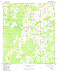 1982 Izagora1983 Print · USGSThe Florida-Alabama borderlands near the Choctawhatchee River come into focus in the early eighties, showing a landscape of scattered rural settlements and winding creeks. Genealogists can trace family roots at Izagora, Smith Crossroads, and several local landmarks like Midway Ch and Curry Cem.2 unique versions available
 - 1988 Map of Tallahassee
 1988 Tallahassee1988 Print · USGSThe Florida Panhandle and South Georgia are captured here in the late eighties, showing the expansion of the regional highway network and coastal growth. Genealogists and historians can trace rail lines like the Seaboard System Railroad or locate family roots in Blountstown, Graceville, or Crawfordville.2 unique versions available
End of results
Showing maps 1-4 of 4
Top cities near Black
- Dothan historical maps
- Geneva historical maps
- Chipley historical maps
- Bonifay historical maps
- Hartford historical maps
- Graceville historical maps
See more
Frequently asked questions
- What are the different types of historical maps available for Black?
- What is the oldest map of Black?
- Where can I purchase historical maps of Black for my home or office?
- Where can I download high-res historical maps of Black?
- Are there historical topographic maps available for Black?
- Is there historical aerial imagery available for Black?
- Where are historical maps of Black sourced from?