1900s (20th Century) Maps of Sulligent, Alabama
Explore 9 historic maps of Sulligent from the 1900s (20th Century). These maps offer a rare glimpse into what life looked like during the 1900s — showing old roads, neighborhoods, homes, and landmarks that have changed or disappeared over time.
Whether you're researching your family's past, planning a metal detecting trip, or studying how Sulligent's landscape evolved across the 1900s, these high-resolution maps are a powerful tool for exploring the history of this region.
- Focus on a specific era: All maps on this page are from the 1900s, giving you a focused view of this time period.
- See what’s changed: Compare century-old streets, trails, and buildings to today's modern landscape using overlays and satellite layers.
- Research with precision: Use these maps for genealogy, historical research, land use analysis, or educational projects.
- View, download, or print: Maps are fully viewable online in high resolution, and can be downloaded or printed for your own records.
Start exploring Sulligent's history through authentic maps from the 1900s. This is your window into the past.
Sulligent, AL maps
(9)- 1953 Map of West Point, 1973 Print
 1953 West Point1973 Print · USGSNorth-Central Mississippi and the Alabama borderlands are captured here during the mid-twentieth century as new reservoirs and national forests transformed the landscape. Researchers can trace the path of the Mississippi & Skuna Valley railroad or locate old landings along the Tombigbee River and Schooner Creek.3 unique versions available
 - 1958 Map of West Point
 1958 West Point1958 Print · USGSNortheastern Mississippi and western Alabama are shown in the late 1950s, highlighting a region defined by its river-and-rail economy. Researchers can trace family roots through numerous settlements like Artesia and Vardaman or explore the corridor of the Tombigbee River.
 - 1963 Map of West Point
 1963 West Point1963 Print · USGSEastern Mississippi and western Alabama are captured in the early sixties as industrial centers and rail lines connected the Black Prairie to the hills. Genealogists and historians can trace family-named watercourses and the early footprints of Starkville, Columbus, and the Noxubee National Wildlife Refuge.2 unique versions available
 - 1967 Map of Sulligent, 1968 Print
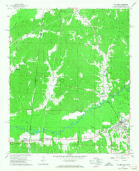 1967 Sulligent1968 Print · USGSThe Alabama-Mississippi state line comes alive in the late 1960s, centered on the railroad hub of Sulligent. Genealogists and local historians can trace rural life through numerous family burial sites like Almon Cem and country churches such as Wesley Chapel.2 unique versions available
 - 1967 Map of Beaverton, 1968 Print
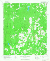
 1967 Beaverton1968 Print · USGSLamar County in the late sixties reveals a landscape shaped by the Buttahatchee River and the St Louis - San Francisco railroad. Genealogists can locate family landmarks like Spruiell Cem and Crews Ch, or trace old crossings at Hawkins Ford.2 unique versions available
 - 1967 Map of Sulligent SW, 1968 Print
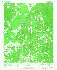
 1967 Sulligent SW1968 Print · USGSThe Alabama-Mississippi borderlands in the late sixties reveal a landscape of creek-side communities and country churches. Genealogists can locate family landmarks like Taylor Cem and Bedford Sch, or trace the path of Watson Creek.2 unique versions available
 - 1967 Map of Vernon, 1968 Print
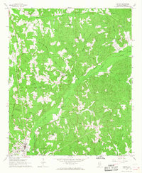 1967 Vernon1968 Print · USGSLamar County in the late sixties reveals a landscape of tight-knit rural communities centered around the town of Vernon. Researchers can trace family history through a high density of country churches and cemeteries like Kennedy Ch, Moscow Cem, and Emmaus Cem.2 unique versions available
 - 1982 Map of West Point, 1983 Print
 1982 West Point1983 Print · USGSEastern Mississippi and western Alabama are captured in the early eighties as the river-and-rail economy evolved. Trace family roots and old township lines near West Point, Columbus Air Force Base, and the historic Natchez Trace Parkway.
 - 1984 Map of West Point
 1984 West Point1984 Print · USGSNorth-Central Mississippi in the mid-eighties shows a landscape defined by massive water management projects and dense timberlands. Researchers can trace the legacy of rural settlements like Geeslin Corner or the rail corridors of the Illinois Central Gulf RR near Grenada Lake.3 unique versions available
End of results
Showing maps 1-9 of 9
Top cities near Sulligent
- Hamilton historical maps
- Guin historical maps
- Vernon historical maps
- Caledonia historical maps
- Detroit historical maps
- Beaverton historical maps
See more
Frequently asked questions
- What are the different types of historical maps available for Sulligent?
- What is the oldest map of Sulligent?
- Where can I purchase historical maps of Sulligent for my home or office?
- Where can I download high-res historical maps of Sulligent?
- Are there historical topographic maps available for Sulligent?
- Is there historical aerial imagery available for Sulligent?
- Where are historical maps of Sulligent sourced from?