1950s Maps of Saint Florian, Alabama
Explore 6 historic maps of Saint Florian from the 1950s. These maps offer a rare glimpse into what life looked like during the 1950s — showing old roads, neighborhoods, homes, and landmarks that have changed or disappeared over time.
Whether you're researching your family's past, planning a metal detecting trip, or studying how Saint Florian's landscape evolved across the 1950s, these high-resolution maps are a powerful tool for exploring the history of this region.
- Focus on a specific era: All maps on this page are from the 1950s, giving you a focused view of this time period.
- See what’s changed: Compare century-old streets, trails, and buildings to today's modern landscape using overlays and satellite layers.
- Research with precision: Use these maps for genealogy, historical research, land use analysis, or educational projects.
- View, download, or print: Maps are fully viewable online in high resolution, and can be downloaded or printed for your own records.
Start exploring Saint Florian's history through authentic maps from the 1950s. This is your window into the past.
Saint Florian, AL maps
(6)- 1952 Map of Blackburn, 1958 Print
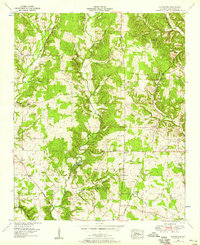 1952 Blackburn1958 Print · USGSLauderdale County's rural heartland is captured here in the early fifties, showing a landscape of creek-side mills and historic post roads. Researchers can locate family sites near Zip City and Jacksonburg or trace the Big Cut Station Mines and Sharps Mill.3 unique versions available
 - 1952 Map of Pruitton, 1958 Print
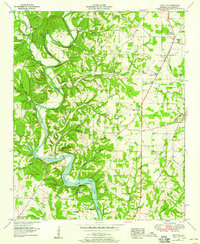 1952 Pruitton1958 Print · USGSLauderdale County settlement in the early fifties is captured here as the waters of Wilson Lake meet the agricultural uplands. Researchers can trace family roots through numerous landmarks like Bailey Springs, Milners Chapel, and the Pleasant Grove Cem.3 unique versions available
 - 1953 Map of Killen, 1957 Print
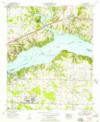 1953 Killen1957 Print · USGSThe Tennessee River valley in the early fifties shows a landscape reshaped by industry and the waters of Wilson Lake. Researchers can trace the development of Nitrate City and Listerhill or find family landmarks like Old Brick Ch and Woodlawn Cem.
 - 1956 Map of Gadsden, 1966 Print
 1956 Gadsden1966 Print · USGSNorth Alabama in the mid-1950s shows a region transformed by river engineering and federal industry. Genealogists and local historians can trace the development of the Tennessee Valley through the growth of Huntsville, the sprawling Redstone Arsenal, and the expansive Guntersville Lake.3 unique versions available
 - 1957 Map of Florence, 1958 Print
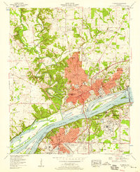 1957 Florence1958 Print · USGSThe riverfront cities of Florence and Sheffield are shown in the late fifties as industrial and educational growth transformed the Shoals. Researchers can trace family sites like Africa Ch, Greeview Memorial Cem, and the early campus of Florence State College.2 unique versions available
 - 1958 Map of Gadsden
 1958 Gadsden1958 Print · USGSNorth Alabama comes alive in the late 1950s as the Tennessee Valley Authority’s massive river projects and the rise of the space industry reshaped the landscape. Researchers can trace the mid-century footprints of Huntsville, Redstone Arsenal, and the riverside rail networks of the Southern railroad.
End of results
Showing maps 1-6 of 6
Top cities near Saint Florian
- Florence historical maps
- Muscle Shoals historical maps
- Sheffield historical maps
- Tuscumbia historical maps
- Underwood-Petersville historical maps
- Loretto historical maps
See more
Frequently asked questions
- What are the different types of historical maps available for Saint Florian?
- What is the oldest map of Saint Florian?
- Where can I purchase historical maps of Saint Florian for my home or office?
- Where can I download high-res historical maps of Saint Florian?
- Are there historical topographic maps available for Saint Florian?
- Is there historical aerial imagery available for Saint Florian?
- Where are historical maps of Saint Florian sourced from?