1920s Maps of Wright, Alabama
Explore 2 historic maps of Wright from the 1920s. These maps offer a rare glimpse into what life looked like during the 1920s — showing old roads, neighborhoods, homes, and landmarks that have changed or disappeared over time.
Whether you're researching your family's past, planning a metal detecting trip, or studying how Wright's landscape evolved across the 1920s, these high-resolution maps are a powerful tool for exploring the history of this region.
- Focus on a specific era: All maps on this page are from the 1920s, giving you a focused view of this time period.
- See what’s changed: Compare century-old streets, trails, and buildings to today's modern landscape using overlays and satellite layers.
- Research with precision: Use these maps for genealogy, historical research, land use analysis, or educational projects.
- View, download, or print: Maps are fully viewable online in high resolution, and can be downloaded or printed for your own records.
Start exploring Wright's history through authentic maps from the 1920s. This is your window into the past.
Wright, AL maps
(2)- 1924 Map of Gravelly Springs
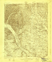 1924 Gravelly Springs1924 Print · USGSLauderdale County at the edge of the Tennessee River reveals a vibrant rural society in the mid-twenties, centered on the river and the rail line. Researchers can trace the heritage of vanished landmarks like Lyle Academy, the Colbert Shoals Canal, and the Oakland School (Colored).2 unique versions available
 - 1926 Map of Gravelly Springs
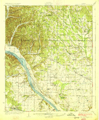 1926 Gravelly Springs1926 Print · USGSNorthwest Alabama is seen here in the mid-twenties, when the river and rail lines dictated the rhythm of Lauderdale and Colbert counties. Genealogists can locate family landmarks like Lyle Academy, Youngs Store, and the Colbert Shoals Canal.2 unique versions available
End of results
Showing maps 1-2 of 2
Top cities near Wright
Frequently asked questions
- What are the different types of historical maps available for Wright?
- What is the oldest map of Wright?
- Where can I purchase historical maps of Wright for my home or office?
- Where can I download high-res historical maps of Wright?
- Are there historical topographic maps available for Wright?
- Is there historical aerial imagery available for Wright?
- Where are historical maps of Wright sourced from?