Old Maps of Reynolds, Hillsboro
Explore 14 old maps of Reynolds, spanning from 1936 to today. These high-resolution historic maps reveal how streets, neighborhoods, landmarks, and natural features evolved over time — perfect for genealogy, metal detecting, research, and local history exploration.
What you can do with these maps:
- See how Reynolds changed over time: Compare historical maps to modern-day views to trace roads, homesites, rail lines & more.
- View detailed metadata: Each map includes creators, publishers, year, scale, and archive source.
- Overlay maps with satellite & LiDAR: Visualize the past alongside modern tools to explore terrain & human change.
- Trusted historical sources: Maps sourced from the USGS, Library of Congress, and other archives.
- Access maps your way: View online, download high-res files, or order prints for personal or research use.
Start exploring old maps of Reynolds to uncover forgotten places, hidden landmarks, and the deep history beneath your feet.
Reynolds, Hillsboro maps
(14)- 1936 Map of Hillsboro
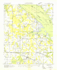 1936 Hillsboro1936 Print · USGSHillsboro and the Tennessee River banks are captured here during the transformative mid-1930s as the new reservoir began to fill. Local historians can locate early schools and churches such as Ebenezer Sch, Canaan Ch, and the riverside Milton Bluff.
 - 1948 Map of Hillsboro, 1969 Print
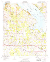 1948 Hillsboro1969 Print · USGSLawrence County and the Tennessee River shoreline are captured here in the late 1940s as the regional landscape adjusted to the presence of Wheeler Lake. Genealogists can trace family roots through numerous local landmarks, including Pointer Quarters, Bethel Ch, and Hillsboro Cem.
 - 1951 Map of Hillsboro
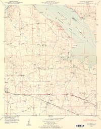 1951 Hillsboro1951 Print · USGSLawrence County life is captured here in the early fifties, showing the area as the local economy balanced riverfront geography with rail access. Genealogists can locate family landmarks like Pointer Quarters and numerous burial grounds including Hillsboro Cem and Canaan Cem.2 unique versions available
 - 1956 Map of Gadsden, 1966 Print
 1956 Gadsden1966 Print · USGSNorth Alabama in the mid-1950s shows a region transformed by river engineering and federal industry. Genealogists and local historians can trace the development of the Tennessee Valley through the growth of Huntsville, the sprawling Redstone Arsenal, and the expansive Guntersville Lake.3 unique versions available
 - 1958 Map of Gadsden
 1958 Gadsden1958 Print · USGSNorth Alabama comes alive in the late 1950s as the Tennessee Valley Authority’s massive river projects and the rise of the space industry reshaped the landscape. Researchers can trace the mid-century footprints of Huntsville, Redstone Arsenal, and the riverside rail networks of the Southern railroad.
 - 1960 Map of Gadsden
 1960 Gadsden1960 Print · USGSNorthern Alabama in the mid-1950s is defined by the mighty Tennessee River and its massive reservoirs. Trace the development of Huntsville and Redstone Arsenal or explore the vast William B Bankhead National Forest.2 unique versions available
 - 1963 Map of Gadsden
 1963 Gadsden1963 Print · USGSNorthern Alabama underwent a dramatic mid-century transformation as the Tennessee Valley became a hub for defense and industry. Researchers can trace the development of the Redstone Arsenal, the route of the Natchez Trace Parkway, and long-standing rail lines like the Southern Railway.
 - 1974 Map of Hillsboro, 1975 Print
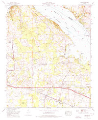 1974 Hillsboro1975 Print · USGSHillsboro and the banks of the Tennessee River are captured here in the mid-seventies as industry and tradition met. Family historians can locate dozens of burial sites like Shackelford Cem and Graves Cem Church alongside the Southern Railway.
 - 1986 Map of Tuscumbia
 1986 Tuscumbia1986 Print · USGSThe Tennessee River valley in the mid-1980s shows a landscape transformed by massive reservoirs and industrial hubs. Genealogists and local historians can trace the development of the Shoals area and locate rural communities like Tharp Town, Leighton, and Rogersville.3 unique versions available
 - 2011 Map of Hillsboro, 2011 Print
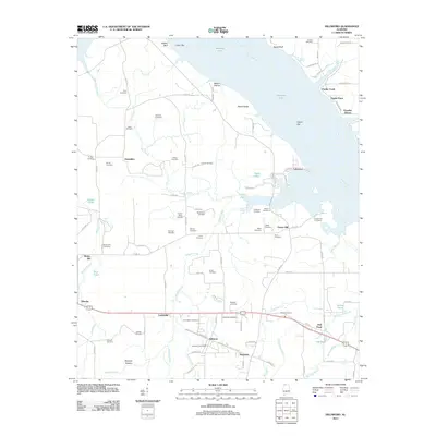 2011 Hillsboro2011 Print · USGSCovers Reynolds, including Hillsboro, Brides Hill, and other nearby areas
 - 2014 Map of Hillsboro, 2014 Print
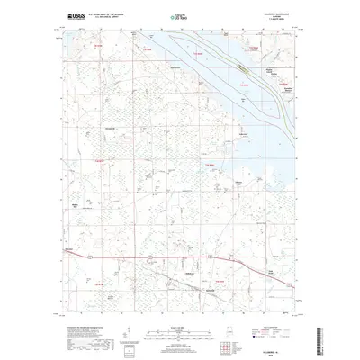
 2014 Hillsboro2014 Print · USGSCovers Reynolds, including Hillsboro, Brides Hill, and other nearby areas
 - 2018 Map of Hillsboro, 2018 Print
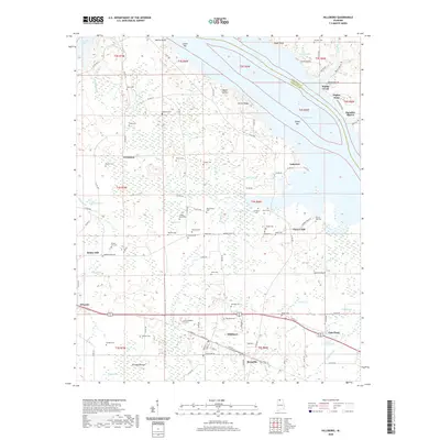
 2018 Hillsboro2018 Print · USGSCovers Reynolds, including Hillsboro, Brides Hill, and other nearby areas
 - 2020 Map of Hillsboro, 2020 Print
 2020 Hillsboro2020 Print · USGSCovers Reynolds, including Hillsboro, Brides Hill, and other nearby areas
 - 2024 Map of Hillsboro, 2024 Print
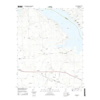
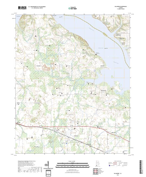 2024 Hillsboro2024 Print · USGSLawrence County, Alabama, is documented here in the early twenty-first century as it borders the wide waters of the Tennessee River. Researchers can trace deep family roots through dozens of local landmarks like Swoope Cem, Coss Ferry, and the community of Hillsboro.
End of results
Showing maps 1-14 of 14
Top cities near Reynolds
- Huntsville historical maps
- Decatur historical maps
- Athens historical maps
- Hartselle historical maps
- Moulton historical maps
- Trinity historical maps
See more
Frequently asked questions
- What are the different types of historical maps available for Reynolds?
- What is the oldest map of Reynolds?
- Where can I purchase historical maps of Reynolds for my home or office?
- Where can I download high-res historical maps of Reynolds?
- Are there historical topographic maps available for Reynolds?
- Is there historical aerial imagery available for Reynolds?
- Where are historical maps of Reynolds sourced from?