1980s Maps of Montgomery County, Alabama
Explore 17 historic maps of Montgomery County from the 1980s. These maps offer a rare glimpse into what life looked like during the 1980s — showing old roads, neighborhoods, homes, and landmarks that have changed or disappeared over time.
Whether you're researching your family's past, planning a metal detecting trip, or studying how Montgomery County's landscape evolved across the 1980s, these high-resolution maps are a powerful tool for exploring the history of this region.
- Focus on a specific era: All maps on this page are from the 1980s, giving you a focused view of this time period.
- See what’s changed: Compare century-old streets, trails, and buildings to today's modern landscape using overlays and satellite layers.
- Research with precision: Use these maps for genealogy, historical research, land use analysis, or educational projects.
- View, download, or print: Maps are fully viewable online in high resolution, and can be downloaded or printed for your own records.
Start exploring Montgomery County's history through authentic maps from the 1980s. This is your window into the past.
Montgomery County, AL maps
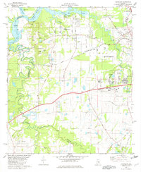
(17)- 1981 Map of Snowdoun
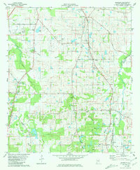 1981 Snowdoun1981 Print · USGSRural Montgomery County comes into focus in the early 1980s, documenting a landscape of rail-side hamlets and family-named homesteads. Researchers can trace the Seaboard Coast Line as it passes Snowdoun and Sprague, or locate family sites like Shackelford Cem and Beulah Ch.2 unique versions available
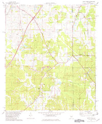
 - 1981 Map of Letohatchee
 1981 Letohatchee1981 Print · USGSLowndes and Montgomery Counties are captured here in the early eighties, showing a landscape defined by the intersection of historic transit and rural life. Genealogists can locate family-named landmarks and old congregations like Mosleys Cem, Rogers Cem, and Shiloh Ch.2 unique versions available
 - 1981 Map of Sellers
 1981 Sellers1981 Print · USGSCentral Alabama's agricultural heartland is documented here in the early eighties, showing the transition between Montgomery and Crenshaw Counties. Researchers can locate family landmarks like Bell Cem, rural churches such as Fair Prospect Ch, and trace the path of the Seaboard Coast Line railroad.2 unique versions available
 - 1981 Map of Prattville
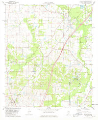
 1981 Prattville1981 Print · USGSPrattville at the start of the eighties shows a city balancing its industrial heritage with modern expansion near the Alabama River. Genealogists and historians can locate family burial sites like Doster Cem and trace the old Washington Ferry Road toward the water.2 unique versions available
 - 1981 Map of Cantelous, 1982 Print
 1981 Cantelous1982 Print · USGSSouthwest of Montgomery in the early eighties, this area showcases a landscape defined by military aviation and rural junctions. Genealogists and historians can trace the foundations of Dannelly Field and local settlements like Antioch and Mt Sinai.2 unique versions available
 - 1981 Map of Troy, 1982 Print
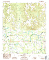
 1981 Troy1982 Print · USGSThe Chattahoochee River valley and the wiregrass region of Alabama come alive in the early eighties as the Walter F George Reservoir reshapes the eastern border. Genealogists can trace family roots through historic railroad towns like Brundidge and Louisville or explore the rural surroundings of Blue Springs State Park.
 - 1981 Map of Sandy Ridge, 1982 Print
 1981 Sandy Ridge1982 Print · USGSLowndes County and its neighbors are captured here in the early eighties as a rural landscape of family cemeteries and crossroad hamlets. Researchers can find generational landmarks like Lily Ch Cem, Sawyer Cem, and the settlement of Guys Village.2 unique versions available
 - 1981 Map of Tuskegee, 1982 Print
 1981 Tuskegee1982 Print · USGSMacon and Bullock counties are captured here in the early eighties, showcasing a landscape deeply tied to the railroad and the legacies of Tuskegee Institute. Researchers can locate specific sites from Moton Field to rural settlements along the Seaboard Coast Line like Hurtsboro and Pittsview.2 unique versions available
 - 1986 Map of Montgomery
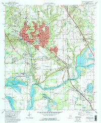
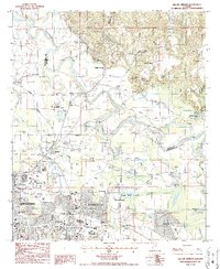
 1986 Montgomery1986 Print · USGSCentral Alabama's river-and-rail corridor is captured in the mid-1980s, centered on the state capital and its surrounding rural counties. Researchers can trace ancestral landmarks like Oakwood Cemetery, military sites like Maxwell Air Force Base, and small towns such as Lowndesboro.2 unique versions available
 - 1986 Map of Clanton
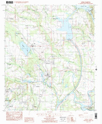
 1986 Clanton1986 Print · USGSCentral Alabama’s river-driven landscape is captured here in the mid-eighties, centered on the growth of Clanton and the hydroelectric lakes of the Coosa River. Genealogists and historians can trace the Old Indian Treaty Boundary or locate landmarks like Sykes Mill and Collins Chapel.
 - 1986 Map of Greenville
 1986 Greenville1986 Print · USGSMid-century South Central Alabama comes alive in this survey of the creek-laced timberlands and rail-dependent towns between the Gulf Coastal Plain and the Piedmont. Researchers can trace family roots through numerous country landmarks like Magnolia Cem, Spring Hill Ch, and the Butler County State Wildlife Management Area.2 unique versions available
 - 1987 Map of Barachias
 1987 Barachias1987 Print · USGSSoutheast of Montgomery in the late 1980s, the rural-urban fringe shows a landscape of expanding schools and deep-rooted family landmarks. Genealogists and historians can trace numerous sites like Perrys Mill, the Jackson Prospect Cem, and Macedonia Ch.2 unique versions available
 - 1987 Map of Mount Meigs
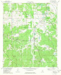
 1987 Mount Meigs1987 Print · USGSEastern Montgomery County is captured in the late eighties as its rural crossroads began to evolve. Genealogists can trace family landmarks like Antioch Cem and Birch Hill Cem alongside the tracks of the SOUTHERN and CSX railroads.
 - 1987 Map of Brassell
 1987 Brassell1987 Print · USGSAlabama's river-bottom lands near the meeting of three counties were captured in detail during the late 1980s. Researchers can trace family sites like Dawson Bradford Cem and Cathmagby Ch or locate the Mount Meigs (Sta) along the CSX rail line.
 - 1987 Map of Elmore
 1987 Elmore1987 Print · USGSThe riverfront communities of Elmore County appear in the late 1980s as the Coosa River landscape transitions from industrial dam sites to historic parklands. Researchers can trace family roots at Jones Chapel, Zeigler Cem, and the old settlement of Coosada.2 unique versions available
 - 1987 Map of Willow Springs
 1987 Willow Springs1987 Print · USGSGreater Montgomery and the Elmore County line come alive in this late 1980s survey of the riverbend country. Genealogists and local historians can trace family markers at Young Cem and Peck Cem or locate the sprawling Gunter AF Station.2 unique versions available
 - 1987 Map of Clanton, 1990 Print
 1987 Clanton1990 Print · USGSCentral Alabama in the late eighties reveals a landscape of massive river reservoirs and forest reserves. Trace the rail-and-road corridors through Clanton and Wetumpka to find historic sites like Fort Toulouse and Collins Chapel.
End of results
Showing maps 1-17 of 17
Top cities of Montgomery County
Frequently asked questions
- What are the different types of historical maps available for Montgomery County?
- What is the oldest map of Montgomery County?
- Where can I purchase historical maps of Montgomery County for my home or office?
- Where can I download high-res historical maps of Montgomery County?
- Are there historical topographic maps available for Montgomery County?
- Is there historical aerial imagery available for Montgomery County?
- Where are historical maps of Montgomery County sourced from?