Old Maps of Fleta, Alabama
Explore 11 old maps of Fleta, spanning from 1953 to today. These high-resolution historic maps reveal how streets, neighborhoods, landmarks, and natural features evolved over time — perfect for genealogy, metal detecting, research, and local history exploration.
What you can do with these maps:
- See how Fleta changed over time: Compare historical maps to modern-day views to trace roads, homesites, rail lines & more.
- View detailed metadata: Each map includes creators, publishers, year, scale, and archive source.
- Overlay maps with satellite & LiDAR: Visualize the past alongside modern tools to explore terrain & human change.
- Trusted historical sources: Maps sourced from the USGS, Library of Congress, and other archives.
- Access maps your way: View online, download high-res files, or order prints for personal or research use.
Start exploring old maps of Fleta to uncover forgotten places, hidden landmarks, and the deep history beneath your feet.
Fleta, AL maps
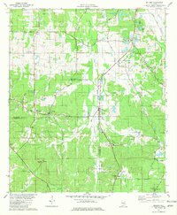
(11)- 1953 Map of Montgomery, 1964 Print
 1953 Montgomery1964 Print · USGSCentral Alabama's river-and-rail corridor is mapped here in the mid-fifties, showing the vital connections between the capital and the Black Belt. Genealogists and historians can trace rail depots and crossroads from Marion Junction to Wetumpka, alongside landmarks like Craig AFB.4 unique versions available
 - 1956 Map of Montgomery
 1956 Montgomery1956 Print · USGSCentral Alabama in the mid-1950s shows a landscape defined by its great river systems and a booming military aviation presence. Genealogists and historians can trace the rail corridors of the Southern Railway and locate tactical bases like Maxwell AFB and Craig AFB.
 - 1957 Map of Montgomery
 1957 Montgomery1957 Print · USGSCentral Alabama in the mid-fifties is defined by the winding Alabama River and a strategic network of military bases and rail lines. Trace family roots in Montgomery and Selma, or locate landmarks like Craig AFB and the State Capitol before the interstate era.
 - 1957 Map of Letohatchee, 1958 Print
 1957 Letohatchee1958 Print · USGSSouthern Montgomery and Lowndes counties are shown here in the mid-fifties, dominated by timbered creek bottoms and small agricultural centers. Genealogists can trace family names at Shackelford Cem, Letohatchee, and the Louisville and Nashville RR corridor.
 - 1981 Map of Sellers
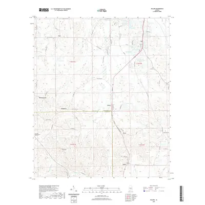
 1981 Sellers1981 Print · USGSCentral Alabama's agricultural heartland is documented here in the early eighties, showing the transition between Montgomery and Crenshaw Counties. Researchers can locate family landmarks like Bell Cem, rural churches such as Fair Prospect Ch, and trace the path of the Seaboard Coast Line railroad.2 unique versions available
 - 1986 Map of Montgomery
 1986 Montgomery1986 Print · USGSCentral Alabama's river-and-rail corridor is captured in the mid-1980s, centered on the state capital and its surrounding rural counties. Researchers can trace ancestral landmarks like Oakwood Cemetery, military sites like Maxwell Air Force Base, and small towns such as Lowndesboro.2 unique versions available
 - 2011 Map of Sellers, 2011 Print
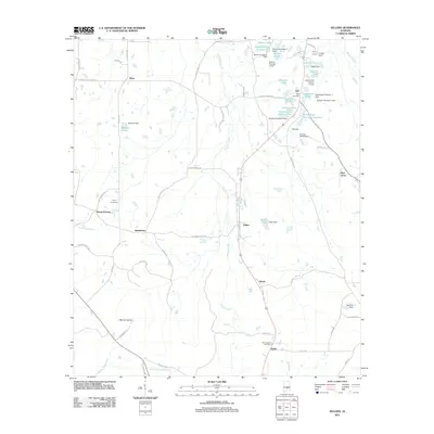 2011 Sellers2011 Print · USGSCovers Fleta, including Bethlehem, Mount Carmel, and other nearby areas
 - 2014 Map of Sellers, 2014 Print
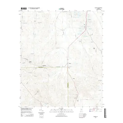 2014 Sellers2014 Print · USGSCovers Fleta, including Bethlehem, Mount Carmel, and other nearby areas
 - 2018 Map of Sellers, 2018 Print
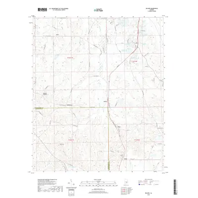 2018 Sellers2018 Print · USGSCovers Fleta, including Bethlehem, Mount Carmel, and other nearby areas
 - 2020 Map of Sellers, 2020 Print
 2020 Sellers2020 Print · USGSCovers Fleta, including Bethlehem, Mount Carmel, and other nearby areas
 - 2024 Map of Sellers, 2024 Print
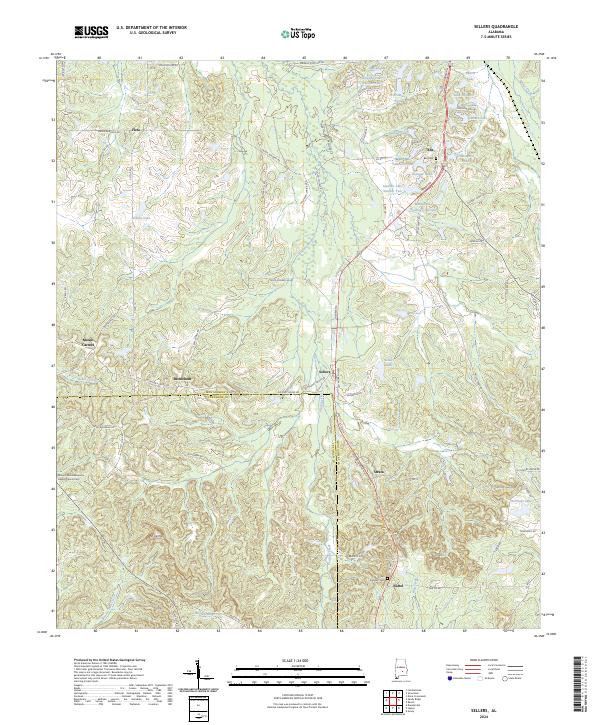 2024 Sellers2024 Print · USGSSouthern Montgomery County’s rural communities are meticulously documented in this contemporary survey of the Alabama Black Belt. Genealogists can locate family landmarks such as Fair Prospect Cem, the church at Bethlehem, and small settlements like Ada and Fleta.
End of results
Showing maps 1-11 of 11
Top cities near Fleta
- Montgomery historical maps
- Pike Road historical maps
- Greenville historical maps
- Fort Deposit historical maps
- Hayneville historical maps
Frequently asked questions
- What are the different types of historical maps available for Fleta?
- What is the oldest map of Fleta?
- Where can I purchase historical maps of Fleta for my home or office?
- Where can I download high-res historical maps of Fleta?
- Are there historical topographic maps available for Fleta?
- Is there historical aerial imagery available for Fleta?
- Where are historical maps of Fleta sourced from?