Old Maps of Trinity, Alabama for Metal Detecting
Plan your next treasure hunt with 22 historic maps of Trinity. Find old homesites, ghost towns, trails, and gathering spots that may be lost to time — perfect for identifying promising metal detecting locations.
- Locate forgotten sites: Uncover places like long-lost settlements, abandoned rail lines, or gathering spots.
- Plan better hunts: Use map overlays combined with LiDAR or satellite views to narrow in on historically rich areas.
- Made for detectorists: Thousands of hobbyists use these maps to discover relics, coins, and hidden history.
Use these historic maps to boost your research and find new opportunities beneath the surface of Trinity.
Trinity, AL maps
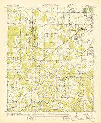
(22)- 1936 Map of Stewart Cross Roads
 1936 Stewart Cross Roads1936 Print · USGSThe Tennessee River valley underwent a massive transformation in the mid-1930s as the new reservoir flooded the lowlands. You can trace submerged riverbanks and find upland landmarks like Stewart Cross Roads, Beulah Land, and St Luke Sch.
 - 1936 Map of Trinity
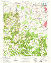
 1936 Trinity1936 Print · USGSThe Tennessee River valley near the Lawrence and Morgan county line is captured here just as the new reservoir system was taking shape. Genealogists can trace family names at Roselawn Cem, find old rural schools like Means Sch, and locate the historic Kirby Bridge.
 - 1950 Map of Jones Crossroads
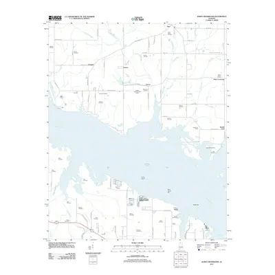
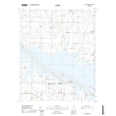
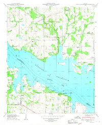 1950 Jones Crossroads1950 Print · USGSLimestone and Morgan counties meet along the wide waters of the Tennessee River in the post-war era. Genealogists and local historians can trace family plots at Neville Cem or locate community centers like Jones Crossroads and the Pine Ridge School.3 unique versions available
 - 1950 Map of Trinity
 1950 Trinity1950 Print · USGSMid-century Morgan County is captured here as the Tennessee Valley Authority's influence reshaped the landscape near Trinity and Moulton Heights. Genealogists and historians can trace the locations of family burial grounds like Lile Cem, early schools such as Pleasant Hill School, and natural landmarks like San-Souci Cave.2 unique versions available
 - 1956 Map of Gadsden, 1966 Print
 1956 Gadsden1966 Print · USGSNorth Alabama in the mid-1950s shows a region transformed by river engineering and federal industry. Genealogists and local historians can trace the development of the Tennessee Valley through the growth of Huntsville, the sprawling Redstone Arsenal, and the expansive Guntersville Lake.3 unique versions available
 - 1958 Map of Gadsden
 1958 Gadsden1958 Print · USGSNorth Alabama comes alive in the late 1950s as the Tennessee Valley Authority’s massive river projects and the rise of the space industry reshaped the landscape. Researchers can trace the mid-century footprints of Huntsville, Redstone Arsenal, and the riverside rail networks of the Southern railroad.
 - 1960 Map of Gadsden
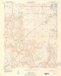
 1960 Gadsden1960 Print · USGSNorthern Alabama in the mid-1950s is defined by the mighty Tennessee River and its massive reservoirs. Trace the development of Huntsville and Redstone Arsenal or explore the vast William B Bankhead National Forest.2 unique versions available
 - 1962 Map of Trinity, 1975 Print
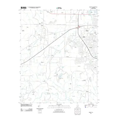
 1962 Trinity1975 Print · USGSMorgan County settlement and the expansion of Decatur are captured in this mid-century survey as the suburbs met the rural hills. Genealogists can trace family names at Lile Cem, Fennell Cem, and Love Chapel along the Southern Railway.
 - 1963 Map of Gadsden
 1963 Gadsden1963 Print · USGSNorthern Alabama underwent a dramatic mid-century transformation as the Tennessee Valley became a hub for defense and industry. Researchers can trace the development of the Redstone Arsenal, the route of the Natchez Trace Parkway, and long-standing rail lines like the Southern Railway.
 - 1963 Map of Trinity, 1965 Print
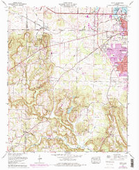
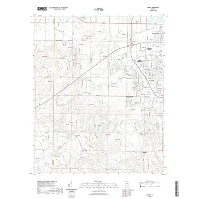
 1963 Trinity1965 Print · USGSThe western edge of Decatur meets the ridgelines of the Tennessee Valley in the early 1960s as suburban growth began to reach the base of Trinity Mountain. Trace your family history through rural landmarks like Dancy Chapel, West Morgan Sch, and the Wimbley Cem.
 - 1976 Map of Jones Crossroads, 1977 Print
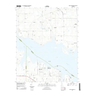
 1976 Jones Crossroads1977 Print · USGSThe Tennessee River valley north of Decatur underwent significant industrial transformation by the mid-seventies. Researchers can trace family history through numerous burial sites like Malone Cem or locate the sprawling Browns Ferry Nuclear Plant.
 - 1986 Map of Tuscumbia
 1986 Tuscumbia1986 Print · USGSThe Tennessee River valley in the mid-1980s shows a landscape transformed by massive reservoirs and industrial hubs. Genealogists and local historians can trace the development of the Shoals area and locate rural communities like Tharp Town, Leighton, and Rogersville.3 unique versions available
 - 2011 Map of Trinity, 2011 Print
 2011 Trinity2011 Print · USGSCovers Trinity, including Decatur, Griffin Addition, and other nearby areas
 - 2011 Map of Jones Crossroads, 2011 Print
 2011 Jones Crossroads2011 Print · USGSCovers Trinity, including Decatur, Athens, and other nearby areas
 - 2014 Map of Jones Crossroads, 2014 Print
 2014 Jones Crossroads2014 Print · USGSCovers Trinity, including Decatur, Athens, and other nearby areas
 - 2014 Map of Trinity, 2014 Print
 2014 Trinity2014 Print · USGSCovers Trinity, including Decatur, Griffin Addition, and other nearby areas
 - 2018 Map of Trinity, 2018 Print
 2018 Trinity2018 Print · USGSCovers Trinity, including Decatur, Griffin Addition, and other nearby areas
 - 2018 Map of Jones Crossroads, 2018 Print
 2018 Jones Crossroads2018 Print · USGSCovers Trinity, including Decatur, Athens, and other nearby areas
 - 2020 Map of Jones Crossroads, 2020 Print
 2020 Jones Crossroads2020 Print · USGSCovers Trinity, including Decatur, Athens, and other nearby areas
 - 2020 Map of Trinity, 2020 Print
 2020 Trinity2020 Print · USGSCovers Trinity, including Decatur, Griffin Addition, and other nearby areas
 - 2024 Map of Trinity, 2024 Print
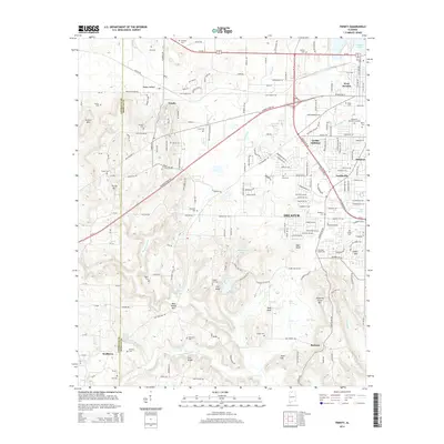
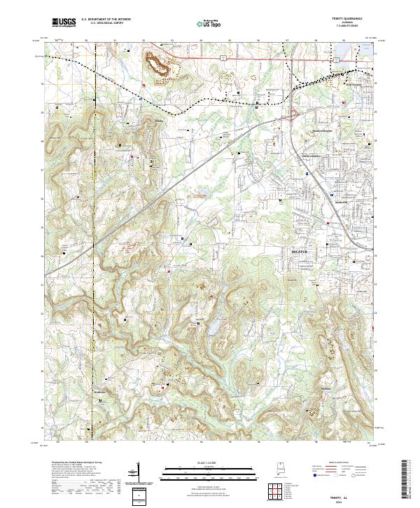 2024 Trinity2024 Print · USGSThe rolling terrain between Lawrence and Morgan counties comes into focus in this recent survey. Genealogists can trace family roots at Mount Zion Cem, Lile Cem, and Fall Bluff Chapel Cem near Trinity Mtn.
 - 2024 Map of Jones Crossroads, 2024 Print
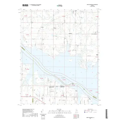
 2024 Jones Crossroads2024 Print · USGSThis recent survey of the Tennessee River shoreline in Northern Alabama details the communities surrounding Athens and Decatur. Researchers can trace numerous family-named landmarks and cemeteries, from Oak Grove Cem to Malone Cem and the riverfront at Heints Bar.
End of results
Showing maps 1-22 of 22
Top cities near Trinity
- Huntsville historical maps
- Decatur historical maps
- Athens historical maps
- Hartselle historical maps
- Priceville historical maps
- Moulton historical maps
See more
Frequently asked questions
- What are the different types of historical maps available for Trinity?
- What is the oldest map of Trinity?
- Where can I purchase historical maps of Trinity for my home or office?
- Where can I download high-res historical maps of Trinity?
- Are there historical topographic maps available for Trinity?
- Is there historical aerial imagery available for Trinity?
- Where are historical maps of Trinity sourced from?