Old Maps of Moundville, Alabama for Hiking & Exploration
Hike through history with 37 historic maps of Moundville. Explore old trails, ghost towns, and forgotten backroads — perfect for outdoor adventurers and local explorers.
- Rediscover forgotten places: Map out old mining camps, roads, and footpaths that no longer exist on modern maps.
- Layer with modern tools: Combine with LiDAR or satellite views to plan hikes through historical terrain.
- Made for exploration: Popular among hikers, overlanders, and local history lovers.
Use these maps to find adventure and explore the hidden past of Moundville.
Moundville, AL maps
(37)- 1924 Map of Tuscaloosa, 1957 Print
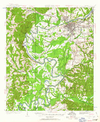 1924 Tuscaloosa1957 Print · USGSTuscaloosa and the Black Warrior River valley are seen here in the mid-1920s, showing a landscape defined by river bends and rail lines. Researchers can trace the early footprint of the University of Alabama or locate rural sites like Cribbs Mill and Little Satan Church.
 - 1926 Map of Tuscaloosa
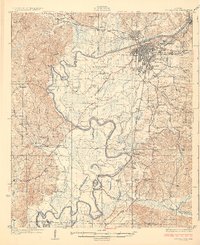 1926 Tuscaloosa1926 Print · USGSCentral Alabama's river-and-rail landscape is captured here during the mid-twenties, showcasing the growth of the University of Alabama and Tuscaloosa. Genealogists and historians can trace family-named sites like Carson Bluff Bend and rural landmarks such as Coker, Kings Ferry, and the Hull Consolidated School.3 unique versions available
 - 1953 Map of Montgomery, 1964 Print
 1953 Montgomery1964 Print · USGSCentral Alabama's river-and-rail corridor is mapped here in the mid-fifties, showing the vital connections between the capital and the Black Belt. Genealogists and historians can trace rail depots and crossroads from Marion Junction to Wetumpka, alongside landmarks like Craig AFB.4 unique versions available
 - 1953 Map of Birmingham, 1964 Print
 1953 Birmingham1964 Print · USGSCentral Alabama at mid-century shows a landscape defined by industrial expansion and the iron-rich ridges surrounding Birmingham. Researchers can trace the extensive rail networks of the L & N RR or locate historic federal sites like the Anniston Ordnance Depot.4 unique versions available
 - 1956 Map of Birmingham
 1956 Birmingham1956 Print · USGSCentral Alabama in the mid-fifties exhibits a landscape of growing cities and deep-rooted industrial corridors. Genealogists and historians can trace the development of suburban Mountain Brook or locate regional hubs like Sylacauga and Jasper.
 - 1956 Map of Montgomery
 1956 Montgomery1956 Print · USGSCentral Alabama in the mid-1950s shows a landscape defined by its great river systems and a booming military aviation presence. Genealogists and historians can trace the rail corridors of the Southern Railway and locate tactical bases like Maxwell AFB and Craig AFB.
 - 1957 Map of Birmingham
 1957 Birmingham1957 Print · USGSNorth-Central Alabama in the mid-fifties is an industrial powerhouse centered on the steel valleys and sprawling iron ridges. Genealogists and historians can trace the rail-linked growth of Birmingham and Tuscaloosa, or locate rural landmarks like Talladega College and the Anniston Ordnance Depot.
 - 1957 Map of Montgomery
 1957 Montgomery1957 Print · USGSCentral Alabama in the mid-fifties is defined by the winding Alabama River and a strategic network of military bases and rail lines. Trace family roots in Montgomery and Selma, or locate landmarks like Craig AFB and the State Capitol before the interstate era.
 - 1969 Map of Fosters, 1973 Print
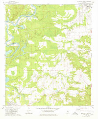
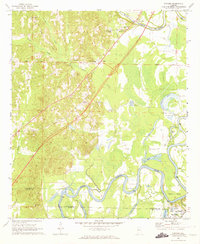 1969 Fosters1973 Print · USGSThe Black Warrior River valley near Tuscaloosa was undergoing major change in the late sixties as new highways were built through the bottomlands. Researchers can locate the Indian Mounds at Moundville or trace family sites like Myrtlewood Sch and Dry Creek Ch.2 unique versions available
 - 1970 Map of Englewood, 1973 Print
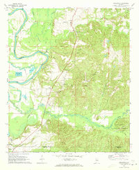 1970 Englewood1973 Print · USGSThe Black Warrior River valley and the Talladega National Forest meet in this 1970s survey of the Alabama borderlands. Researchers can trace rural lineages through numerous country churches like Zion Hope Ch or locate the ancient mounds at Mound State Mon.4 unique versions available
 - 1980 Map of Moundville West
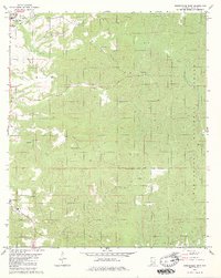
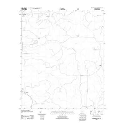
 1980 Moundville West1980 Print · USGSThe Black Warrior River and Southern Railway define this Hale County landscape during the late twentieth century. Genealogists can trace family names at Taylor Chapel, Havana Cem, and small settlements like Powers and Guinea.
 - 1980 Map of Moundville East
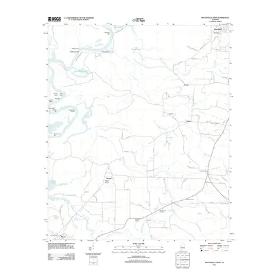
 1980 Moundville East1980 Print · USGSHale County settlement and the western fringes of the national forest are documented here during the early eighties. Researchers can trace rural lineages through numerous landmarks including Greenleaf Cem, Pleasant Hill Ch Cem, and Salem Ch.2 unique versions available
 - 1984 Map of Tuscaloosa, 1985 Print
 1984 Tuscaloosa1985 Print · USGSWest-central Alabama centers on the mid-1980s expansion of the university and the river economy. Genealogists and historians can trace small-town connections through Burchfield Store, North Johns, and the rail lines of the Southern railroad.2 unique versions available
 - 1986 Map of Demopolis
 1986 Demopolis1986 Print · USGSWest-central Alabama's river-and-rail corridors are preserved here in the mid-eighties, showing the deep-seated settlement patterns of the Black Belt. Genealogists and historians can locate family-named landmarks like Crenshaw Quarters or industrial sites including Cleveland Mills and the Warrior Lock and Dam.
 - 1990 Map of Demopolis
 1990 Demopolis1990 Print · USGSWest-central Alabama's river corridors and educational centers are mapped here in the late twentieth century. Genealogists and local historians can trace old family sites near Oak Grove Ch, the historic Marion Military Institute, or the landings at Finchal Ferry.
 - 2002 Map of Englewood, 2003 Print
 2002 Englewood2003 Print · USGSTuscaloosa and Hale Counties appear in the early 21st century as a landscape of river bends and national forest. Researchers can trace the ancient earthworks at Mound State Mon, locate rural congregations like Zion Hope Ch, or find historical river access at Mcpherson Landing.
 - 2002 Map of Moundville East, 2004 Print
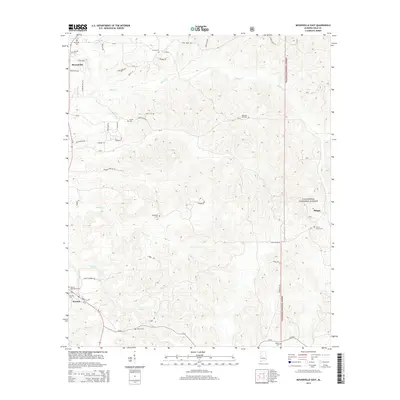
 2002 Moundville East2004 Print · USGSHale County, Alabama, is documented here in the early 2000s, balancing the growing community of Moundville with the protected wildlands of the Talladega National Forest. Researchers can locate several historic family and church burial sites, from Oak Hill Cem to Star of Bethlehem Cem.
 - 2011 Map of Moundville East, 2011 Print
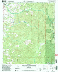
 2011 Moundville East2011 Print · USGSCovers Moundville, including Phipps, Havana, and other nearby areas
 - 2011 Map of Fosters, 2011 Print
 2011 Fosters2011 Print · USGSCovers Moundville, including Fosters, Mountainbrook, and other nearby areas
 - 2011 Map of Moundville West, 2011 Print
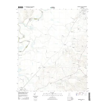
 2011 Moundville West2011 Print · USGSCovers Moundville, including Akron, Cypress, and other nearby areas
 - 2011 Map of Englewood, 2011 Print
 2011 Englewood2011 Print · USGSCovers Moundville, including Tuscaloosa, Hinton Gardens, and other nearby areas
 - 2014 Map of Fosters, 2014 Print
 2014 Fosters2014 Print · USGSCovers Moundville, including Fosters, Mountainbrook, and other nearby areas
 - 2014 Map of Englewood, 2014 Print
 2014 Englewood2014 Print · USGSCovers Moundville, including Tuscaloosa, Hinton Gardens, and other nearby areas
 - 2014 Map of Moundville East, 2014 Print
 2014 Moundville East2014 Print · USGSCovers Moundville, including Phipps, Havana, and other nearby areas
 - 2014 Map of Moundville West, 2014 Print
 2014 Moundville West2014 Print · USGSCovers Moundville, including Akron, Cypress, and other nearby areas
Showing maps 1-25 of 37
Top cities near Moundville
Frequently asked questions
- What are the different types of historical maps available for Moundville?
- What is the oldest map of Moundville?
- Where can I purchase historical maps of Moundville for my home or office?
- Where can I download high-res historical maps of Moundville?
- Are there historical topographic maps available for Moundville?
- Is there historical aerial imagery available for Moundville?
- Where are historical maps of Moundville sourced from?