1900s (20th Century) Maps of Russell County, Alabama
Explore 49 historic maps of Russell County from the 1900s (20th Century). These maps offer a rare glimpse into what life looked like during the 1900s — showing old roads, neighborhoods, homes, and landmarks that have changed or disappeared over time.
Whether you're researching your family's past, planning a metal detecting trip, or studying how Russell County's landscape evolved across the 1900s, these high-resolution maps are a powerful tool for exploring the history of this region.
- Focus on a specific era: All maps on this page are from the 1900s, giving you a focused view of this time period.
- See what’s changed: Compare century-old streets, trails, and buildings to today's modern landscape using overlays and satellite layers.
- Research with precision: Use these maps for genealogy, historical research, land use analysis, or educational projects.
- View, download, or print: Maps are fully viewable online in high resolution, and can be downloaded or printed for your own records.
Start exploring Russell County's history through authentic maps from the 1900s. This is your window into the past.
Russell County, AL maps
(49)- 1907 Map of Talbotton
 1907 Talbotton1907 Print · USGSWest-central Georgia at the turn of the century is a landscape of ridges and rail-lines, dominated by the thermal waters of Warm Springs. Local historians can trace the foundations of Talbotton and rural life at Turntime Crossroads, Cataula Camp Ground, and Greens Mill.3 unique versions available
 - 1907 Map of Opelika, 1963 Print
 1907 Opelika1963 Print · USGSEastern Alabama and western Georgia come alive in this early 1900s survey of the rail-and-river economy. Genealogists can trace family names at Mitchell Crossroads, find rural landmarks like the Poor Farm, and locate historic river crossings like Dixon Ferry.
 - 1908 Map of Columbus
 1908 Columbus1908 Print · USGSThe Chattahoochee riverfront at the dawn of the century shows the thriving river-and-rail economy of the Georgia-Alabama border. Genealogists and historians can trace early landings like BRADLEY LDG, rural congregations at Goodhope Church, and the operations at Cooks Mill.8 unique versions available
 - 1909 Map of Opelika
 1909 Opelika1909 Print · USGSEastern Alabama and western Georgia are seen here in the first decade of the twentieth century as the river-and-rail economy reached its peak. Genealogists and historians can trace old river crossings like Blanton Ferry, rural post offices such as Antioch Church Huckabee P O, and the path of the Chattahoochee Valley railroad.4 unique versions available
 - 1914 Map of Seale
 1914 Seale1914 Print · USGSRussell County's agricultural and railroad landscape is meticulously documented just before the First World War. Genealogists can trace family connections through local landmarks like Kite School, the community of Sand Fort, and historical river crossings like Perrys Ford.6 unique versions available
 - 1929 Map of Columbus
 1929 Columbus1929 Print · USGSThe Georgia-Alabama borderlands come alive in this late 1920s survey of the bustling military and rail hub around Columbus. Genealogists and historians can trace the transition from rural farmsteads to military grounds at Fort Benning, identifying family landmarks like Greenwood Hill and Holliday Hill.
 - 1947 Map of Columbus, 1954 Print
 1947 Columbus1954 Print · USGSPostwar Georgia and Alabama meet along the Chattahoochee River in this detailed study of military expansion and urban growth. Genealogists and historians can trace family-named landmarks across Fort Benning and locate sites like Riverdale Cem, Midway Ch, and Baker Village.2 unique versions available
 - 1949 Map of Fort Mitchell
 1949 Fort Mitchell1949 Print · USGSRussell County, Alabama, was a landscape of military expansion and rural rail stops shortly after the war. You can trace the Central of Georgia line as it passes through Fort Mitchell and Lato, or locate riverfront sites like Bradley Landing.2 unique versions available
 - 1949 Map of Julia
 1949 Julia1949 Print · USGSThe river border between Georgia and Alabama comes alive in this post-war survey of the Stewart County backcountry. Genealogists can trace family landholdings like Heard Place and Slayton Place along the Seaboard Air Line and Hannahatchee Creek.2 unique versions available
 - 1949 Map of Columbus
 1949 Columbus1949 Print · USGSColumbus and Phenix City flank the Chattahoochee River during a period of massive military growth following the war. Genealogists can trace family footprints through Linwood Cem and neighborhood schools like St Elmo School or Jordan High School.2 unique versions available
 - 1950 Map of Fort Benning
 1950 Fort Benning1950 Print · USGSFort Benning and the surrounding riverlands appear in sharp detail during the post-war era as the military reservation expanded across the Georgia-Alabama line. Researchers can trace the mid-century infrastructure of the Fort Benning post alongside natural landmarks like Uchee Creek and McMurrin Pond.
 - 1950 Map of Fortson, 1953 Print
 1950 Fortson1953 Print · USGSThe northern suburbs of Columbus were beginning to take shape in the early fifties, while rural outposts like Fortson and Nankipooh remained distinct. Genealogists can locate family landmarks such as Mealing Cem and Double Churches or trace the early layout of the Muscogee County Airport.2 unique versions available
 - 1950 Map of Crawford, 1953 Print
 1950 Crawford1953 Print · USGSMid-century Russell County comes into focus in this study of the communities surrounding Crawford and the Lee County line. Genealogists and historians can trace local landmarks like Uchee Sch, St Johns Ch, and the many crossings over Little Uchee Creek.2 unique versions available
 - 1950 Map of Seale, 1953 Print
 1950 Seale1953 Print · USGSRussell County, Alabama, is documented here in the early postwar era as its rural communities and rail corridors remained firmly established. Genealogists and historians can trace local family roots through sites like Sandfort Sch, Friendship Ch, and the settlement of Villula.2 unique versions available
 - 1950 Map of Phenix City, 1954 Print
 1950 Phenix City1954 Print · USGSPhenix City and Girard are captured here in the early fifties, showing a dense community of schools, churches, and industry along the Georgia border. Genealogists can trace family landmarks like the Carmichael Cemetery, St Pauls Church, and the settlement at Ladonia.2 unique versions available
 - 1950 Map of Seale, 1955 Print
 1950 Seale1955 Print · USGSRussell County during the mid-century shows a landscape of small farming communities and expanding military boundaries. Genealogists can trace family roots through numerous rural landmarks like Evans Cem, Hillside Chapel, and the Brickyard Sch.
 - 1950 Map of Lumpkin, 1955 Print
 1950 Lumpkin1955 Print · USGSStewart County and the Chattahoochee River valley appear in the mid-fifties as a landscape of deep canyons, family farmsteads, and rail-side settlements. Researchers can trace local genealogy through numerous sites like Fitzgerald Cem, Oak Grove Sch, and Ushers Mill Pond.
 - 1950 Map of Ellerslie, 1955 Print
 1950 Ellerslie1955 Print · USGSThe Muscogee and Harris County borderlands appear here in the mid-twentieth century as the city of Columbus begins its northward expansion. Researchers can trace the rural roots of the region through landmarks like Turntime Crossroads, Double Churches, and the Columbus Speedway Racetrack.
 - 1955 Map of Phenix City, 1959 Print
 1955 Phenix City1959 Print · USGSThe mid-century landscape of Russell County reveals the growth of Phenix City and the industrial activity at Kaolin. Genealogists and historians can trace numerous rural landmarks, from Friendship Cemetery and Uchee Hill Church to the legacy of Mother Mary Mission.5 unique versions available
 - 1955 Map of Seale, 1959 Print
 1955 Seale1959 Print · USGSRussell County in the mid-fifties is captured here as a landscape of rural communities and vital rail connections. Researchers can trace the local lineage through family-named landmarks and rural institutions like Chavala High Sch, Sandfort, and Ross Chapel.3 unique versions available
 - 1955 Map of Crawford, 1959 Print
 1955 Crawford1959 Print · USGSRussell County's rural landscape is captured here in the mid-1950s, showing the area around the settlement of Crawford. Local historians can trace family roots through sites like Davis Cem or follow the early school and church locations at Uchee Sch and Pleasant Hill Ch.3 unique versions available
 - 1955 Map of Fort Mitchell, 1959 Print
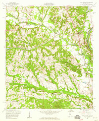 1955 Fort Mitchell1959 Print · USGSThe Alabama-Georgia borderlands come to life in the mid-fifties as the Chattahoochee River meets the expanding Fort Benning Military Reservation. Genealogists and local historians can trace rural sites like Oswichee, Bradley Landing, and the Providence Cem before modern development altered the landscape.3 unique versions available
 - 1955 Map of Fort Benning, 1959 Print
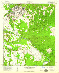 1955 Fort Benning1959 Print · USGSThe mid-1950s expansion of the Fort Benning Military Reservation is captured here along the Chattahoochee River. Researchers can trace the development of military infrastructure at Lawson Field and locate family-named landmarks like Riche Hill or McMurrin Pond.4 unique versions available
 - 1955 Map of Columbus, 1959 Print
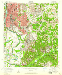 1955 Columbus1959 Print · USGSMid-century Columbus and Phenix City thrive along the river at the height of their industrial and military significance. Genealogists and local historians can locate many vanished city schools, the sprawling Rose Hill Cemetery, and the early layout of the Fort Benning Military Reservation.5 unique versions available
 - 1955 Map of Fortson, 1959 Print
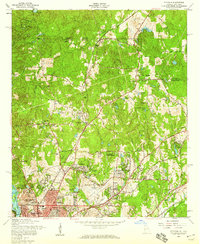 1955 Fortson1959 Print · USGSMuscogee County is shown in the mid-fifties as the northern edge of Columbus begins its post-war expansion into the countryside. Researchers can trace old family roots and rural landmarks at Double Churches, Pierce Chapel Cemetery, and the historic settlement of Nankipooh.5 unique versions available
Showing maps 1-25 of 49
Top cities of Russell County
Frequently asked questions
- What are the different types of historical maps available for Russell County?
- What is the oldest map of Russell County?
- Where can I purchase historical maps of Russell County for my home or office?
- Where can I download high-res historical maps of Russell County?
- Are there historical topographic maps available for Russell County?
- Is there historical aerial imagery available for Russell County?
- Where are historical maps of Russell County sourced from?