Old Maps of Cordova, Alabama for Genealogy
Trace your family roots with 21 historic maps of Cordova. These high-res maps reveal old neighborhoods, homesites, landmarks, and streets — helping you uncover where your ancestors lived and how the area evolved over time.
- Explore historic neighborhoods: Identify where your relatives may have lived in the 1800s or 1900s.
- Compare maps over time: Trace the changes in streets, buildings, and landmarks for multi-generational research.
- Perfect for genealogy & ancestry research: Used by family historians and researchers to map out lineage and migration.
These maps are an incredible resource for exploring your personal connection to Cordova's past.
Cordova, AL maps
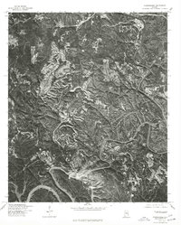
(21)- 1893 Map of Jasper
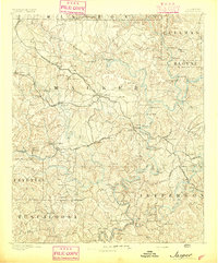 1893 Jasper1893 Print · USGSNorthern Alabama’s coal and timber country comes into focus in the 1890s as railroads began to penetrate the river valleys. Genealogists and historians can trace family-named river crossings like Miller Ferry and Baltimore Ford or early industry at Gamble Mines.5 unique versions available
 - 1935 Map of Port Birmingham
 1935 Port Birmingham1935 Print · USGSThe coal and power corridor of the Black Warrior River is captured here in the mid-1930s, showing a landscape defined by mines and industrial camps. Genealogists can locate family sites at Pennsylvania Camp, Satterfield Cem, or the Barney Mine community.
 - 1938 Map of Port Birmingham
 1938 Port Birmingham1938 Print · USGSThe river-and-rail industry of the Black Warrior coalfields is captured here in the late 1930s. Genealogists and historians can trace the foundations of local commerce at Port Birmingham and locate vanished river crossings like Underwood Ferry or the Atwood Ferry.4 unique versions available
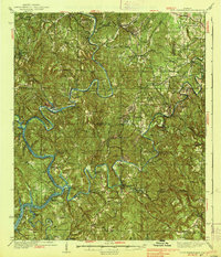
 - 1949 Map of Cordova, 1967 Print
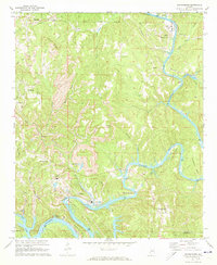
 1949 Cordova1967 Print · USGSWalker County during the late 1940s shows a complex network of river bends and rail lines centered on Cordova. Researchers can trace old family settlements and rural landmarks like Gardiners Gin, Wesley Ch, and the crossing at Benoit.4 unique versions available
 - 1951 Map of Cordova
 1951 Cordova1951 Print · USGSWalker County at the start of the 1950s reveals a landscape defined by the Mulberry Fork river and a dense network of competing rail lines. Researchers can trace family roots through numerous local landmarks like Gardiners Gin, Sardis Cem, and the rural Wesley Ch.2 unique versions available
 - 1953 Map of Birmingham, 1964 Print
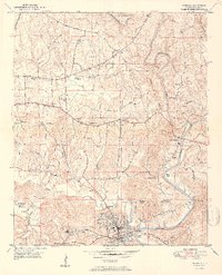
 1953 Birmingham1964 Print · USGSCentral Alabama at mid-century shows a landscape defined by industrial expansion and the iron-rich ridges surrounding Birmingham. Researchers can trace the extensive rail networks of the L & N RR or locate historic federal sites like the Anniston Ordnance Depot.4 unique versions available
 - 1956 Map of Birmingham
 1956 Birmingham1956 Print · USGSCentral Alabama in the mid-fifties exhibits a landscape of growing cities and deep-rooted industrial corridors. Genealogists and historians can trace the development of suburban Mountain Brook or locate regional hubs like Sylacauga and Jasper.
 - 1957 Map of Birmingham
 1957 Birmingham1957 Print · USGSNorth-Central Alabama in the mid-fifties is an industrial powerhouse centered on the steel valleys and sprawling iron ridges. Genealogists and historians can trace the rail-linked growth of Birmingham and Tuscaloosa, or locate rural landmarks like Talladega College and the Anniston Ordnance Depot.
 - 1971 Map of Goodsprings, 1973 Print
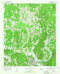
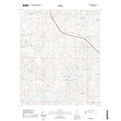
 1971 Goodsprings1973 Print · USGSThe coal and power corridor of Walker County is on full display in the early 1970s, where the winding Mulberry Fork meets industrial growth. Genealogists and historians can locate the Martin High Sch, Busby Cem, and several Strip Mine sites near Gorgas.4 unique versions available
 - 1975 Map of Goodsprings, 1977 Print
 1975 Goodsprings1977 Print · USGSThe winding Black Warrior River and its surrounding coalfields dominate this mid-seventies aerial survey of Walker County. Genealogists and industrial historians can trace the residential layouts of Gorgas, Dovertown, and Aldridge amidst massive surface mines.
 - 1984 Map of Jasper, 1985 Print
 1984 Jasper1985 Print · USGSIn the mid-1980s, the Walker County coalfields were a complex web of rail lines and river terminals. Researchers can trace the industrial heritage of the Mulberry Fork and locate local landmarks like the Carbon Hill National Fish Hatchery or Saragossa Ch.2 unique versions available
 - 2011 Map of Goodsprings, 2011 Print
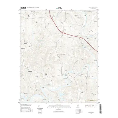
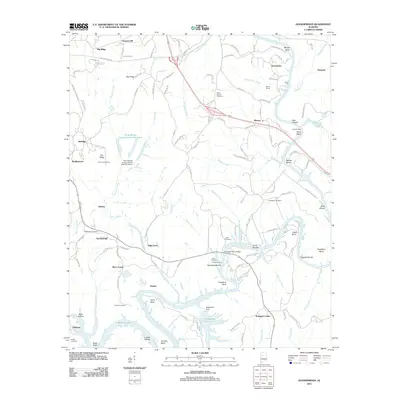 2011 Goodsprings2011 Print · USGSCovers Cordova, including High Level, Dovertown, and other nearby areas
 - 2011 Map of Cordova, 2011 Print
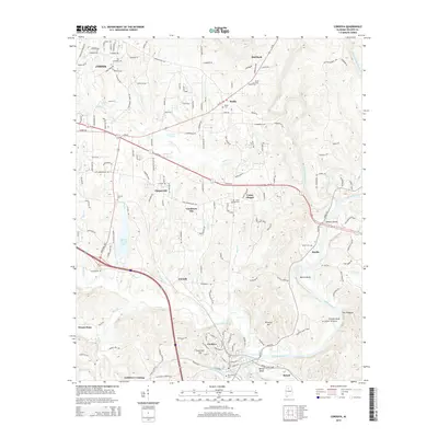
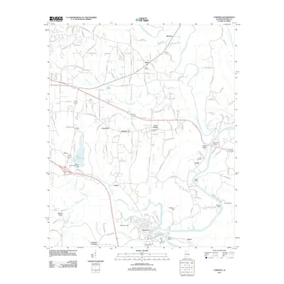 2011 Cordova2011 Print · USGSCovers Cordova, including Jasper, Lynns Park, and other nearby areas
 - 2014 Map of Cordova, 2014 Print
 2014 Cordova2014 Print · USGSCovers Cordova, including Jasper, Lynns Park, and other nearby areas
 - 2014 Map of Goodsprings, 2014 Print
 2014 Goodsprings2014 Print · USGSCovers Cordova, including High Level, Dovertown, and other nearby areas
 - 2018 Map of Cordova, 2018 Print
 2018 Cordova2018 Print · USGSCovers Cordova, including Jasper, Lynns Park, and other nearby areas
 - 2018 Map of Goodsprings, 2018 Print
 2018 Goodsprings2018 Print · USGSCovers Cordova, including High Level, Dovertown, and other nearby areas
 - 2020 Map of Goodsprings, 2020 Print
 2020 Goodsprings2020 Print · USGSCovers Cordova, including High Level, Dovertown, and other nearby areas
 - 2020 Map of Cordova, 2020 Print
 2020 Cordova2020 Print · USGSCovers Cordova, including Jasper, Lynns Park, and other nearby areas
 - 2024 Map of Goodsprings, 2024 Print
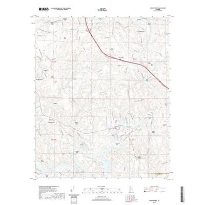
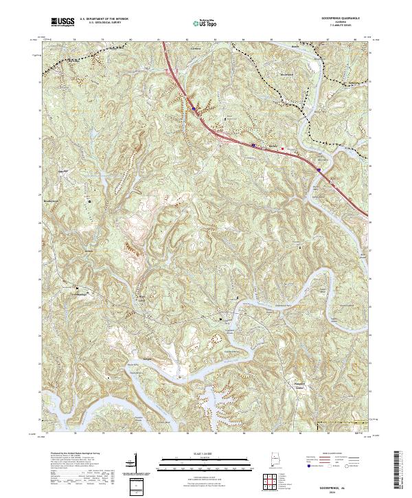 2024 Goodsprings2024 Print · USGSThe Mulberry Fork meanders through Walker County in this modern survey, revealing a landscape of ridge-top settlements and historic river crossings. Genealogists can locate several family cemeteries like Leonard Cem and Goodsprings Cem, or trace old routes to Copeland Ferry.
 - 2024 Map of Cordova, 2024 Print
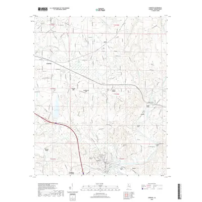
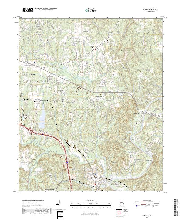 2024 Cordova2024 Print · USGSWalker County at the headwaters of the Black Warrior River remains a landscape of river bends and rural crossroads. You can trace old family roots at Samaria Baptist Church Cem, locate former river crossings like Bartons Ferry, or explore the settlement at Gobblers Crossing.
End of results
Showing maps 1-21 of 21
Top cities near Cordova
- Birmingham historical maps
- Jasper historical maps
- Adamsville historical maps
- Sumiton historical maps
- Dora historical maps
- Graysville historical maps
See more
Top neighborhoods of Cordova
Frequently asked questions
- What are the different types of historical maps available for Cordova?
- What is the oldest map of Cordova?
- Where can I purchase historical maps of Cordova for my home or office?
- Where can I download high-res historical maps of Cordova?
- Are there historical topographic maps available for Cordova?
- Is there historical aerial imagery available for Cordova?
- Where are historical maps of Cordova sourced from?