Old Maps of King Cove, Alaska for Hiking & Exploration
Hike through history with 5 historic maps of King Cove. Explore old trails, ghost towns, and forgotten backroads — perfect for outdoor adventurers and local explorers.
- Rediscover forgotten places: Map out old mining camps, roads, and footpaths that no longer exist on modern maps.
- Layer with modern tools: Combine with LiDAR or satellite views to plan hikes through historical terrain.
- Made for exploration: Popular among hikers, overlanders, and local history lovers.
Use these maps to find adventure and explore the hidden past of King Cove.
King Cove, AK maps
(5)- 1943 Map of Fort Randall, 1954 Print
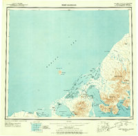 1943 Fort Randall1954 Print · USGSThe Alaska Peninsula and its wartime outposts are documented in this mid-forties survey. Researchers can trace the military footprint at Thornbrough Air Force Base and maritime hubs like King Cove and Belkofski.7 unique versions available
 - 1949 Map of Fort Randall, 1958 Print
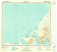
 1949 Fort Randall1958 Print · USGSThe southern Alaska Peninsula and the entrance to the Aleutians are documented here during the late 1940s. Researchers can trace remote coastal outposts like Belkofski, locate the Air Force Base at Fort Randall, and find the abandoned cannery at Morzhovoi Bay.
 - 1950 Map of Fort Randall
 1950 Fort Randall1950 Print · USGSThe Alaska Peninsula at the dawn of the 1950s reveals a rugged landscape of strategic airbases and isolated fishing settlements. Researchers can trace the layout of Thornbrough Air Force Base, find the site of a Cannery (Abandoned), or locate the coastal village of Belkofski.2 unique versions available
 - 1983 Map of Cold Bay A-1
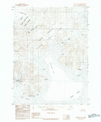 1983 Cold Bay A-11983 Print · USGSThe western Alaska Peninsula in the early eighties shows a landscape of remote maritime settlements and vast wildlife preserves. Researchers can locate the coastal villages of King Cove and Belkofski, alongside features like Johnny Smith Lagoon and Mount Dutton.2 unique versions available
 - 2020 Map of Cold Bay A-1 SW, 2020 Print
 2020 Cold Bay A-1 SW2020 Print · USGSThe remote Alaska Peninsula community of King Cove is shown in detail during the early 2020s, highlighting its vital maritime and aviation infrastructure. Researchers can trace local landmarks like King Cove Cem, the King Cove Airport, and coastal features from Indian Head to Bold Cape.
End of results
Showing maps 1-5 of 5
Frequently asked questions
- What are the different types of historical maps available for King Cove?
- What is the oldest map of King Cove?
- Where can I purchase historical maps of King Cove for my home or office?
- Where can I download high-res historical maps of King Cove?
- Are there historical topographic maps available for King Cove?
- Is there historical aerial imagery available for King Cove?
- Where are historical maps of King Cove sourced from?