1960s Maps of Eagle Point Homeowner's Association, Anchorage
Explore 2 historic maps of Eagle Point Homeowner's Association from the 1960s. These maps offer a rare glimpse into what life looked like during the 1960s — showing old roads, neighborhoods, homes, and landmarks that have changed or disappeared over time.
Whether you're researching your family's past, planning a metal detecting trip, or studying how Eagle Point Homeowner's Association's landscape evolved across the 1960s, these high-resolution maps are a powerful tool for exploring the history of this region.
- Focus on a specific era: All maps on this page are from the 1960s, giving you a focused view of this time period.
- See what’s changed: Compare century-old streets, trails, and buildings to today's modern landscape using overlays and satellite layers.
- Research with precision: Use these maps for genealogy, historical research, land use analysis, or educational projects.
- View, download, or print: Maps are fully viewable online in high resolution, and can be downloaded or printed for your own records.
Start exploring Eagle Point Homeowner's Association's history through authentic maps from the 1960s. This is your window into the past.
Eagle Point Homeowner's Association, Anchorage maps
(2)- 1960 Map of Anchorage B-7, 1961 Print
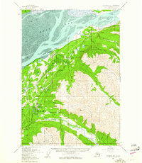 1960 Anchorage B-71961 Print · USGSThe growing communities north of Anchorage are captured here as they expanded during the mid-century. Genealogists and historians can trace the early infrastructure of Chugiak and Eagle River, or locate landmarks like Birchwood Auxiliary Airfield and Camp Gorsuch.4 unique versions available
 - 1962 Map of Anchorage, 1966 Print
 1962 Anchorage1966 Print · USGSThe Anchorage bowl and Matanuska Valley appear in this mid-century survey during a period of significant military and industrial expansion. Researchers can trace the Alaska Railroad through Sutton and Jonesville or locate historic stops like Meekins Roadhouse and the Watertower Inn.6 unique versions available
End of results
Showing maps 1-2 of 2
Frequently asked questions
- What are the different types of historical maps available for Eagle Point Homeowner's Association?
- What is the oldest map of Eagle Point Homeowner's Association?
- Where can I purchase historical maps of Eagle Point Homeowner's Association for my home or office?
- Where can I download high-res historical maps of Eagle Point Homeowner's Association?
- Are there historical topographic maps available for Eagle Point Homeowner's Association?
- Is there historical aerial imagery available for Eagle Point Homeowner's Association?
- Where are historical maps of Eagle Point Homeowner's Association sourced from?