Old Maps of Heritage Estates, Anchorage for Academic Research
Study the evolution of Heritage Estates with 9 high-resolution historic maps. Whether you're teaching, researching, or modeling changes in land use, these maps provide essential visual documentation of urban, environmental, and geographic change.
- Analyze long-term change: Track patterns in development, transportation, and natural features.
- Ideal for environmental or urban studies: Support academic projects with primary historical map data.
- Use in the classroom or lab: Educators and researchers rely on these maps to bring historical context to life.
These maps are a powerful tool for teaching, research, and visualizing how Heritage Estates has changed over the decades.
Heritage Estates, Anchorage maps
(9)- 1951 Map of Anchorage
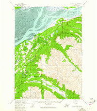
 1951 Anchorage1951 Print · USGSMid-century Anchorage and the Matanuska Valley are seen here during a period of rapid strategic growth. Trace the development of Fort Richardson, early rail stops at Wasilla, and established mining operations like the Independence Mine or Premier Mine.4 unique versions available
 - 1960 Map of Anchorage B-7, 1961 Print
 1960 Anchorage B-71961 Print · USGSThe growing communities north of Anchorage are captured here as they expanded during the mid-century. Genealogists and historians can trace the early infrastructure of Chugiak and Eagle River, or locate landmarks like Birchwood Auxiliary Airfield and Camp Gorsuch.4 unique versions available
 - 1962 Map of Anchorage, 1966 Print
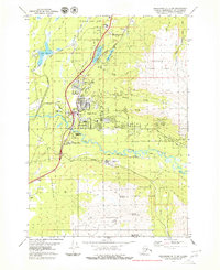
 1962 Anchorage1966 Print · USGSThe Anchorage bowl and Matanuska Valley appear in this mid-century survey during a period of significant military and industrial expansion. Researchers can trace the Alaska Railroad through Sutton and Jonesville or locate historic stops like Meekins Roadhouse and the Watertower Inn.6 unique versions available
 - 1979 Map of Anchorage B-7 SW
 1979 Anchorage B-7 SW1979 Print · USGSThe community of Eagle River and the neighboring military lands are shown in detail during the late seventies as the region transitioned toward suburban growth. Genealogists and historians can locate Chugiak High Sch, trace the path of the Alaska Railroad, and identify numerous family landmarks near Lower Fire Lake.4 unique versions available
 - 1979 Map of Anchorage, 1980 Print
 1979 Anchorage1980 Print · USGSThe Anchorage bowl and Matanuska Valley appear in the late seventies as the region's transportation and military infrastructure matured. Genealogists and historians can trace rail and road evolution through Wasilla, the Matanuska Branch line, and Jonesville.
 - 1994 Map of Anchorage B-7, 2002 Print
 1994 Anchorage B-72002 Print · USGSThe Eagle River valley and Chugach foothills are captured in the mid-nineties as the Glenn Highway corridor expanded. Researchers can trace the infrastructure of the era, from the Birchwood Airport and Alaska Railroad to the historic Eklutna Cem.
 - 2015 Map of Anchorage B-7 SW, 2015 Print
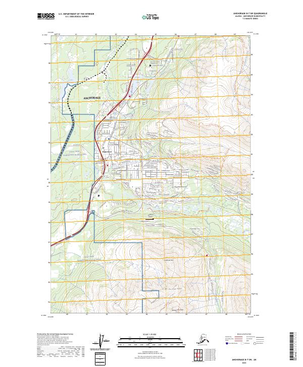
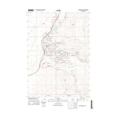 2015 Anchorage B-7 SW2015 Print · USGSCovers Heritage Estates, including Chugiak, Anchorage, and other nearby areas
 - 2021 Map of Anchorage B-7 SW, 2021 Print
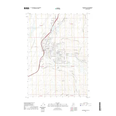 2021 Anchorage B-7 SW2021 Print · USGSCovers Heritage Estates, including Chugiak, Anchorage, and other nearby areas
 - 2023 Map of Anchorage B-7 SW, 2023 Print
 2023 Anchorage B-7 SW2023 Print · USGSThe Eagle River valley in the 2020s shows a sophisticated mix of suburban growth and steep mountain terrain. Hikers and researchers can trace paths like the Mile-High Trl or locate landmarks such as the Saint John Catholic Cathedral Cem.
End of results
Showing maps 1-9 of 9
Frequently asked questions
- What are the different types of historical maps available for Heritage Estates?
- What is the oldest map of Heritage Estates?
- Where can I purchase historical maps of Heritage Estates for my home or office?
- Where can I download high-res historical maps of Heritage Estates?
- Are there historical topographic maps available for Heritage Estates?
- Is there historical aerial imagery available for Heritage Estates?
- Where are historical maps of Heritage Estates sourced from?