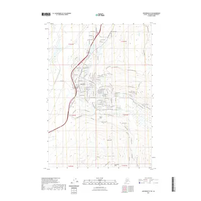
2021 Map of Anchorage B-7 SW
USGS Topo · Published 2021About this map
Eagle River serves as the focal point of this community, where the modern residential grid meets the dramatic rise of the Chugach Mountains. The map illustrates a developed suburban landscape characterized by a dense network of roads such as the Birchwood Loop Road and Artillery Rd, supporting local institutions like the University of Alaska Anchorage - Eagle River Campus. To the east, the terrain transitions sharply into high alpine peaks including Mt Gordon Lyon and Rendezvous Peak. This area is a hub for outdoor recreation, featuring the Mile High Ridge Trl and the Eagle River Greenbelt Access Trl. Smaller water bodies like Upper Fire Lake and Lake Clunie are nestled within the northern valleys, while the S Fork Eagle River carves through the southern mountain passes near the Highland Airport.
Find a feature on this map
32 named features on this map. Tap any name to fly to it.
Don’t see what you’re looking for? This feature index may not catch every label — zoom into the map to look around manually.
Map Details
Editions of this 2021 Anchorage B-7 SW Map
This is the sole edition of this map. No revisions or reprints were ever made.
Other maps of this area

1951 · Anchorage
USGS Topo · 1:250,000

1952 · Anchorage A-8
USGS Topo · 1:63,360

1952 · Anchorage B-8
USGS Topo · 1:63,360

1953 · Anchorage A-8
USGS Topo · 1:63,360

1953 · Anchorage B-8
USGS Topo · 1:63,360

1960 · Anchorage B-7
USGS Topo · 1:63,360

1960 · Anchorage A-7
USGS Topo · 1:63,360

1962 · Anchorage
USGS Topo · 1:250,000

1965 · Anchorage B-8
USGS Topo · 1:63,360

1979 · Anchorage B-7 SW
USGS Topo · 1:25,000