Old Maps of Douglas, Alaska for Academic Research
Study the evolution of Douglas with 8 high-resolution historic maps. Whether you're teaching, researching, or modeling changes in land use, these maps provide essential visual documentation of urban, environmental, and geographic change.
- Analyze long-term change: Track patterns in development, transportation, and natural features.
- Ideal for environmental or urban studies: Support academic projects with primary historical map data.
- Use in the classroom or lab: Educators and researchers rely on these maps to bring historical context to life.
These maps are a powerful tool for teaching, research, and visualizing how Douglas has changed over the decades.
Douglas, AK maps
(8)- 1947 Map of Juneau B-2, 1955 Print
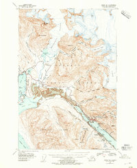 1947 Juneau B-21955 Print · USGSThe industrial waterfront of Juneau and Douglas comes to life in the years following the war. Genealogists and historians can trace mining sites like the Alaska-Juneau Mill, the development of the Juneau Airport, and the early layout of Treadwell.2 unique versions available
 - 1949 Map of Juneau B-2
 1949 Juneau B-21949 Print · USGSJuneau and Douglas Island appear at a pivotal post-war moment when mining infrastructure and new aviation developments sat side-by-side. Trace the legacy of the gold era through the Alaska Juneau Mill, the Ebner Adit, and the industrial footprint at Treadwell.
 - 1951 Map of Juneau
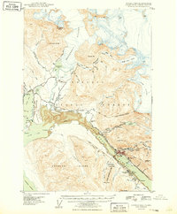
 1951 Juneau1951 Print · USGSJuneau and the industrial waterfront of the Gastineau Channel are shown here at the start of the 1950s. Researchers can trace the mid-century footprint of Juneau, the mining history of Treadwell, and remote maritime outposts like Hoonah and Gustavus.4 unique versions available
 - 1962 Map of Juneau B-2, 1963 Print
 1962 Juneau B-21963 Print · USGSThe Gastineau Channel and the peaks of Douglas Island appear here in the early sixties as the regional mining legacy began to meet modern growth. Genealogists and historians can trace the foundations of the local economy through The Glory Hole, the Alaska Juneau Adit, and the Treadwell site.4 unique versions available
 - 1962 Map of Juneau, 1966 Print
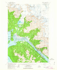
 1962 Juneau1966 Print · USGSSoutheast Alaska in the early sixties showcases a maritime landscape defined by the Tongass National Forest and the peaks of the Coast Mountains. Trace the footprints of coastal industry at Treadwell, Thane, and the regional hub of Juneau.7 unique versions available
 - 1986 Map of Juneau B-2 SE, 1987 Print
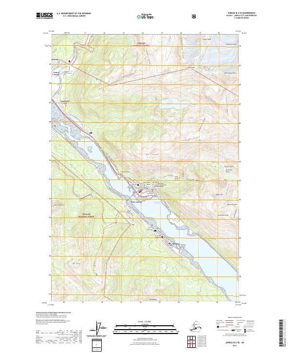
 1986 Juneau B-2 SE1987 Print · USGSThe Alaskan capital and Douglas Island appear here in the mid-eighties, showing the intersection of state government and deep-rooted mining history. Researchers can locate the Treadwell (Site), the State Capitol, and the Treadwell Glory Hole.2 unique versions available
 - 2017 Map of Juneau B-2 SE, 2017 Print
 2017 Juneau B-2 SE2017 Print · USGSCovers Douglas, including Juneau, West Juneau, and other nearby areas
 - 2021 Map of Juneau B-2 SE, 2021 Print
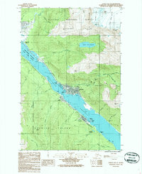
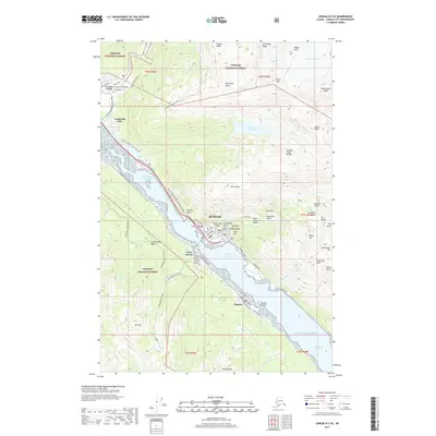
 2021 Juneau B-2 SE2021 Print · USGSThe maritime and mountain geography of the Alaskan Panhandle is on full display here during the early twenty-first century. Researchers can trace the layout of coastal neighborhoods from Norway Point to Douglas or locate local landmarks like Evergreen Cem and the Diamond Courthouse.
End of results
Showing maps 1-8 of 8
Top cities near Douglas
Frequently asked questions
- What are the different types of historical maps available for Douglas?
- What is the oldest map of Douglas?
- Where can I purchase historical maps of Douglas for my home or office?
- Where can I download high-res historical maps of Douglas?
- Are there historical topographic maps available for Douglas?
- Is there historical aerial imagery available for Douglas?
- Where are historical maps of Douglas sourced from?