Old Maps of Saint Terese, Alaska for Academic Research
Study the evolution of Saint Terese with 9 high-resolution historic maps. Whether you're teaching, researching, or modeling changes in land use, these maps provide essential visual documentation of urban, environmental, and geographic change.
- Analyze long-term change: Track patterns in development, transportation, and natural features.
- Ideal for environmental or urban studies: Support academic projects with primary historical map data.
- Use in the classroom or lab: Educators and researchers rely on these maps to bring historical context to life.
These maps are a powerful tool for teaching, research, and visualizing how Saint Terese has changed over the decades.
Saint Terese, AK maps
(9)- 1947 Map of Juneau B-3, 1955 Print
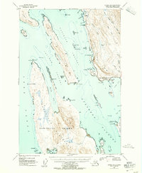 1947 Juneau B-31955 Print · USGSThe coastal waters north of Juneau come alive in the late 1940s, showing a maritime landscape of channels and remote landings. Researchers can trace early infrastructure like the lighthouse at Point Retreat, the small settlement at Dotsons Landing, and the original Glacier Highway route.2 unique versions available
 - 1949 Map of Juneau B-3
 1949 Juneau B-31949 Print · USGSThe Juneau coastline in the late 1940s is shown here as a landscape of maritime channels and early highway development. Researchers can trace historic access points like Dotsons Landing, the St Terese mission, and remote inlets such as Funter Bay.
 - 1951 Map of Juneau
 1951 Juneau1951 Print · USGSJuneau and the industrial waterfront of the Gastineau Channel are shown here at the start of the 1950s. Researchers can trace the mid-century footprint of Juneau, the mining history of Treadwell, and remote maritime outposts like Hoonah and Gustavus.4 unique versions available
 - 1962 Map of Juneau B-3, 1963 Print
 1962 Juneau B-31963 Print · USGSThe Juneau coastline and northern Admiralty Island are captured here in the early sixties, showing the maritime networks of the Inside Passage. Trace coastal history through the Shrine of St Terese, the docks at Dotsons Landing, and the Montana Creek Trail.2 unique versions available
 - 1962 Map of Juneau, 1966 Print
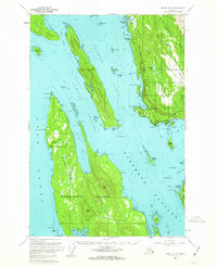
 1962 Juneau1966 Print · USGSSoutheast Alaska in the early sixties showcases a maritime landscape defined by the Tongass National Forest and the peaks of the Coast Mountains. Trace the footprints of coastal industry at Treadwell, Thane, and the regional hub of Juneau.7 unique versions available
 - 1986 Map of Juneau B-3 NE, 1987 Print
 1986 Juneau B-3 NE1987 Print · USGSCoastal Juneau in the mid-1980s reveals a landscape of sheltered harbors and forest boundaries at the edge of the Favorite Channel. Researchers can trace the development of Tee Harbor, locate the Shrine of St Terese, and identify early landings like Dotsons Landing.
 - 1996 Map of Juneau B-3, 2000 Print
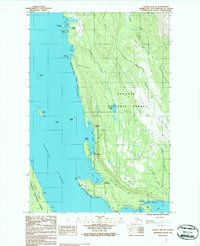
 1996 Juneau B-32000 Print · USGSThe coastal reaches of Juneau and Admiralty Island are captured here in the late twentieth century. Researchers can trace historic industrial sites like the Cannery Ruins at Funter or locate the John Muir Cabin (FS) and Auke Village.
 - 2017 Map of Juneau B-3 NE, 2017 Print
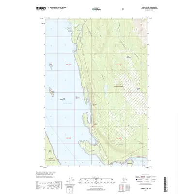 2017 Juneau B-3 NE2017 Print · USGSCovers Saint Terese, including Tee Harbor, Fairhaven, and other nearby areas
 - 2021 Map of Juneau B-3 NE, 2021 Print
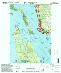
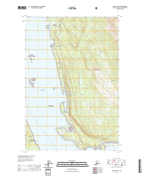 2021 Juneau B-3 NE2021 Print · USGSThe Lynn Canal coastline north of Juneau comes alive in this contemporary survey, showing a landscape of rugged forest and protected harbors. Genealogists and hikers can trace the roads and trails connecting Saint Terese, Dobson Landing, and the Auke Nu Trl.
End of results
Showing maps 1-9 of 9
Frequently asked questions
- What are the different types of historical maps available for Saint Terese?
- What is the oldest map of Saint Terese?
- Where can I purchase historical maps of Saint Terese for my home or office?
- Where can I download high-res historical maps of Saint Terese?
- Are there historical topographic maps available for Saint Terese?
- Is there historical aerial imagery available for Saint Terese?
- Where are historical maps of Saint Terese sourced from?