Old Maps of Snug Harbor, Alaska
Explore 8 old maps of Snug Harbor, spanning from 1951 to today. These high-resolution historic maps reveal how streets, neighborhoods, landmarks, and natural features evolved over time — perfect for genealogy, metal detecting, research, and local history exploration.
What you can do with these maps:
- See how Snug Harbor changed over time: Compare historical maps to modern-day views to trace roads, homesites, rail lines & more.
- View detailed metadata: Each map includes creators, publishers, year, scale, and archive source.
- Overlay maps with satellite & LiDAR: Visualize the past alongside modern tools to explore terrain & human change.
- Trusted historical sources: Maps sourced from the USGS, Library of Congress, and other archives.
- Access maps your way: View online, download high-res files, or order prints for personal or research use.
Start exploring old maps of Snug Harbor to uncover forgotten places, hidden landmarks, and the deep history beneath your feet.
Snug Harbor, AK maps
(8)- 1951 Map of Seward
 1951 Seward1951 Print · USGSThe Kenai Peninsula and Prince William Sound come to life in the early 1950s as the rail and maritime networks linked remote coastal outposts. Genealogists and historians can trace the Alaska Railroad corridor through Seward, find the Jesse Lee Indian School, and locate isolated camps like Latouche and Chenega.4 unique versions available
 - 1951 Map of Seward B-8, 1968 Print
 1951 Seward B-81968 Print · USGSThe Kenai Peninsula's wilderness takes shape in the mid-twentieth century as highway access begins to meet remote outposts. Trace early lodge life at Gwins Lodge, the secluded Bohan Cabin Seaplane Base, and landmarks like Schooner Bend.4 unique versions available
 - 1952 Map of Seward B-8, 1954 Print
 1952 Seward B-81954 Print · USGSThe Kenai Peninsula during the early fifties reveals a burgeoning corridor of lodges and river outposts along the newly established Sterling Highway. Researchers can trace the early development of Cooper Landing, the Bohan Cabin Seaplane Base, and family holdings like Nixons Ranch.3 unique versions available
 - 1953 Map of Seward, 1956 Print
 1953 Seward1956 Print · USGSThe Kenai Peninsula and Prince William Sound are documented in the early 1950s as the rail and road networks expanded. Trace the route of the Alaska Railroad and find early settlements like Seward, Moose Pass, and Latouche.12 unique versions available
 - 1959 Map of Seward
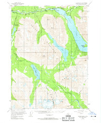
 1959 Seward1959 Print · USGSThe Kenai Peninsula and Prince William Sound are captured here during the mid-century, showing the vital transit corridor between Seward and the interior. Researchers can trace the Alaska Railroad through Whittier and locate historic coastal settlements like Chenega and Latouche.
 - 1994 Map of Seward B-8, 1998 Print
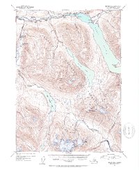
 1994 Seward B-81998 Print · USGSThe northern Kenai Peninsula is documented here during the mid-nineties, showing the intersection of river life and mountain wilderness. Researchers can locate remote outposts like Gwins Lodge, the Russian River Rendezvous ruins, and various cabins including the Barber Cabin.
 - 2018 Map of Seward B-8 NE, 2018 Print
 2018 Seward B-8 NE2018 Print · USGSCovers Snug Harbor, including Kenai Peninsula, United States, and other nearby areas
 - 2023 Map of Seward B-8 NE, 2023 Print
 2023 Seward B-8 NE2023 Print · USGSThe upper Kenai River corridor and Kenai Lake appear here in the early 2020s. Researchers can trace the development of Cooper Landing and find local landmarks like the Quartz Creek Airport and Snug Harbor.
End of results
Showing maps 1-8 of 8
Frequently asked questions
- What are the different types of historical maps available for Snug Harbor?
- What is the oldest map of Snug Harbor?
- Where can I purchase historical maps of Snug Harbor for my home or office?
- Where can I download high-res historical maps of Snug Harbor?
- Are there historical topographic maps available for Snug Harbor?
- Is there historical aerial imagery available for Snug Harbor?
- Where are historical maps of Snug Harbor sourced from?