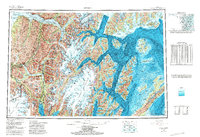
1951 Map of Seward
USGS Topo · Published 1951About this map
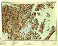
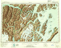
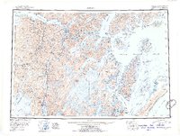
Seward serves as the coastal anchor of the Kenai Peninsula in this mid-century reconnaissance, marking the southern terminus where the Alaska Railroad meets the deep waters of Resurrection Bay. The map captures a critical era of post-war infrastructure, showing the rail line winding north through Moose Pass and Lawing before reaching Whittier via the Passage Canal tunnel. Beyond the rail corridor, the landscape is defined by the massive Harding Ice Field and the complex fjords of Prince William Sound, where isolated outposts like Chenega and the mining camp at Latouche remain accessible only by sea.
Find a feature on this map
56 named features on this map. Tap any name to fly to it.
Don’t see what you’re looking for? This feature index may not catch every label — zoom into the map to look around manually.
Map Details
Editions of this 1951 Seward Map
4 editions found
Historical Maps of Seward Through Time
3 maps found