
1950 Map of Seward A-6
USGS Topo · Published 1964About this map
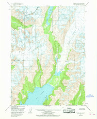
The Kenai Mountains and Chugach Mountains dominate this 1950 topographical study, revealing a landscape defined by massive ice fields and deep coastal inlets before mid-century shifts. At the center of the sheet, the Seward Base Line provides a surveying anchor for the surrounding wilderness of the Chugach National Forest. The map documents the extensive reach of the Godwin Glacier and Ellsworth Glacier, which feed into the glacial waters of Day Harbor and Nellie Juan Lake. Along the southern coastline, the Resurrection Peninsula separates the open harbor from secluded maritime features like Bowen Anchorage and Talus Bay. This 1950 data, compiled from aerial photography, captures the precise extent of the Bear Glacier and the headwaters of the South Fork Snow River during a period of significant glacial presence in the region.
Find a feature on this map
17 named features on this map. Tap any name to fly to it.
Don’t see what you’re looking for? This feature index may not catch every label — zoom into the map to look around manually.
Map Details
Editions of this 1950 Seward A-6 Map
2 editions found
Other maps of this area

1946 · Blying Sound
USGS Topo · 1:250,000

1950 · Blying Sound D-7
USGS Topo · 1:63,360

1950 · Blying Sound D-6
USGS Topo · 1:63,360

1950 · Seward A-7
USGS Topo · 1:63,360

1950 · Blying Sound D-5
USGS Topo · 1:63,360

1951 · Blying Sound
USGS Topo · 1:250,000

1951 · Seward
USGS Topo · 1:250,000

1951 · Seward A-6
USGS Topo · 1:63,360

1951 · Seward A-7
USGS Topo · 1:63,360

1951 · Seward B-7
USGS Topo · 1:63,360