Old Maps of Kenai Peninsula, Alaska
Explore 969 old maps of Kenai Peninsula, spanning from 1944 to today. These high-resolution historic maps reveal how streets, neighborhoods, landmarks, and natural features evolved over time — perfect for genealogy, metal detecting, research, and local history exploration.
What you can do with these maps:
- See how Kenai Peninsula changed over time: Compare historical maps to modern-day views to trace roads, homesites, rail lines & more.
- View detailed metadata: Each map includes creators, publishers, year, scale, and archive source.
- Overlay maps with satellite & LiDAR: Visualize the past alongside modern tools to explore terrain & human change.
- Trusted historical sources: Maps sourced from the USGS, Library of Congress, and other archives.
- Access maps your way: View online, download high-res files, or order prints for personal or research use.
Start exploring old maps of Kenai Peninsula to uncover forgotten places, hidden landmarks, and the deep history beneath your feet.
Kenai Peninsula, AK maps
(969)- 1944 Map of Kenai, 1954 Print
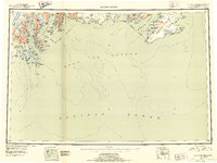
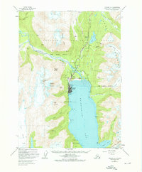
 1944 Kenai1954 Print · USGSThe Kenai Peninsula and Cook Inlet are captured here during a period of postwar growth, just as the regional road system began to expand. Genealogists and historians can trace early settlements and family landmarks such as Salamatoff, Stelters Ranch, and the Snug Harbor Cannery.4 unique versions available
 - 1946 Map of Blying Sound, 1954 Print
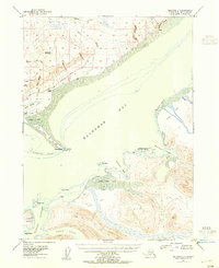
 1946 Blying Sound1954 Print · USGSThe Kenai Peninsula coastline at the end of World War II reveals a wilderness of massive ice fields and deep fjords. Trace the glacial reaches of the Harding Ice Field and locate coastal landmarks like Caines Head and Cape Resurrection.2 unique versions available
 - 1946 Map of Lake Clark, 1954 Print
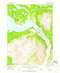
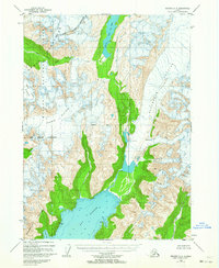
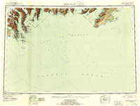
 1946 Lake Clark1954 Print · USGSInterior Alaska during the mid-forties and early fifties reveals a remote landscape of glacial lakes and mountain peaks. You can trace early settlements at Nondalton, find the Old Village trail network, and locate the Tanalian Point Landing Field near the shores of Lake Clark.2 unique versions available
 - 1946 Map of Seldovia C-5, 1958 Print
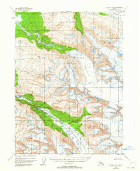
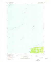
 1946 Seldovia C-51958 Print · USGSThe coastal settlement of Homer and the lower Kenai Peninsula are captured here just after the war as the regional road network began to solidify. Researchers can trace early infrastructure like the Sterling Highway, a shoreline Coal Mine, and the Seaplane Anchorage.
 - 1946 Map of Seldovia D-5, 1958 Print
 1946 Seldovia D-51958 Print · USGSThe Kenai Peninsula coastline comes into focus just after the war as the modern road network begins to take shape. Researchers can trace the early layout of Anchor Point and identify coastal landmarks like Cape Starichkof and the Sterling Highway.
 - 1948 Map of Mt Katmai, 1954 Print
 1948 Mt Katmai1954 Print · USGSKatmai National Monument appears in the late 1940s as a landscape of dramatic volcanic activity and displaced settlements. Researchers can trace the geological impact of the 1912 eruption via the Valley of Ten Thousand Smokes or locate early habitation sites like Savonoski (Abandoned).
 - 1948 Map of Seldovia C-4, 1955 Print
 1948 Seldovia C-41955 Print · USGSThe Kachemak Bay coastline comes alive in the mid-1940s, showing the early infrastructure of the Homer area before its modern expansion. Genealogists and researchers can locate old landmarks like Millers Landing, the original Homer Airport, and the Sawmill along the waterfront.2 unique versions available
 - 1949 Map of Iliamna C-1
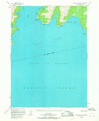
 1949 Iliamna C-11949 Print · USGSThe remote coast of the Kenai Peninsula is documented here in the late 1940s, showing a wild landscape of jagged peaks and deep bays. Researchers can trace the maritime features of Cook Inlet and find landmarks like Mt Pomeroy and Oil Point.
 - 1949 Map of Seldovia C-4
 1949 Seldovia C-41949 Print · USGSKachemak Bay and the Kenai Peninsula shoreline are captured here in the late 1940s, showing early maritime and aviation development. Trace the origins of local industry and navigation at Millers Landing, the Homer Spit, and the Homer Airport.
 - 1949 Map of Tyonek, 1954 Print
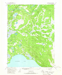
 1949 Tyonek1954 Print · USGSUpper Cook Inlet and the Alaska Range appear here in the mid-twentieth century as a landscape of massive glaciers and river-bound outposts. Researchers can trace the early rail corridor through Willow, locate the Moquawkie Indian Reservation, and find the site of McDougall.2 unique versions available
 - 1949 Map of Seldovia D-4, 1958 Print
 1949 Seldovia D-41958 Print · USGSThe interior of the Kenai Peninsula comes into focus during the late 1940s, showing a rugged landscape of unnamed drainages and high peaks. Researchers can trace the complex courses of Deep Creek and the Anchor River, or locate landmarks like Ninilchik Dome and Bald Mtn.
 - 1950 Map of Kenai
 1950 Kenai1950 Print · USGSThe Kenai Peninsula and Cook Inlet appear here during a pivotal era of mid-century growth and road construction. Researchers can trace the early layout of Soldotna, locate the Snug Harbor Cannery, and see the footprint of Salamatof.2 unique versions available
 - 1950 Map of Kenai C-3, 1959 Print
 1950 Kenai C-31959 Print · USGSThe Kenai Peninsula in the early fifties shows a burgeoning wilderness frontier at the dawn of modern settlement. Trace the early layout of Sterling and the Sterling Highway alongside remote landmarks like Mackeys Lakes and the Kenai River.
 - 1950 Map of Kenai B-1, 1960 Print
 1950 Kenai B-11960 Print · USGSThe Kenai Peninsula wilderness is captured here in the early 1950s, showing the intersection of new roads and ancient ice. Trace early travel routes like the Sterling Highway and Seven Lakes Trail or locate remote outposts like Statters Ranch.4 unique versions available
 - 1950 Map of Seldovia D-2, 1964 Print
 1950 Seldovia D-21964 Print · USGSThe Kenai Peninsula wilderness is captured here in the mid-twentieth century, showing a landscape defined by massive ice fields and protected habitats. Map collectors can trace the icy expanses of Chernof Glacier and the headwaters of the Fox River.2 unique versions available
 - 1950 Map of Seward A-6, 1964 Print
 1950 Seward A-61964 Print · USGSThe Kenai Peninsula coastline is captured here in the mid-twentieth century, showing a landscape defined by massive ice fields and deep fjords. You can trace the reach of the Godwin Glacier and the Ellsworth Glacier as they carve toward Day Harbor.2 unique versions available
 - 1950 Map of Seward A-8, 1964 Print
 1950 Seward A-81964 Print · USGSThe frozen interior of the Kenai Peninsula is captured here in the early 1950s, centered on the massive Harding Icefield. Researchers can study the mid-century extent of the Bear Glacier and Lowell Glacier before decades of change, or trace the remote drainages of Placer Creek and Martin Cr.
 - 1950 Map of Blying Sound D-7, 1964 Print
 1950 Blying Sound D-71964 Print · USGSCoastal Alaska at the mid-century reveals a landscape of ice and deep water south of Seward. Boaters and historians can trace the intricate shorelines of Resurrection Bay and locate landmarks like Caines Head and Rugged Island.
 - 1950 Map of Kenai B-3, 1966 Print
 1950 Kenai B-31966 Print · USGSThe Kenai Peninsula at the start of the 1950s shows the early growth of Soldotna as the regional road network began to take shape. Researchers can trace the original path of the Sterling Highway and locate remote Cabins along the banks of the Kenai River.2 unique versions available
 - 1950 Map of Blying Sound D-6, 1967 Print
 1950 Blying Sound D-61967 Print · USGSThe Kenai Peninsula coastline at mid-century reveals a landscape of remote maritime inlets and steep coastal headlands. Researchers can trace the rugged contours of Day Harbor, the sheltered Safety Cove, and landmarks like Cape Fairfield.3 unique versions available
 - 1950 Map of Kenai D-4, 1976 Print
 1950 Kenai D-41976 Print · USGSThe northern Kenai Peninsula and Cook Inlet appear here during the mid-century expansion of Alaska's oil industry. Researchers can locate early offshore installations like Oil Platform Anna and trace the original North Kenai Road as it skirts the Kenai National Moose Range.2 unique versions available
 - 1950 Map of Seward A-7, 1976 Print
 1950 Seward A-71976 Print · USGSSeward and its surrounding fjord-like landscape are captured here at mid-century, just as the port town solidified its role as a rail and maritime hub. Researchers can trace the original rail alignment of the Alaska Railroad, locate the Army Dock, and find early landmarks like Bayview School and the Sawmill.3 unique versions available
 - 1950 Map of Blying Sound D-5, 1988 Print
 1950 Blying Sound D-51988 Print · USGSThe Kenai Peninsula coastline at mid-century reveals a wild and roadless landscape shaped by glacial ice and the open sea. Map collectors and researchers can trace the reach of Excelsior Glacier and locate maritime landmarks like Cape Fairfield and Pinnacle Rock.
 - 1951 Map of Blying Sound
 1951 Blying Sound1951 Print · USGSThe Kenai Peninsula coastline in the early fifties shows a landscape of tidewater glaciers and remote islands before the 1964 earthquake. Trace coastal features like the Harding Ice Field, Montague Island, and the maritime passage of Harding Gateway.2 unique versions available
 - 1951 Map of Seldovia C-5
 1951 Seldovia C-51951 Print · USGSThe Kenai Peninsula shoreline comes to life in the early fifties as the southern road system reached toward the sea. Trace the early layout of Homer, the coastal Coal Mine, and landmarks like Ohlson Mtn and Diamond Gulch.
Showing maps 1-25 of 969
Top cities of Kenai Peninsula
- Kenai historical maps
- Homer historical maps
- Soldotna historical maps
- Seward historical maps
- Kachemak City historical maps
- Nikolaevsk historical maps
See more
Frequently asked questions
- What are the different types of historical maps available for Kenai Peninsula?
- What is the oldest map of Kenai Peninsula?
- Where can I purchase historical maps of Kenai Peninsula for my home or office?
- Where can I download high-res historical maps of Kenai Peninsula?
- Are there historical topographic maps available for Kenai Peninsula?
- Is there historical aerial imagery available for Kenai Peninsula?
- Where are historical maps of Kenai Peninsula sourced from?