
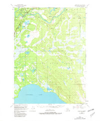
1950 Map of Kenai B-3
USGS Topo · Published 1966About this map
Soldotna and the winding course of the Kenai River dominate this mid-century survey of the Kenai Peninsula. The landscape is a mosaic of muskeg and forest, largely encompassed by the Kenai Moose Range. Settlement is concentrated along the newly established Sterling Highway, where a small Landing Field and the Kasilof Road provide essential links for early homesteaders and bush pilots.
Find a feature on this map
19 named features on this map. Tap any name to fly to it.
Don’t see what you’re looking for? This feature index may not catch every label — zoom into the map to look around manually.
Map Details
Editions of this 1950 Kenai B-3 Map
2 editions found
Other maps of this area

1944 · Kenai
USGS Topo · 1:250,000

1950 · Kenai
USGS Topo · 1:250,000

1950 · Kenai C-3
USGS Topo · 1:63,360

1951 · Kenai B-2
USGS Topo · 1:63,360

1951 · Kenai C-2
USGS Topo · 1:63,360

1951 · Kenai A-3
USGS Topo · 1:63,360

1951 · Kenai A-2
USGS Topo · 1:63,360

1951 · Kenai C-4
USGS Topo · 1:63,360

1951 · Kenai C-3
USGS Topo · 1:63,360

1951 · Kenai B-4
USGS Topo · 1:63,360