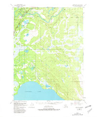
1950 Map of Kenai B-3
USGS Topo · Published 1981About this map
Soldotna serves as the focal point of development on this mid-century survey of the Kenai Peninsula. The settlement is centered along the Sterling Highway, which crosses the Kenai River as it winds through the northern portion of the map. Much of the surrounding landscape is defined by the Kenai National Moose Range, a massive tract of wetlands and forests punctuated by numerous bodies of water such as Longmere Lake and Headquarters Lake. In the south, the terrain transitions into the expansive Tustumena Lake, fed by drainage systems like Shantatalik Creek. The map documents a period of early infrastructure growth, where formal roads give way to a Pack Trail and several Landing Strips, reflecting the necessity of air and foot travel in the Alaskan interior.
Find a feature on this map
27 named features on this map. Tap any name to fly to it.
Don’t see what you’re looking for? This feature index may not catch every label — zoom into the map to look around manually.
Map Details
Editions of this 1950 Kenai B-3 Map
2 editions found
Other maps of this area

1944 · Kenai
USGS Topo · 1:250,000

1950 · Kenai
USGS Topo · 1:250,000

1950 · Kenai C-3
USGS Topo · 1:63,360

1950 · Kenai B-3
USGS Topo · 1:63,360

1951 · Kenai B-2
USGS Topo · 1:63,360

1951 · Kenai C-2
USGS Topo · 1:63,360

1951 · Kenai A-3
USGS Topo · 1:63,360

1951 · Kenai A-2
USGS Topo · 1:63,360

1951 · Kenai C-4
USGS Topo · 1:63,360

1951 · Kenai C-3
USGS Topo · 1:63,360