
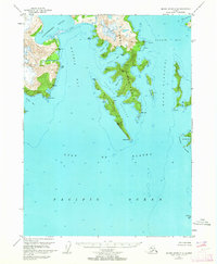
1950 Map of Blying Sound D-7
USGS Topo · Published 1964About this map
Bear Glacier dominates the northwestern reaches of this coastal Alaskan landscape, where its massive ice field pushes toward Bulldog Cove. Photogrammetric data from 1950 reveals a complex maritime environment at the mouth of Resurrection Bay, defined by prominent landforms like Caines Head and the high peaks of the Aialik Peninsula. The map details a labyrinth of coastal features including Renard Island and Rugged Island, which guard the entrance to the inner bay.
Find a feature on this map
34 named features on this map. Tap any name to fly to it.
Don’t see what you’re looking for? This feature index may not catch every label — zoom into the map to look around manually.
Map Details
Editions of this 1950 Blying Sound D-7 Map
This is the sole edition of this map. No revisions or reprints were ever made.
Other maps of this area

1946 · Blying Sound
USGS Topo · 1:250,000

1950 · Seward A-6
USGS Topo · 1:63,360

1950 · Seward A-8
USGS Topo · 1:63,360

1950 · Blying Sound D-6
USGS Topo · 1:63,360

1950 · Seward A-7
USGS Topo · 1:63,360

1951 · Blying Sound
USGS Topo · 1:250,000

1951 · Seward
USGS Topo · 1:250,000

1951 · Seward A-6
USGS Topo · 1:63,360

1951 · Seward A-7
USGS Topo · 1:63,360
1951 · Blying Sound C-8
USGS Topo · 1:63,360