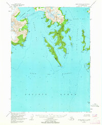
1951 Map of Blying Sound C-8
USGS Topo · Published 1964About this map
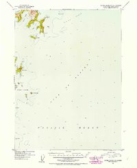
Harris Peninsula dominates this coastal landscape, a finger of land separating the waters of Harris Bay from Aialik Bay. Surveyed in the early 1950s, the map reveals an intricate network of deep-water coves and rocky points, including Crater Bay, Ripple Cove, and the prominent Granite Cape at the peninsula's southern tip. The map records several Vertical Angle Bench Marks (VABM), such as VABM Spruce and VABM Apex, which provided essential elevation data for this complex shoreline. To the east, the Dora Passage separates the mainland from Harbor Island, while the southern reaches of the map extend into the Gulf of Alaska, marking the isolated Seal Rocks. The topography reflects a glacier-carved environment, most notably where the Northwestern Lagoon meets the head of Harris Bay, illustrating the interface between maritime and glacial systems during this era of Alaskan mapping.
Find a feature on this map
39 named features on this map. Tap any name to fly to it.
Don’t see what you’re looking for? This feature index may not catch every label — zoom into the map to look around manually.
Map Details
Editions of this 1951 Blying Sound C-8 Map
2 editions found
Other maps of this area

1946 · Blying Sound
USGS Topo · 1:250,000

1950 · Blying Sound D-7
USGS Topo · 1:63,360

1951 · Blying Sound
USGS Topo · 1:250,000

1951 · Seldovia
USGS Topo · 1:250,000
1951 · Blying Sound D-8
USGS Topo · 1:63,360

1951 · Blying Sound D-7
USGS Topo · 1:63,360

1951 · Seldovia D-1
USGS Topo · 1:63,360
1952 · Blying Sound C-8
USGS Topo · 1:63,360
1952 · Blying Sound C-7
USGS Topo · 1:63,360
1953 · Seldovia B-1
USGS Topo · 1:63,360