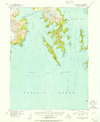
1952 Map of Blying Sound C-8
USGS Topo · Published 1954About this map
Harris Peninsula dominates this coastal survey, reaching south into the Gulf of Alaska as a complex network of bays and coves. The coastline here is defined by deep-water inlets like Aialik Bay and Harris Bay, which frame the central peninsula. Navigation around the islands is marked by several narrow waterways, including Granite Passage and Dora Passage, providing transit between the exposed gulf and protected inner waters.
Find a feature on this map
34 named features on this map. Tap any name to fly to it.
Don’t see what you’re looking for? This feature index may not catch every label — zoom into the map to look around manually.
Map Details
Editions of this 1952 Blying Sound C-8 Map
2 editions found
Other maps of this area

1946 · Blying Sound
USGS Topo · 1:250,000

1950 · Blying Sound D-7
USGS Topo · 1:63,360

1951 · Blying Sound
USGS Topo · 1:250,000

1951 · Seldovia
USGS Topo · 1:250,000
1951 · Blying Sound C-8
USGS Topo · 1:63,360
1951 · Blying Sound D-8
USGS Topo · 1:63,360

1951 · Blying Sound D-7
USGS Topo · 1:63,360

1951 · Seldovia D-1
USGS Topo · 1:63,360
1952 · Blying Sound C-7
USGS Topo · 1:63,360
1953 · Seldovia B-1
USGS Topo · 1:63,360