1970s Maps of Kenai Peninsula, Alaska
Explore 4 historic maps of Kenai Peninsula from the 1970s. These maps offer a rare glimpse into what life looked like during the 1970s — showing old roads, neighborhoods, homes, and landmarks that have changed or disappeared over time.
Whether you're researching your family's past, planning a metal detecting trip, or studying how Kenai Peninsula's landscape evolved across the 1970s, these high-resolution maps are a powerful tool for exploring the history of this region.
- Focus on a specific era: All maps on this page are from the 1970s, giving you a focused view of this time period.
- See what’s changed: Compare century-old streets, trails, and buildings to today's modern landscape using overlays and satellite layers.
- Research with precision: Use these maps for genealogy, historical research, land use analysis, or educational projects.
- View, download, or print: Maps are fully viewable online in high resolution, and can be downloaded or printed for your own records.
Start exploring Kenai Peninsula's history through authentic maps from the 1970s. This is your window into the past.
Kenai Peninsula, AK maps
(4)- 1979 Map of Anchorage A-8 SE
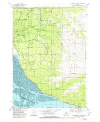 1979 Anchorage A-8 SE1979 Print · USGSThe Cook Inlet coastline and Chugach foothills are captured here in the late seventies as South Anchorage began its suburban expansion. Trace the route of the Alaska Railroad past Potter or locate family-named sites like the Nystrom Landing Strip and O'Malley Sch.2 unique versions available
 - 1979 Map of Anchorage, 1980 Print
 1979 Anchorage1980 Print · USGSThe Anchorage bowl and Matanuska Valley appear in the late seventies as the region's transportation and military infrastructure matured. Genealogists and historians can trace rail and road evolution through Wasilla, the Matanuska Branch line, and Jonesville.
 - 1979 Map of Tyonek A-1 NW, 1980 Print
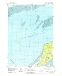 1979 Tyonek A-1 NW1980 Print · USGSFire Island and the surrounding tidal reaches of the Cook Inlet are captured here during the late seventies. Researchers can locate infrastructure like the FAA Facility and Radio Facility, or trace the shoreline near Race Point and West Point.2 unique versions available
 - 1979 Map of Anchorage A-8 SW, 1980 Print
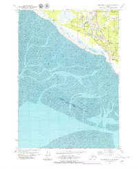 1979 Anchorage A-8 SW1980 Print · USGSCoastal Anchorage and the Turnagain Arm mudflats are captured in the late seventies as suburban growth pushed south. Trace the development of Klatt and neighborhood landmarks like the Evergreen Memorial Cem or the Alaska Railroad line.
End of results
Showing maps 1-4 of 4
Top cities of Kenai Peninsula
- Kenai historical maps
- Homer historical maps
- Soldotna historical maps
- Seward historical maps
- Kachemak City historical maps
- Nikolaevsk historical maps
See more
Frequently asked questions
- What are the different types of historical maps available for Kenai Peninsula?
- What is the oldest map of Kenai Peninsula?
- Where can I purchase historical maps of Kenai Peninsula for my home or office?
- Where can I download high-res historical maps of Kenai Peninsula?
- Are there historical topographic maps available for Kenai Peninsula?
- Is there historical aerial imagery available for Kenai Peninsula?
- Where are historical maps of Kenai Peninsula sourced from?