1980s Maps of Kenai Peninsula, Alaska
Explore 80 historic maps of Kenai Peninsula from the 1980s. These maps offer a rare glimpse into what life looked like during the 1980s — showing old roads, neighborhoods, homes, and landmarks that have changed or disappeared over time.
Whether you're researching your family's past, planning a metal detecting trip, or studying how Kenai Peninsula's landscape evolved across the 1980s, these high-resolution maps are a powerful tool for exploring the history of this region.
- Focus on a specific era: All maps on this page are from the 1980s, giving you a focused view of this time period.
- See what’s changed: Compare century-old streets, trails, and buildings to today's modern landscape using overlays and satellite layers.
- Research with precision: Use these maps for genealogy, historical research, land use analysis, or educational projects.
- View, download, or print: Maps are fully viewable online in high resolution, and can be downloaded or printed for your own records.
Start exploring Kenai Peninsula's history through authentic maps from the 1980s. This is your window into the past.
Kenai Peninsula, AK maps
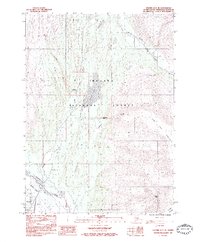
(80)- 1981 Map of Seldovia B-4
 1981 Seldovia B-41981 Print · USGSThe Kenai Peninsula coastline is captured here in the early eighties, showing a landscape defined by deep fjords and the rising Kenai Mountains. Researchers can locate the Chrome Mine near Red Mountain or trace early coastal sites at San Juan and Picnic Harbor.
 - 1983 Map of Seward A-7 SE
 1983 Seward A-7 SE1983 Print · USGSThe eastern coast of the Kenai Peninsula is captured here in the early eighties, showing the town of Seward where it meets the waters of Resurrection Bay. Researchers can trace the drainage of Godwin Glacier and explore the shoreline from Lowell Point to the Thumb Cove inlet.
 - 1983 Map of Seward A-7 NW
 1983 Seward A-7 NW1983 Print · USGSThe Kenai Peninsula's glacial valleys and high peaks are captured here in the early eighties as federal land boundaries were being defined. Trace the wilderness limits of the Kenai Fjords National Monument and landmarks like Mount Benson.
 - 1983 Map of Seward A-7 SW
 1983 Seward A-7 SW1983 Print · USGSSeward and the northeastern edge of the Kenai Fjords are captured in the early eighties as the town sits between the mountains and the sea. Researchers can trace the coastal landscape from Lowell Point to Derby Cove and locate landmarks like Marathon Mountain and the Bear Glacier.
 - 1983 Map of Seward B-7 NE
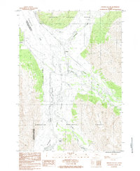
 1983 Seward B-7 NE1983 Print · USGSThe Kenai Peninsula wilderness is captured in the early 1980s as it centers on the glacial lakes and mountain corridors of the Chugach. Genealogists and local historians can trace the lakeside settlements of Moose Pass and Lawing, or locate the remote Landing Strip near Crown Point.
 - 1983 Map of Seward A-7 NE
 1983 Seward A-7 NE1983 Print · USGSSeward and the Resurrection River valley are captured in the early eighties as the coastal hub continued its northern expansion. Researchers can trace the path of the Seward Highway past Woodrow and the waters of Bear Lake toward the icy reaches of the Godwin Glacier.2 unique versions available
 - 1983 Map of Seward B-7 SE
 1983 Seward B-7 SE1983 Print · USGSThe Kenai Peninsula's interior wilderness is captured in the early 1980s as it transitions from the shores of Kenai Lake to the peaks of Sheep Mountain. Researchers can trace the path of the Snow River and locate remote spots like Lakeview, Divide, and Lost Lake.
 - 1983 Map of Afognak D-6, 1988 Print
 1983 Afognak D-61988 Print · USGSThe eastern edge of the Alaska Peninsula is shown here during the early eighties, a time of newly established federal protections. Trace the course of the Douglas River as it flows through the Katmai Wilderness toward Fourpeaked Mountain.
 - 1984 Map of Seward D-6 SE
 1984 Seward D-6 SE1984 Print · USGSThe head of Turnagain Arm in the mid-1980s reveals a critical Alaskan transit corridor between the coast and the mountains. Researchers can trace the layout of Portage and Ingram or locate landmarks like Explorer Glacier and Luebner Lake.
 - 1984 Map of Seward D-6 Nw
 1984 Seward D-6 Nw1984 Print · USGSCoastal mountain life near Anchorage is captured here in the mid-eighties as the settlements at Girdwood and Alyeska expanded. Researchers can trace the drainage of Glacier Creek into the Turnagain Arm and locate the rail point at Kern.
 - 1984 Map of Seward D-7 NW
 1984 Seward D-7 NW1984 Print · USGSThe northern Kenai Peninsula coast in the mid-eighties shows the critical transport corridor along Turnagain Arm. Researchers can trace the infrastructure of Indian and Bird, and locate landmarks like Windy Point and the RR Br.
 - 1984 Map of Seward D-7 NE
 1984 Seward D-7 NE1984 Print · USGSThe Turnagain Arm shoreline near Anchorage and the Kenai Peninsula is captured here in the mid-eighties. Researchers can locate the settlement of Sunrise near Sixmile Creek or trace coastal features like Bird Point and Snipers Point.
 - 1986 Map of Kenai B-4 NW
 1986 Kenai B-4 NW1986 Print · USGSThe northern waters of the Kenai Peninsula are captured in the mid-1980s, focusing on the maritime reach of Cook Inlet. Researchers can trace the shifting shoreline and locate the isolated Light marking the extensive coastal Mud flats.
 - 1986 Map of Kenai C-4 NW
 1986 Kenai C-4 NW1986 Print · USGSThe Kenai Peninsula coastline in the mid-eighties shows an expanding industrial and residential landscape. Genealogists and historians can trace the growth of Port Nikiski and locate family landmarks like the East Foreland Lighthouse and Lower Salamatof Lake.
 - 1986 Map of Kenai D-1 NW
 1986 Kenai D-1 NW1986 Print · USGSThe northern Kenai Peninsula is shown in the mid-1980s as a wild expanse of water and forest where the Kenai Wilderness meets the sea. Environmental historians and researchers can trace the intricate shorelines of Chickaloon Bay and dozens of interior basins like Tangerra Lake and Mull Lake.
 - 1986 Map of Kenai D-3 NE
 1986 Kenai D-3 NE1986 Print · USGSThe Kenai Peninsula shoreline meets the waters of the inlet during the mid-eighties, showing a landscape defined by conservation and industry. Researchers can trace the path of a Pipeline near Otter Creek and locate landmarks like Birch Hill and the National Wildlife Refuge.
 - 1986 Map of Kenai B-4 SW
 1986 Kenai B-4 SW1986 Print · USGSThe western coast of the Kenai Peninsula is captured here in the mid-1980s, where the mudflats of Cook Inlet meet the interior. Researchers can trace the shoreline at Cape Kasilof and locate the freshwater systems of Upper Cohoe Lake and Bottleneck Lakes.
 - 1986 Map of Kenai B-1 NW
 1986 Kenai B-1 NW1986 Print · USGSThe Kenai Peninsula wilderness is captured here in the mid-eighties, showing a landscape defined by glacial lakes and conservation boundaries. Trace the winding Pack Trail and locate remote recreational landmarks like Explorer Island and Engineer Lake.2 unique versions available
 - 1986 Map of Kenai C-2 SE
 1986 Kenai C-2 SE1986 Print · USGSThe Kenai Peninsula in the mid-1980s reveals a vast interior of protected marshlands and interconnected lake systems. Researchers and outdoorsmen can trace the complex waterways of Seven Lakes River or locate remote landmarks like Bottenintnin Lake and Afonasi Lake.
 - 1986 Map of Kenai D-2 SW
 1986 Kenai D-2 SW1986 Print · USGSThe Kenai Peninsula's interior wetlands and pristine lake systems are preserved here in the mid-eighties. Trace the path of the Swanson River as it winds past Tundra Lake, Snowflake Lake, and the protected Kenai Wilderness.
 - 1986 Map of Kenai C-1 NE
 1986 Kenai C-1 NE1986 Print · USGSThe Kenai Peninsula's interior wetlands and wilderness boundaries are captured in the mid-1980s, revealing a landscape defined by water and federal conservation. Remote travelers can trace the Chickaloon River or locate the solitary Landing Strip and 4WD trail used for backcountry access.
 - 1986 Map of Kenai D-1 SE
 1986 Kenai D-1 SE1986 Print · USGSThe Kenai Peninsula's interior wilderness is captured in the mid-1980s, showcasing a landscape of dense hydrology and protected habitat. Trace the course of the Chickaloon River and locate remote landmarks like the Landing Strip or Trapper Joe Lake.
 - 1986 Map of Kenai C-4 NE
 1986 Kenai C-4 NE1986 Print · USGSMid-1980s Alaska development meets the edge of the wild as industrial infrastructure expands near Nikiski and the Kenai National Wildlife Refuge. Trace the early footprint of the energy economy through the Pipeline and Gravel Pits, or locate remote landmarks like Salamatof Lake and the local Landing Strip.
 - 1986 Map of Kenai B-4 NE
 1986 Kenai B-4 NE1986 Print · USGSThe Kenai Peninsula in the mid-1980s shows a landscape defined by coastal settlement and the expanding oil and gas industry. Researchers can trace early infrastructure and local landmarks like the Cem, the Kalifornsky settlement, and the Kasilof River boat ramp.
 - 1986 Map of Kenai C-4 SE
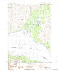
 1986 Kenai C-4 SE1986 Print · USGSKenai and the surrounding peninsula come into focus during the mid-eighties as the area balanced industrial growth with wildlife preservation. Genealogists and researchers can locate Wildwood, the local Cem, and infrastructure like the Municipal Airport.
Showing maps 1-25 of 80
Top cities of Kenai Peninsula
- Kenai historical maps
- Homer historical maps
- Soldotna historical maps
- Seward historical maps
- Kachemak City historical maps
- Nikolaevsk historical maps
See more
Frequently asked questions
- What are the different types of historical maps available for Kenai Peninsula?
- What is the oldest map of Kenai Peninsula?
- Where can I purchase historical maps of Kenai Peninsula for my home or office?
- Where can I download high-res historical maps of Kenai Peninsula?
- Are there historical topographic maps available for Kenai Peninsula?
- Is there historical aerial imagery available for Kenai Peninsula?
- Where are historical maps of Kenai Peninsula sourced from?