
1950 Map of Seldovia D-2
USGS Topo · Published 1964About this map
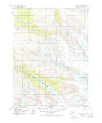
The Kenai National Moose Range dominates this mid-century portrait of the Kenai Peninsula’s glaciated interior. The landscape is defined by the massive slow-moving ice of the Chernof Glacier and Dingelstadt Glacier, which are marked by extensive fields of crevasses as they descend from the high peaks. This 1950 photogrammetric study captures the drainages that feed the region’s complex ecosystem, including Clearwater Slough and the Fox River, which winds through the northwestern forest cover. To the northeast, a portion of Tustumena Lake is visible, serving as a primary hydrological feature for the surrounding wilderness. The absence of roads or established trails on this sheet underscores the isolation of the territory during the early years of Alaskan statehood. Survey markers like VABM Tustumena 3942 provide fixed points in a terrain otherwise characterized by shifting ice and seasonal watercourses like Sheep Creek.
Find a feature on this map
11 named features on this map. Tap any name to fly to it.
Don’t see what you’re looking for? This feature index may not catch every label — zoom into the map to look around manually.
Map Details
Editions of this 1950 Seldovia D-2 Map
2 editions found
Other maps of this area

1944 · Kenai
USGS Topo · 1:250,000

1950 · Kenai
USGS Topo · 1:250,000

1951 · Seldovia
USGS Topo · 1:250,000

1951 · Seldovia D-3
USGS Topo · 1:63,360

1951 · Kenai A-3
USGS Topo · 1:63,360

1951 · Kenai A-2
USGS Topo · 1:63,360

1951 · Kenai A-1
USGS Topo · 1:63,360

1951 · Seldovia C-3
USGS Topo · 1:63,360

1951 · Seldovia D-1
USGS Topo · 1:63,360

1952 · Kenai A-1
USGS Topo · 1:63,360