
1951 Map of Seldovia D-3
USGS Topo · Published 1960About this map
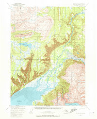
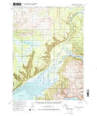
Kachemak Bay meets the vast river deltas of the Kenai Peninsula in this mid-century topographic record. The landscape is defined by the braided channels of the Fox River and Sheep Creek as they spill into the extensive Mud Flat at the head of the bay. The northeastern portion of the sheet is dominated by the Kenai National Moose Range, reflecting the federal management of this wilderness area during Alaska's transition into statehood.
Find a feature on this map
27 named features on this map. Tap any name to fly to it.
Don’t see what you’re looking for? This feature index may not catch every label — zoom into the map to look around manually.
Map Details
Editions of this 1951 Seldovia D-3 Map
3 editions found
Other maps of this area

1944 · Kenai
USGS Topo · 1:250,000

1948 · Seldovia C-4
USGS Topo · 1:63,360

1949 · Seldovia C-4
USGS Topo · 1:62,500

1949 · Seldovia D-4
USGS Topo · 1:63,360

1950 · Kenai
USGS Topo · 1:250,000

1950 · Seldovia D-2
USGS Topo · 1:63,360

1951 · Seldovia D-4
USGS Topo · 1:63,360

1951 · Seldovia
USGS Topo · 1:250,000

1951 · Kenai A-3
USGS Topo · 1:63,360

1951 · Kenai A-2
USGS Topo · 1:63,360