
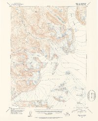
1952 Map of Kenai A-1
USGS Topo · Published 1954About this map
Harding Ice Field dominates this 1952 topographic study of the Kenai Peninsula, showcasing a massive expanse of ice and snow marked by numerous Crevasses. The landscape is defined by the slow movement of ice towards the lowlands, with the Skilak Glacier, Killey Glacier, and Indian Glacier carving deep into the surrounding peaks. This area was surveyed just as modern aerial photography began to provide precise details of these remote frozen reaches.
Find a feature on this map
10 named features on this map. Tap any name to fly to it.
Don’t see what you’re looking for? This feature index may not catch every label — zoom into the map to look around manually.
Map Details
Editions of this 1952 Kenai A-1 Map
2 editions found
Other maps of this area

1944 · Kenai
USGS Topo · 1:250,000

1946 · Blying Sound
USGS Topo · 1:250,000

1950 · Kenai
USGS Topo · 1:250,000

1950 · Kenai B-1
USGS Topo · 1:63,360

1950 · Seldovia D-2
USGS Topo · 1:63,360

1950 · Seward A-8
USGS Topo · 1:63,360

1951 · Blying Sound
USGS Topo · 1:250,000

1951 · Seward
USGS Topo · 1:250,000

1951 · Seldovia
USGS Topo · 1:250,000

1951 · Kenai B-2
USGS Topo · 1:63,360