Old Maps of Duck Village, Alaska for Academic Research
Study the evolution of Duck Village with 4 high-resolution historic maps. Whether you're teaching, researching, or modeling changes in land use, these maps provide essential visual documentation of urban, environmental, and geographic change.
- Analyze long-term change: Track patterns in development, transportation, and natural features.
- Ideal for environmental or urban studies: Support academic projects with primary historical map data.
- Use in the classroom or lab: Educators and researchers rely on these maps to bring historical context to life.
These maps are a powerful tool for teaching, research, and visualizing how Duck Village has changed over the decades.
Duck Village, AK maps
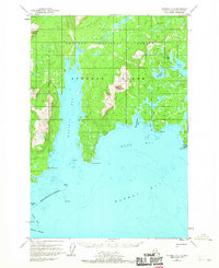
(4)- 1952 Map of Afognak, 1953 Print
 1952 Afognak1953 Print · USGSThe Afognak and Shelikof Strait region in the early fifties shows a remote landscape of maritime outposts and glacier-fed coasts. Researchers can locate coastal settlements like Port William, the Hatchery on Afognak, and the isolated village of Kaguyak.10 unique versions available
 - 1952 Map of Afognak A-2, 1967 Print
 1952 Afognak A-21967 Print · USGSAfognak Island in the early fifties shows a coastal landscape of remote outposts and maritime activity. Researchers can locate the hatchery at Kitoi Bay and trace the shorelines of Kazakof Bay and Selezen Bay.2 unique versions available
 - 1954 Map of Afognak A-2, 1955 Print
 1954 Afognak A-21955 Print · USGSAfognak Island in the mid-1950s was a rugged maritime environment defined by steep peaks and sheltered coves. Researchers can trace early activity at the Hatchery and coastal Cabin sites while navigating landmarks like Duck Mountain and Big Kitoi Lake.
 - 2021 Map of Afognak A-2 SW, 2021 Print
 2021 Afognak A-2 SW2021 Print · USGSKodiak Island’s coastline and remote maritime passages are captured in this recent survey of the Afognak region. Researchers can trace the shoreline between Cape Kazakof and Cape Kostromitinof, or locate hazards like Skipwith Reefs and Stripe Rock.
End of results
Showing maps 1-4 of 4
Top cities near Duck Village
Frequently asked questions
- What are the different types of historical maps available for Duck Village?
- What is the oldest map of Duck Village?
- Where can I purchase historical maps of Duck Village for my home or office?
- Where can I download high-res historical maps of Duck Village?
- Are there historical topographic maps available for Duck Village?
- Is there historical aerial imagery available for Duck Village?
- Where are historical maps of Duck Village sourced from?