Old Maps of Perryville, Alaska for Academic Research
Study the evolution of Perryville with 5 high-resolution historic maps. Whether you're teaching, researching, or modeling changes in land use, these maps provide essential visual documentation of urban, environmental, and geographic change.
- Analyze long-term change: Track patterns in development, transportation, and natural features.
- Ideal for environmental or urban studies: Support academic projects with primary historical map data.
- Use in the classroom or lab: Educators and researchers rely on these maps to bring historical context to life.
These maps are a powerful tool for teaching, research, and visualizing how Perryville has changed over the decades.
Perryville, AK maps
(5)- 1951 Map of Stepovak Bay, 1952 Print
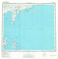
 1951 Stepovak Bay1952 Print · USGSThe Alaska Peninsula and Shumagin Islands are documented here during the early fifties, showing a remote maritime and coastal landscape. Researchers can trace early settlements and coastal landings such as Perryville, Bales Ldg, and the waters of Stepovak Bay.
 - 1963 Map of Stepovak Bay D-4, 1967 Print
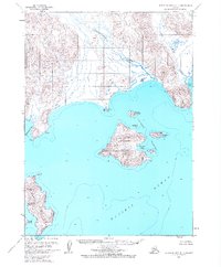 1963 Stepovak Bay D-41967 Print · USGSCoastal life on the Alaska Peninsula comes into focus in the early sixties, centered on the village of Perryville. Genealogists and researchers can trace the coastal landscape around the Kametolook River, the designated Landing Area, and the Chiachi Islands.2 unique versions available
 - 1963 Map of Stepovak Bay, 1969 Print
 1963 Stepovak Bay1969 Print · USGSThe Alaska Peninsula and its maritime outposts are charted here during the 1960s, documenting a remote stretch of Pacific coastline. Researchers can locate the settlement of Perryville and trace coastal features like Sanborn Harbor, Red Bluff Mountain, and the Ivanof Bay coastline.3 unique versions available
 - 1969 Map of Stepovak Bay
 1969 Stepovak Bay1969 Print · USGSThe Alaska Peninsula and its offshore archipelagos are captured here in the late sixties, showing the remote coastal settlement of Perryville. Researchers can trace maritime routes through the Shumagin Islands and locate landmarks like Castle Rock and Mitrofania Island.
 - 2020 Map of Stepovak Bay D-4 NE, 2020 Print
 2020 Stepovak Bay D-4 NE2020 Print · USGSCoastal life in the Lake and Peninsula Borough comes into focus here on the shores of the Gulf of Alaska. Researchers can trace the local infrastructure of Perryville, locating the Perryville Village Graveyard and landmarks like Coal Cape.
End of results
Showing maps 1-5 of 5
Frequently asked questions
- What are the different types of historical maps available for Perryville?
- What is the oldest map of Perryville?
- Where can I purchase historical maps of Perryville for my home or office?
- Where can I download high-res historical maps of Perryville?
- Are there historical topographic maps available for Perryville?
- Is there historical aerial imagery available for Perryville?
- Where are historical maps of Perryville sourced from?