Old Maps of Lake and Peninsula, Alaska
Explore 797 old maps of Lake and Peninsula, spanning from 1943 to today. These high-resolution historic maps reveal how streets, neighborhoods, landmarks, and natural features evolved over time — perfect for genealogy, metal detecting, research, and local history exploration.
What you can do with these maps:
- See how Lake and Peninsula changed over time: Compare historical maps to modern-day views to trace roads, homesites, rail lines & more.
- View detailed metadata: Each map includes creators, publishers, year, scale, and archive source.
- Overlay maps with satellite & LiDAR: Visualize the past alongside modern tools to explore terrain & human change.
- Trusted historical sources: Maps sourced from the USGS, Library of Congress, and other archives.
- Access maps your way: View online, download high-res files, or order prints for personal or research use.
Start exploring old maps of Lake and Peninsula to uncover forgotten places, hidden landmarks, and the deep history beneath your feet.
Lake and Peninsula, AK maps
(797)- 1943 Map of Ugashik, 1958 Print
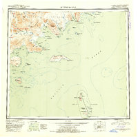
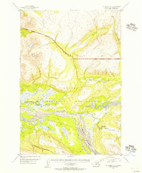
 1943 Ugashik1958 Print · USGSThe remote Alaska Peninsula is captured here in the 1940s, showing a wilderness of volcanic peaks and vast coastal drainages. You can trace early 20th-century outposts like Pilot Point and Lee Cabin set against landmarks like Mt Peulik and the waters of Becharof Lake.3 unique versions available
 - 1945 Map of Nushagak Bay, 1954 Print
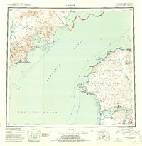
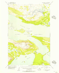
 1945 Nushagak Bay1954 Print · USGSNushagak Bay and the sprawling Alaskan coastline are captured in the mid-1940s, highlighting a landscape defined by salmon fishing and tidal waters. Researchers can locate remote outposts like Old Saltery, the busy Nushagak Cannery, and the coastal settlement of Clarks Point.
 - 1946 Map of Lake Clark, 1954 Print
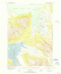
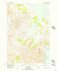
 1946 Lake Clark1954 Print · USGSInterior Alaska during the mid-forties and early fifties reveals a remote landscape of glacial lakes and mountain peaks. You can trace early settlements at Nondalton, find the Old Village trail network, and locate the Tanalian Point Landing Field near the shores of Lake Clark.2 unique versions available
 - 1948 Map of Mt Katmai, 1954 Print
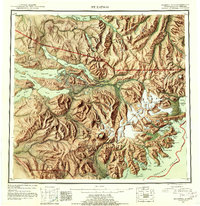
 1948 Mt Katmai1954 Print · USGSKatmai National Monument appears in the late 1940s as a landscape of dramatic volcanic activity and displaced settlements. Researchers can trace the geological impact of the 1912 eruption via the Valley of Ten Thousand Smokes or locate early habitation sites like Savonoski (Abandoned).
 - 1948 Map of Ugashik, 1954 Print
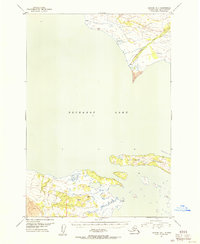
 1948 Ugashik1954 Print · USGSThe remote reaches of the Alaska Peninsula are documented here during the late 1940s, highlighting the early footprint of coastal settlements and mountain passes. Researchers can trace the layout of Kanatak and Pilot Point or locate isolated landmarks like Lee's Cabin and The Gas Rocks.
 - 1949 Map of Ugashik
 1949 Ugashik1949 Print · USGSThe Alaska Peninsula in the late 1940s reveals a wild landscape of salmon-rich rivers and volcanic peaks. Researchers can trace remote coastal settlements like Pilot Point and Kanatak, or locate landmarks such as Lee's Cabin and The Gas Rocks.2 unique versions available
 - 1949 Map of Nushagak Bay
 1949 Nushagak Bay1949 Print · USGSCoastal Alaska at the height of the mid-century salmon industry reveals a landscape of isolated canneries and subsistence camps. You can trace the shorelines to find sites like Nushagak Cannery, the Old Saltery, and the remote Igushik Cannery along the river.2 unique versions available
 - 1951 Map of Lake Clark
 1951 Lake Clark1951 Print · USGSThe Lake Clark region of the Alaskan interior was a remote frontier in the early 1950s, defined by high peaks and sprawling river systems. Researchers can trace historic travel routes like the Native Trail and locate isolated settlements at Old Village or Nondalton.2 unique versions available
 - 1951 Map of Bristol Bay
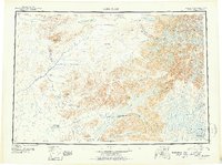
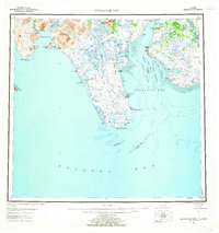
 1951 Bristol Bay1951 Print · USGSBristol Bay and the western edge of the Alaska Peninsula are captured here in the early 1950s, based on earlier reconnaissance and aerial photography. Researchers can trace the shifting coastal geometry of the Tidal Flats and the courses of Cinder River and Reindeer Creek.
 - 1951 Map of Dillingham, 1952 Print
 1951 Dillingham1952 Print · USGSDillingham and the Bristol Bay river systems are captured here in the early fifties, showing a remote landscape linked by water and seasonal camps. Researchers can trace early settlements and post offices at New Stuyahok, Ekwok, and Kvichak.
 - 1951 Map of Mt Katmai, 1952 Print
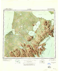
 1951 Mt Katmai1952 Print · USGSThe Alaska Peninsula at mid-century reveals a landscape of volcanic upheaval and empty settlements following the Great Eruption. Researchers can trace the vanished communities of Savonoski and Katmai Village or locate the Novarupta Volcano.11 unique versions available
 - 1951 Map of Karluk, 1952 Print
 1951 Karluk1952 Print · USGSThe Kodiak archipelago and the rugged Katmai coast are shown in the early fifties before statehood. Genealogists and historians can trace the early industrial footprint of the Cannery at Larsen Bay and the isolated settlement at Karluk.
 - 1951 Map of Stepovak Bay, 1952 Print
 1951 Stepovak Bay1952 Print · USGSThe Alaska Peninsula and Shumagin Islands are documented here during the early fifties, showing a remote maritime and coastal landscape. Researchers can trace early settlements and coastal landings such as Perryville, Bales Ldg, and the waters of Stepovak Bay.
 - 1951 Map of Sutwik Island, 1953 Print
 1951 Sutwik Island1953 Print · USGSThe Alaska Peninsula at mid-century remains a wild frontier defined by the Aleutian Range and remote island chains. Trace early survey points and coastal features from Meshik Lake to the isolated Chowiet Island and Sutwik Island.4 unique versions available
 - 1951 Map of Nushagak Bay, 1955 Print
 1951 Nushagak Bay1955 Print · USGSBristol Bay's eastern coastline is captured here in the early fifties, highlighting the salmon fishing and canning hubs of the era. Genealogists and historians can trace coastal settlements like Ekuk and Nushagak or locate the Igushik (Site).7 unique versions available
 - 1951 Map of Iliamna A-5, 1956 Print
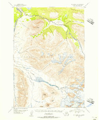
 1951 Iliamna A-51956 Print · USGSThe Alaska wilderness west of Cook Inlet is captured here in the early fifties, showing the pristine drainages of the Paint River. Researchers can trace the hydrography of this unroaded area through Battle Lake, Pirate Lake, and McNeil River.
 - 1951 Map of Ugashik C-5, 1956 Print
 1951 Ugashik C-51956 Print · USGSThe Alaska Peninsula coastline comes into focus in the early 1950s, documenting the vital fishing outposts of the Bristol Bay region. Researchers can trace the layout of Pilot Point and find industrial landmarks like the Cannery and Water Towers near Ugashik Bay.2 unique versions available
 - 1951 Map of Mount Katmai A-6, 1956 Print
 1951 Mount Katmai A-61956 Print · USGSThe Katmai wilderness on the Alaska Peninsula is captured here in the early fifties, showing the region before statehood. You can trace the remote drainage of Takayoto Creek and Angle Creek along the Katmai National Monument boundary.3 unique versions available
 - 1951 Map of Mount Katmai C-3, 1956 Print
 1951 Mount Katmai C-31956 Print · USGSKatmai National Monument in the early fifties was a wilderness of braided glacial streams and high-altitude survey markers. Geologists and researchers can trace the intricate channels of the Savonoski River and locate remote landmarks like VABM 3462 Scrab.3 unique versions available
 - 1951 Map of Ugashik C-4, 1956 Print
 1951 Ugashik C-41956 Print · USGSThe Alaska Peninsula in the early fifties was a wilderness of water and tundra dominated by the winding Ugashik River. Trace the isolated outposts of the era, from a solitary Cabin to a cluster of Cabins connected by a Footbridge near the lake.2 unique versions available
 - 1951 Map of Mount Katmai B-4, 1956 Print
 1951 Mount Katmai B-41956 Print · USGSKatmai National Monument in the early fifties reveals a dynamic landscape of volcanic peaks and glaciers within the Alaska Range. Geologists and researchers can trace the drainages of the Valley of Ten Thousand Smokes and peaks like Novarupta Volcano and Baked Mountain.4 unique versions available
 - 1951 Map of Ugashik B-3, 1956 Print
 1951 Ugashik B-31956 Print · USGSThe Alaska Peninsula in the early fifties remains a wilderness of interconnected waterways and sharp ridges. Researchers can trace the winding paths of the Dog Salmon River and Figure Eight Creek or locate secluded basins like Elizabeth Lake.3 unique versions available
 - 1951 Map of Ugashik D-1, 1956 Print
 1951 Ugashik D-11956 Print · USGSThe Alaska Peninsula at the start of the 1950s reveals a wilderness shaped by the waters of Becharof Lake. Researchers can trace isolated outposts like Grindle and shoreline Cabins along the rugged Severson Peninsula.2 unique versions available
 - 1951 Map of Mount Katmai C-6, 1956 Print
 1951 Mount Katmai C-61956 Print · USGSKatmai National Monument at the mid-century remains a landscape of vast waterways and isolated outposts. Researchers can locate early structural footprints like Cabins (Abandon), Ruins, and the Dam near Brooks Falls.3 unique versions available
 - 1951 Map of Ugashik C-1, 1956 Print
 1951 Ugashik C-11956 Print · USGSThe Alaska Peninsula in the early fifties shows a landscape defined by coastal outposts and high mountain passes. Trace the legacy of resource exploration at the Oil Camp or locate the village site of Kanatak near Portage Bay.2 unique versions available
Showing maps 1-25 of 797
Top cities of Lake and Peninsula
- Kokhanok historical maps
- Newhalen historical maps
- Nondalton historical maps
- Port Heiden historical maps
- Egegik historical maps
- Pilot Point historical maps
See more
Frequently asked questions
- What are the different types of historical maps available for Lake and Peninsula?
- What is the oldest map of Lake and Peninsula?
- Where can I purchase historical maps of Lake and Peninsula for my home or office?
- Where can I download high-res historical maps of Lake and Peninsula?
- Are there historical topographic maps available for Lake and Peninsula?
- Is there historical aerial imagery available for Lake and Peninsula?
- Where are historical maps of Lake and Peninsula sourced from?